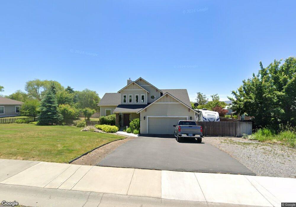
7412 Andrew Dr Klamath Falls, OR 97603
Estimated Value: $398,433 - $560,000
3
Beds
3
Baths
1,862
Sq Ft
$257/Sq Ft
Est. Value
About This Home
This home is located at 7412 Andrew Dr, Klamath Falls, OR 97603 and is currently estimated at $479,217, approximately $257 per square foot. 7412 Andrew Dr is a home located in Klamath County with nearby schools including Shasta Elementary School, Henley Middle School, and Henley High School.
Ownership History
Date
Name
Owned For
Owner Type
Purchase Details
Closed on
Jul 16, 2010
Sold by
Halsted Coy and Halsted Linda
Bought by
Dike Lindsey K and Dike Teri M
Current Estimated Value
Home Financials for this Owner
Home Financials are based on the most recent Mortgage that was taken out on this home.
Original Mortgage
$246,044
Outstanding Balance
$163,826
Interest Rate
4.76%
Mortgage Type
VA
Estimated Equity
$315,391
Create a Home Valuation Report for This Property
The Home Valuation Report is an in-depth analysis detailing your home's value as well as a comparison with similar homes in the area
Home Values in the Area
Average Home Value in this Area
Purchase History
| Date | Buyer | Sale Price | Title Company |
|---|---|---|---|
| Dike Lindsey K | $239,900 | Multiple |
Source: Public Records
Mortgage History
| Date | Status | Borrower | Loan Amount |
|---|---|---|---|
| Open | Dike Lindsey K | $246,044 |
Source: Public Records
Tax History Compared to Growth
Tax History
| Year | Tax Paid | Tax Assessment Tax Assessment Total Assessment is a certain percentage of the fair market value that is determined by local assessors to be the total taxable value of land and additions on the property. | Land | Improvement |
|---|---|---|---|---|
| 2024 | $3,140 | $292,720 | -- | -- |
| 2023 | $3,022 | $210,290 | $35,800 | $174,490 |
| 2022 | $2,941 | $275,930 | $0 | $0 |
| 2021 | $2,848 | $267,900 | $0 | $0 |
| 2020 | $2,761 | $260,100 | $0 | $0 |
| 2019 | $2,692 | $252,530 | $0 | $0 |
| 2018 | $2,614 | $245,180 | $0 | $0 |
| 2017 | $2,669 | $213,120 | $0 | $0 |
| 2016 | $2,479 | $206,920 | $0 | $0 |
| 2015 | $2,412 | $200,890 | $0 | $0 |
| 2014 | $2,304 | $195,040 | $0 | $0 |
| 2013 | -- | $173,030 | $0 | $0 |
Source: Public Records
Map
Nearby Homes
- 0 Vermont St
- 7575 Cannon Ave
- 6800 S 6th St Unit 68
- 6800 S 6th St Unit 1
- 2780 Windsor Ave
- 6506 Sarah Cir
- 3323 Barnes Way
- 7649 Booth Rd
- 2106 Dawn Dr
- 2113 Watson St
- 0 Shamrock Unit 900 220196182
- 0 Joe Wright Rd Unit Parcel 1 220191811
- 0 Hwy 39 Unit 220173061
- 0 Southside Bypass Unit 220171004
- 2003 Kimberly Dr
- 6160 Delaware Ave
- 8333 Oregon 140
- 3723 La Habra Way
- 2003 Carlson Dr
- 3934 El Cerrito Way
- 7406 Andrew Dr
- 7418 Andrew Dr
- 2807 Watson St
- 2701 Watson St
- 7530 Andrew Dr
- 2705 Watson St
- 2815 Watson St
- 2730 Watson St
- 2800 Watson St
- 7537 Hilyard Ave
- 2625 Watson St
- 7536 Andrew Dr
- 2903 Watson St
- 2724 Heritage Ct
- 2704 Watson St
- 2624 Watson St
- 2907 Watson St
- 7642 Andrew Dr
- 7257 Hilyard Ave
- 2718 Heritage Ct