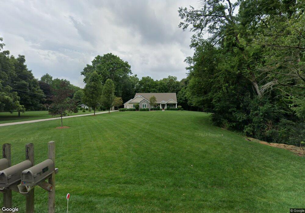
7412 Coder Rd Maumee, OH 43537
Estimated Value: $442,000 - $547,000
3
Beds
3
Baths
2,762
Sq Ft
$184/Sq Ft
Est. Value
About This Home
This home is located at 7412 Coder Rd, Maumee, OH 43537 and is currently estimated at $506,886, approximately $183 per square foot. 7412 Coder Rd is a home located in Lucas County with nearby schools including Anthony Wayne High School, Ohio Digital Learning School, and St. Joan of Arc School.
Ownership History
Date
Name
Owned For
Owner Type
Purchase Details
Closed on
May 13, 2011
Sold by
Green Sweep Inc
Bought by
Hauden Jeffrey M and Hauden Marianne E
Current Estimated Value
Home Financials for this Owner
Home Financials are based on the most recent Mortgage that was taken out on this home.
Original Mortgage
$260,000
Interest Rate
4.12%
Mortgage Type
New Conventional
Purchase Details
Closed on
Aug 12, 2009
Sold by
Shook Rex Daniel and Shook Constance M
Bought by
Greensweep Inc
Purchase Details
Closed on
May 15, 2006
Sold by
Detrick Marion F
Bought by
Shook Rex Daniel and Shook Constance M
Home Financials for this Owner
Home Financials are based on the most recent Mortgage that was taken out on this home.
Original Mortgage
$100,000
Interest Rate
6.54%
Mortgage Type
Fannie Mae Freddie Mac
Purchase Details
Closed on
May 11, 2005
Sold by
Detrick Marion F
Bought by
Detrick Marion F and Marion F Detrick Jr Revocable Trust
Create a Home Valuation Report for This Property
The Home Valuation Report is an in-depth analysis detailing your home's value as well as a comparison with similar homes in the area
Home Values in the Area
Average Home Value in this Area
Purchase History
| Date | Buyer | Sale Price | Title Company |
|---|---|---|---|
| Hauden Jeffrey M | $100,000 | Attorney | |
| Greensweep Inc | $90,000 | Attorney | |
| Shook Rex Daniel | $125,000 | None Available | |
| Detrick Marion F | -- | -- |
Source: Public Records
Mortgage History
| Date | Status | Borrower | Loan Amount |
|---|---|---|---|
| Previous Owner | Hauden Jeffrey M | $260,000 | |
| Previous Owner | Shook Rex Daniel | $100,000 |
Source: Public Records
Tax History
| Year | Tax Paid | Tax Assessment Tax Assessment Total Assessment is a certain percentage of the fair market value that is determined by local assessors to be the total taxable value of land and additions on the property. | Land | Improvement |
|---|---|---|---|---|
| 2025 | -- | $146,090 | $30,555 | $115,535 |
| 2024 | $3,724 | $146,090 | $30,555 | $115,535 |
| 2023 | $7,044 | $123,690 | $25,165 | $98,525 |
| 2022 | $7,089 | $123,690 | $25,165 | $98,525 |
| 2021 | $6,946 | $123,690 | $25,165 | $98,525 |
| 2020 | $6,963 | $111,300 | $22,330 | $88,970 |
| 2019 | $6,860 | $111,300 | $22,330 | $88,970 |
| 2018 | $6,829 | $111,300 | $22,330 | $88,970 |
| 2017 | $6,534 | $99,645 | $24,220 | $75,425 |
| 2016 | $6,471 | $284,700 | $69,200 | $215,500 |
| 2015 | $6,202 | $284,700 | $69,200 | $215,500 |
| 2014 | $5,990 | $96,740 | $23,520 | $73,220 |
| 2013 | $5,990 | $96,740 | $23,520 | $73,220 |
Source: Public Records
Map
Nearby Homes
- 4321 Post Office Cir
- 4334 Post Office Cir
- 4346 Post Office Cir
- 3813 Timber Valley Dr
- 4369 Post Office Cir
- 3962 Secluded Ravine Ct
- 4455 Post Office Cir
- 4351 Sage St
- 4339 Sage St
- 7522 Maumee Western Rd Unit 9
- 7512 Maumee Western Rd Unit 10
- 7632 Maumee Western Rd Unit 2
- 3556 Stillwater Blvd
- 4226 Back Ridge Way
- 4417 Clearwater Dr E
- 4644 Terra Ct
- 7455 Valhalla Dr
- 3360 Stillwater Blvd
- 7936 Rockridge Dr
- 7508 Epaulet Ln
Your Personal Tour Guide
Ask me questions while you tour the home.