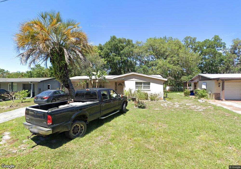
7415 Banner St New Port Richey, FL 34653
Estimated Value: $137,157 - $242,000
2
Beds
1
Bath
1,312
Sq Ft
$148/Sq Ft
Est. Value
About This Home
This home is located at 7415 Banner St, New Port Richey, FL 34653 and is currently estimated at $194,289, approximately $148 per square foot. 7415 Banner St is a home located in Pasco County with nearby schools including Cotee River Elementary School, Gulf Middle School, and Gulf High School.
Ownership History
Date
Name
Owned For
Owner Type
Purchase Details
Closed on
Jun 28, 1999
Sold by
Farmer Timothy B and Farmer Yvonne
Bought by
Jett Janice
Current Estimated Value
Home Financials for this Owner
Home Financials are based on the most recent Mortgage that was taken out on this home.
Original Mortgage
$36,000
Interest Rate
7.13%
Mortgage Type
Purchase Money Mortgage
Purchase Details
Closed on
Aug 26, 1997
Sold by
Fogle Jessie R and Seaman James B
Bought by
Farmer Timothy B and Farmer Yvonne L
Purchase Details
Closed on
Apr 11, 1997
Sold by
Fogle Jessie R
Bought by
Farmer Timothy B and Farmer Yvonne L
Home Financials for this Owner
Home Financials are based on the most recent Mortgage that was taken out on this home.
Original Mortgage
$21,000
Interest Rate
7.69%
Mortgage Type
Purchase Money Mortgage
Create a Home Valuation Report for This Property
The Home Valuation Report is an in-depth analysis detailing your home's value as well as a comparison with similar homes in the area
Home Values in the Area
Average Home Value in this Area
Purchase History
| Date | Buyer | Sale Price | Title Company |
|---|---|---|---|
| Jett Janice | $42,000 | -- | |
| Farmer Timothy B | $100 | -- | |
| Farmer Timothy B | $25,000 | -- |
Source: Public Records
Mortgage History
| Date | Status | Borrower | Loan Amount |
|---|---|---|---|
| Open | Farmer Timothy B | $32,000 | |
| Closed | Farmer Timothy B | $36,000 | |
| Previous Owner | Farmer Timothy B | $21,000 |
Source: Public Records
Tax History Compared to Growth
Tax History
| Year | Tax Paid | Tax Assessment Tax Assessment Total Assessment is a certain percentage of the fair market value that is determined by local assessors to be the total taxable value of land and additions on the property. | Land | Improvement |
|---|---|---|---|---|
| 2025 | $397 | $40,560 | -- | -- |
| 2024 | $397 | $39,420 | -- | -- |
| 2023 | $370 | $38,280 | $0 | $0 |
| 2022 | $406 | $37,170 | $0 | $0 |
| 2021 | $385 | $36,090 | $19,500 | $16,590 |
| 2020 | $370 | $35,600 | $13,000 | $22,600 |
| 2019 | $352 | $34,800 | $0 | $0 |
| 2018 | $335 | $34,156 | $0 | $0 |
| 2017 | $326 | $34,156 | $0 | $0 |
| 2016 | $276 | $32,765 | $0 | $0 |
| 2015 | $274 | $32,537 | $0 | $0 |
| 2014 | $258 | $37,333 | $8,125 | $29,208 |
Source: Public Records
Map
Nearby Homes
- 7441 Cypress Dr
- 6701 Medlar Dr Unit 2
- 6840 Runnel Dr
- 6870 Parkside Dr
- 7435 Hollyridge Dr
- 7631 Cypress Knoll Dr
- 6701 Parkside Dr
- 7131 Dell Rd Unit 2
- 7501 Cumber Dr
- 6445 Belle Terre Rd
- 7744 Greenlawn Dr
- 6336 Wooden St
- 7050 Cognac Dr Unit 1
- 7750 Middlebury Rd
- 000 Rowan Rd
- 7603 Cumber Dr
- 7435 Granada Ave Unit 3
- 7505 Granada Ave
- 7321 Granada Ave
- 6141 Balboa Ave Unit 159
- 7407 Banner St
- 7421 Banner St
- 7414 Cedar Point Dr
- 7406 Cedar Point Dr
- 7420 Cedar Point Dr
- 7353 Banner St
- 7414 Banner St
- 7406 Banner St
- 7426 Cedar Point Dr
- 7352 Cedar Point Dr Unit 3
- 7352 Banner St
- 7435 Banner St
- 7420 Banner St
- 7426 Banner St
- 6720 Penda Dr
- 7434 Cedar Point Dr
- 7434 Banner St
- 6730 Penda Dr Unit 1
- 7346 Banner St
- 7415 Cedar Point Dr