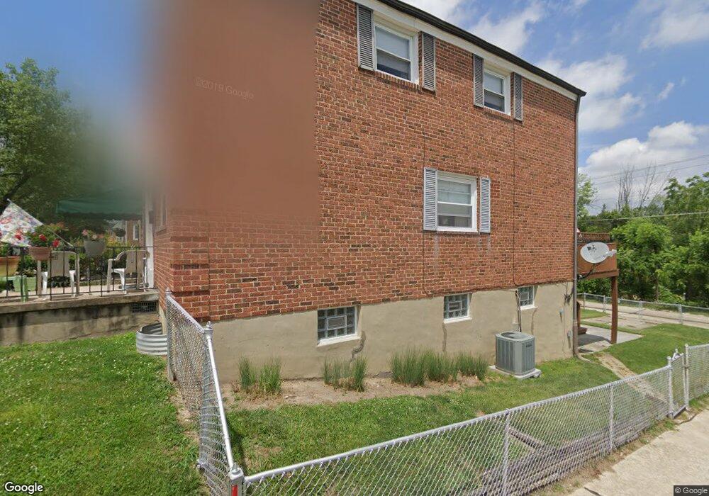
7417 Forrest Ave Parkville, MD 21234
Estimated Value: $219,000 - $245,000
--
Bed
1
Bath
1,258
Sq Ft
$185/Sq Ft
Est. Value
About This Home
This home is located at 7417 Forrest Ave, Parkville, MD 21234 and is currently estimated at $232,581, approximately $184 per square foot. 7417 Forrest Ave is a home located in Baltimore County with nearby schools including Halstead Academy, Loch Raven Technical Academy, and Parkville High School.
Ownership History
Date
Name
Owned For
Owner Type
Purchase Details
Closed on
Apr 19, 2005
Sold by
Lane George S
Bought by
Williams Norman D
Current Estimated Value
Home Financials for this Owner
Home Financials are based on the most recent Mortgage that was taken out on this home.
Original Mortgage
$118,480
Outstanding Balance
$60,823
Interest Rate
5.7%
Mortgage Type
New Conventional
Estimated Equity
$171,758
Purchase Details
Closed on
Jun 19, 1974
Sold by
Doyle Edward J
Bought by
Lane George S
Create a Home Valuation Report for This Property
The Home Valuation Report is an in-depth analysis detailing your home's value as well as a comparison with similar homes in the area
Home Values in the Area
Average Home Value in this Area
Purchase History
| Date | Buyer | Sale Price | Title Company |
|---|---|---|---|
| Williams Norman D | $148,100 | -- | |
| Lane George S | $27,500 | -- |
Source: Public Records
Mortgage History
| Date | Status | Borrower | Loan Amount |
|---|---|---|---|
| Open | Williams Norman D | $118,480 |
Source: Public Records
Tax History Compared to Growth
Tax History
| Year | Tax Paid | Tax Assessment Tax Assessment Total Assessment is a certain percentage of the fair market value that is determined by local assessors to be the total taxable value of land and additions on the property. | Land | Improvement |
|---|---|---|---|---|
| 2025 | $2,712 | $196,900 | $58,000 | $138,900 |
| 2024 | $2,712 | $188,100 | $0 | $0 |
| 2023 | $1,307 | $179,300 | $0 | $0 |
| 2022 | $2,492 | $170,500 | $58,000 | $112,500 |
| 2021 | $2,350 | $167,800 | $0 | $0 |
| 2020 | $2,350 | $165,100 | $0 | $0 |
| 2019 | $2,256 | $162,400 | $58,000 | $104,400 |
| 2018 | $2,167 | $160,033 | $0 | $0 |
| 2017 | $2,046 | $157,667 | $0 | $0 |
| 2016 | $1,159 | $155,300 | $0 | $0 |
| 2015 | $1,159 | $155,300 | $0 | $0 |
| 2014 | $1,159 | $155,300 | $0 | $0 |
Source: Public Records
Map
Nearby Homes
- 1331 Dalton Rd
- 1430 Dartmouth Ave
- 1428 Dartmouth Ave
- 1803 Forrest Rd
- 1211 Dalton Rd
- 1514 Taylor Ave
- 1810 Wentworth Rd
- 7829 Oakleigh Rd
- 1700 Goodview Rd
- 1818 Wendover Rd
- 1847 Wycliffe Rd
- 1931 Edgewood Rd
- 7708 Middlesex Place
- 2513 Glencoe Rd
- 1860 Loch Shiel Rd
- 8101 Hillendale Rd
- 75 Ashlar Hill Ct
- 89 Ashlar Hill Ct
- 2511 Wentworth Rd
- 2519 Wycliffe Rd
- 7419 Forrest Ave
- 7421 Forrest Ave
- 7415 Forrest Ave
- 7423 Forrest Ave
- 7425 Forrest Ave
- 7413 Forrest Ave
- 7427 Forrest Ave
- 7411 Forrest Ave
- 7429 Forrest Ave
- 7431 Forrest Ave
- 7420 Forrest Ave
- 7418 Forrest Ave
- 7422 Forrest Ave
- 7409 Forrest Ave
- 7433 Forrest Ave
- 7424 Forrest Ave
- 7416 Forrest Ave
- 7426 Forrest Ave
- 7414 Forrest Ave
- 7412 Forrest Ave