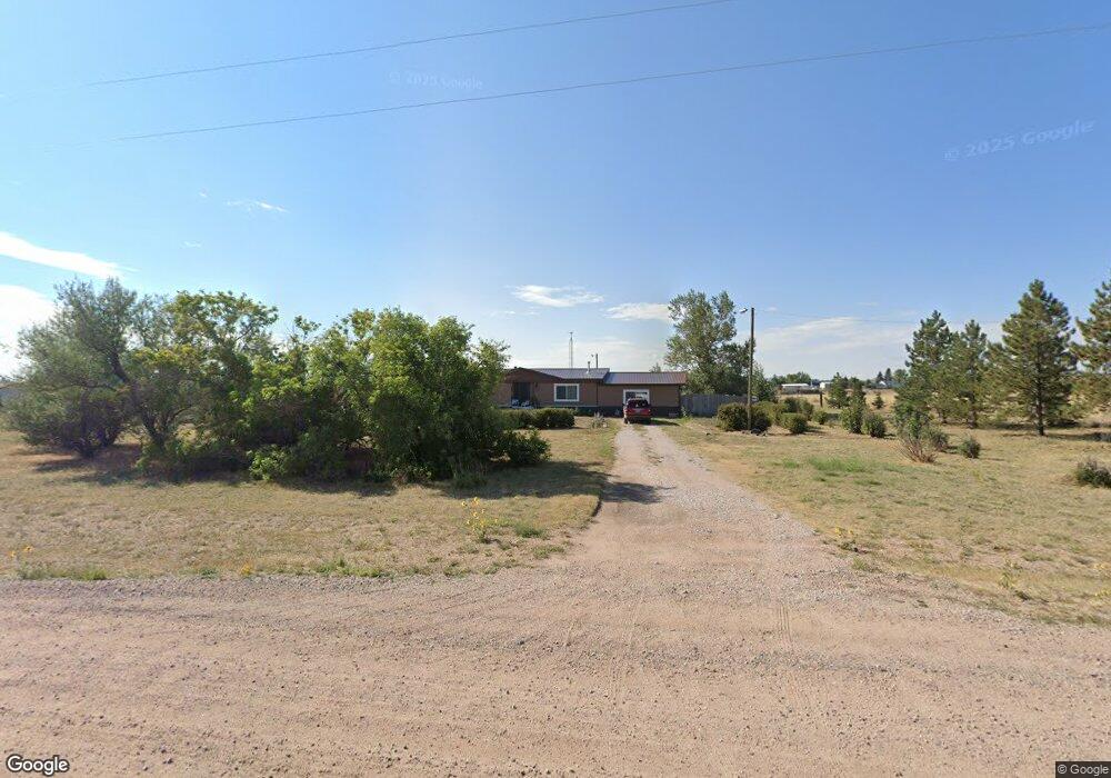
7419 Cox Rd Cheyenne, WY 82009
Estimated Value: $502,250 - $579,000
--
Bed
--
Bath
1,956
Sq Ft
$275/Sq Ft
Est. Value
About This Home
This home is located at 7419 Cox Rd, Cheyenne, WY 82009 and is currently estimated at $538,417, approximately $275 per square foot. 7419 Cox Rd is a home with nearby schools including Gilchrist Elementary School, McCormick Junior High School, and Central High School.
Ownership History
Date
Name
Owned For
Owner Type
Purchase Details
Closed on
Jun 1, 2023
Sold by
Cima Michael F
Bought by
Michael F Cima Living Trust and Cima
Current Estimated Value
Purchase Details
Closed on
Sep 21, 1998
Sold by
Woods Billie L Et Vir
Bought by
Cima Michael F and Cima Wanda N
Home Financials for this Owner
Home Financials are based on the most recent Mortgage that was taken out on this home.
Original Mortgage
$118,456
Interest Rate
6.61%
Mortgage Type
FHA
Create a Home Valuation Report for This Property
The Home Valuation Report is an in-depth analysis detailing your home's value as well as a comparison with similar homes in the area
Home Values in the Area
Average Home Value in this Area
Purchase History
| Date | Buyer | Sale Price | Title Company |
|---|---|---|---|
| Michael F Cima Living Trust | -- | None Listed On Document | |
| Cima Michael F | -- | -- |
Source: Public Records
Mortgage History
| Date | Status | Borrower | Loan Amount |
|---|---|---|---|
| Previous Owner | Cima Michael F | $118,456 |
Source: Public Records
Tax History Compared to Growth
Tax History
| Year | Tax Paid | Tax Assessment Tax Assessment Total Assessment is a certain percentage of the fair market value that is determined by local assessors to be the total taxable value of land and additions on the property. | Land | Improvement |
|---|---|---|---|---|
| 2025 | $2,751 | $21,886 | $5,558 | $16,328 |
| 2024 | $2,751 | $40,924 | $11,115 | $29,809 |
| 2023 | $2,504 | $38,105 | $9,248 | $28,857 |
| 2022 | $2,088 | $31,074 | $7,117 | $23,957 |
| 2021 | $1,946 | $28,892 | $6,829 | $22,063 |
| 2020 | $1,850 | $27,549 | $5,904 | $21,645 |
| 2019 | $1,752 | $26,069 | $5,904 | $20,165 |
| 2018 | $1,672 | $25,139 | $5,904 | $19,235 |
| 2017 | $1,642 | $24,443 | $5,904 | $18,539 |
| 2016 | $1,531 | $22,777 | $4,642 | $18,135 |
| 2015 | $1,485 | $22,089 | $4,642 | $17,447 |
| 2014 | $1,474 | $21,780 | $4,642 | $17,138 |
Source: Public Records
Map
Nearby Homes
- TBD Laramie St
- 3307 Hynds Blvd
- 3923 Mccomb Ave
- 3619 Cribbon Ave
- Lot 5 Snowy Mountain Ct
- Lot 2 Sunset Mountain Rd
- TBD W Lincolnway
- Lot 7 Snowy Mountain Ct
- Lot 8 Hynds Blvd
- Lot 12 Hynds Blvd
- Lot 13 Misty Mountain Rd
- 648 Vista Ln
- 617 Harmony Ln
- 3515 Dillon Ave
- 1122 W 28th St
- 1532 Trent Ct
- 1532 Trent Ct Unit A102
- 1502 Trent Ct Unit 9
- Lot 11 Misty Mountain Rd
- 900 W 31st St
- 7517 Cox Rd
- 7412 Cox Rd
- 7311 Cox Rd
- 7514 Cox Rd
- 7600 Cox Rd
- 7310 Cox Rd
- 7703 Cox Rd
- 7708 Cox Rd
- 3710 Rolling Hills Dr
- 7504 Barrington Rd
- 7212 Cox Rd
- 3316 Rolling Hills D
- 7608 Barrington Rd
- 7805 Cox Rd
- 7710 Barrington Rd
- 7406 Barrington Rd
- 3612 Roundtop Rd
- 7609 Barrington Rd
- 3606 Roundtop Rd
- 7505 Barrington Rd