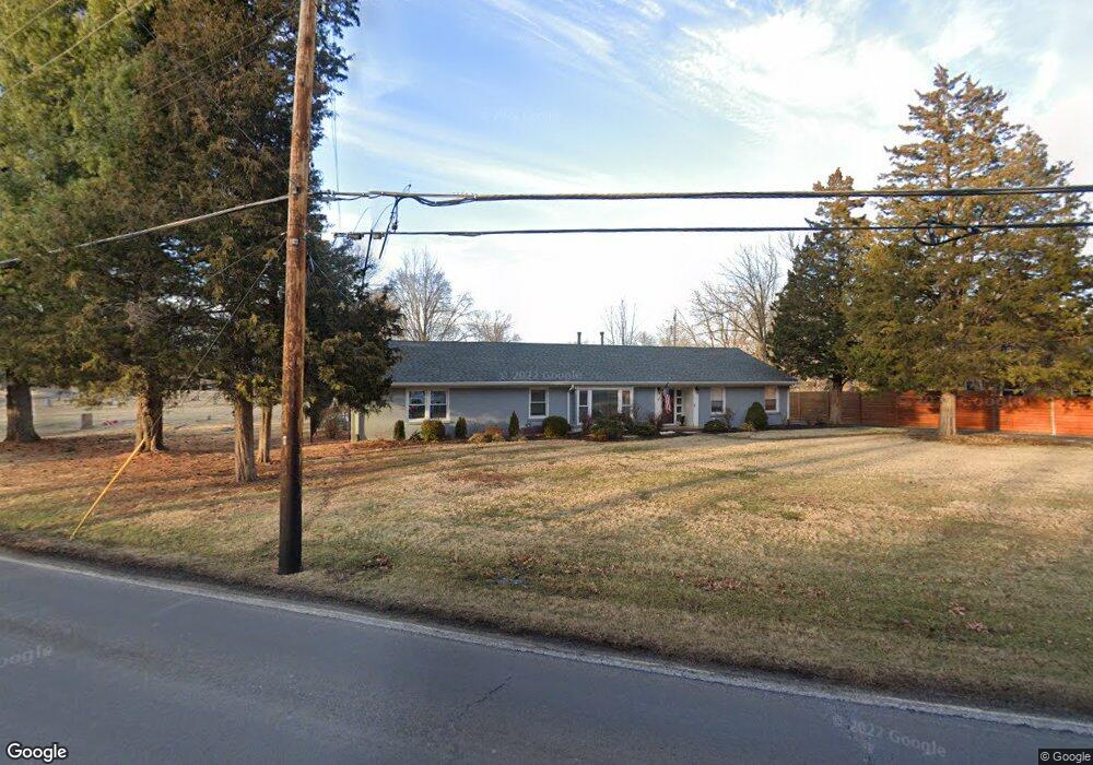
7419 S Rock Hill Rd Saint Louis, MO 63123
Estimated Value: $392,854 - $515,000
2
Beds
3
Baths
2,252
Sq Ft
$198/Sq Ft
Est. Value
About This Home
This home is located at 7419 S Rock Hill Rd, Saint Louis, MO 63123 and is currently estimated at $444,964, approximately $197 per square foot. 7419 S Rock Hill Rd is a home located in St. Louis County with nearby schools including Truman Middle School, Lindbergh High School, and Holy Cross Academy.
Ownership History
Date
Name
Owned For
Owner Type
Purchase Details
Closed on
Jul 2, 2010
Sold by
Brookshire Mary E
Bought by
Brookshire Charles E and Brookshire Mary E
Current Estimated Value
Purchase Details
Closed on
Jan 12, 2006
Sold by
Bowers Randy P
Bought by
Brookshire Mary E
Home Financials for this Owner
Home Financials are based on the most recent Mortgage that was taken out on this home.
Original Mortgage
$79,500
Outstanding Balance
$47,866
Interest Rate
7.5%
Mortgage Type
Fannie Mae Freddie Mac
Estimated Equity
$397,098
Create a Home Valuation Report for This Property
The Home Valuation Report is an in-depth analysis detailing your home's value as well as a comparison with similar homes in the area
Home Values in the Area
Average Home Value in this Area
Purchase History
| Date | Buyer | Sale Price | Title Company |
|---|---|---|---|
| Brookshire Charles E | -- | None Available | |
| Brookshire Mary E | $100,000 | Pulaski Title Company |
Source: Public Records
Mortgage History
| Date | Status | Borrower | Loan Amount |
|---|---|---|---|
| Open | Brookshire Mary E | $79,500 |
Source: Public Records
Tax History Compared to Growth
Tax History
| Year | Tax Paid | Tax Assessment Tax Assessment Total Assessment is a certain percentage of the fair market value that is determined by local assessors to be the total taxable value of land and additions on the property. | Land | Improvement |
|---|---|---|---|---|
| 2025 | $4,046 | $56,560 | $16,660 | $39,900 |
| 2024 | $4,046 | $56,990 | $11,120 | $45,870 |
| 2023 | $3,986 | $56,990 | $11,120 | $45,870 |
| 2022 | $3,386 | $46,190 | $12,220 | $33,970 |
| 2021 | $3,328 | $46,190 | $12,220 | $33,970 |
| 2020 | $2,834 | $37,470 | $9,820 | $27,650 |
| 2019 | $2,806 | $37,470 | $9,820 | $27,650 |
| 2018 | $2,793 | $33,650 | $8,970 | $24,680 |
| 2017 | $2,749 | $33,650 | $8,970 | $24,680 |
| 2016 | $2,498 | $29,930 | $9,940 | $19,990 |
| 2015 | $2,506 | $29,930 | $9,940 | $19,990 |
| 2014 | -- | $34,650 | $3,740 | $30,910 |
Source: Public Records
Map
Nearby Homes
- 8853 Raleigh Dr
- 7424 Granbury Cir
- 8215 General Sheridan Ln
- 7625 General Meade Ln
- 7369 Whitehaven Dr
- 8415 Rockhaven Ln
- 9008 Fernald Dr
- 8405 Rockhaven Ln
- 7123 Craighill Dr
- 7243 General Sherman Ln
- 7601 General Sheridan Ln
- 7636 Fort Henry Dr
- 9134 Fort Donelson Dr
- 8261 Watson Rd
- 7101 Fernbrook Dr
- 8613 Carriage Way Dr
- 7508 Bull Run Dr
- 1405 Culverhill Dr
- 3 Grantview Ln
- 7904 Camelot Ln Unit 4
- 8539 Skyline Dr
- 8511 Skyline Dr
- 7449 Raleigh Dr
- 8507 Skyline Dr
- 7441 Raleigh Dr
- 8801 Raleigh Dr
- 7433 Raleigh Dr
- 8526 Skyline Dr
- 8534 Skyline Dr
- 8518 Skyline Dr
- 7393 S Rock Hill Rd
- 7425 Raleigh Dr
- 8807 Raleigh Dr
- 8501 Skyline Dr
- 8510 Skyline Dr
- 8800 Raleigh Dr
- 7417 Raleigh Dr
- 7389 S Rock Hill Rd
- 8813 Raleigh Dr
- 8800 Rock Forest Dr