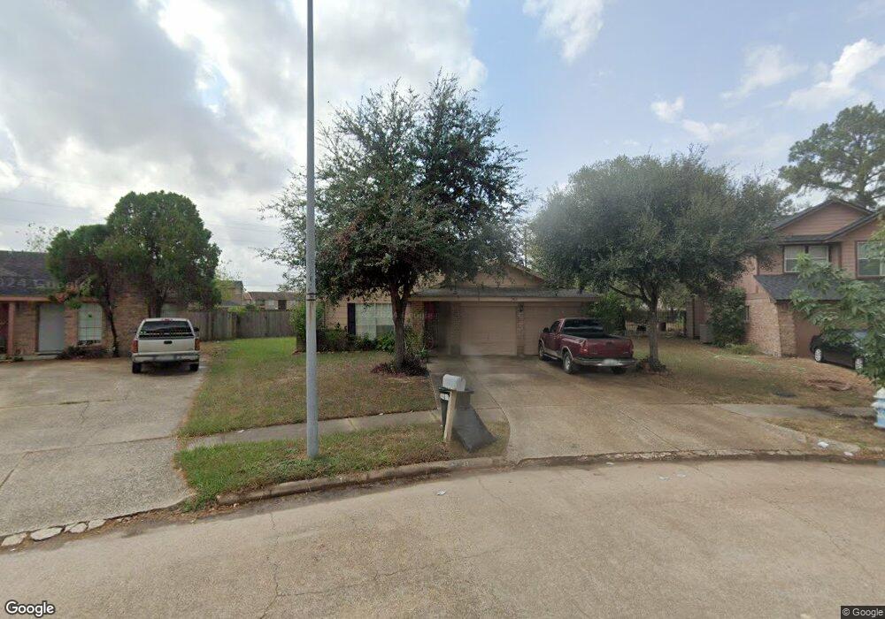
7419 Silver Star Dr Houston, TX 77086
North Houston NeighborhoodEstimated Value: $241,891 - $262,000
3
Beds
2
Baths
1,756
Sq Ft
$144/Sq Ft
Est. Value
About This Home
This home is located at 7419 Silver Star Dr, Houston, TX 77086 and is currently estimated at $252,223, approximately $143 per square foot. 7419 Silver Star Dr is a home located in Harris County with nearby schools including Kujawa EC/Pre-K/K School, Kujawa Elementary School, and Shotwell Middle School.
Ownership History
Date
Name
Owned For
Owner Type
Purchase Details
Closed on
Feb 10, 2004
Sold by
Harris Cedric L and Harris Ta Tanisha B
Bought by
Ortiz Roman
Current Estimated Value
Home Financials for this Owner
Home Financials are based on the most recent Mortgage that was taken out on this home.
Original Mortgage
$78,400
Outstanding Balance
$36,897
Interest Rate
5.88%
Mortgage Type
Purchase Money Mortgage
Estimated Equity
$215,326
Purchase Details
Closed on
Apr 25, 2002
Sold by
Bluebell Place Builders
Bought by
Harris Cedric L and Harris Ta Tanisha B
Home Financials for this Owner
Home Financials are based on the most recent Mortgage that was taken out on this home.
Original Mortgage
$90,087
Interest Rate
7.11%
Mortgage Type
FHA
Create a Home Valuation Report for This Property
The Home Valuation Report is an in-depth analysis detailing your home's value as well as a comparison with similar homes in the area
Home Values in the Area
Average Home Value in this Area
Purchase History
| Date | Buyer | Sale Price | Title Company |
|---|---|---|---|
| Ortiz Roman | -- | Startex 07 Title Company | |
| Harris Cedric L | -- | Chicago Title Insurance Co |
Source: Public Records
Mortgage History
| Date | Status | Borrower | Loan Amount |
|---|---|---|---|
| Open | Ortiz Roman | $78,400 | |
| Previous Owner | Harris Cedric L | $90,087 |
Source: Public Records
Tax History Compared to Growth
Tax History
| Year | Tax Paid | Tax Assessment Tax Assessment Total Assessment is a certain percentage of the fair market value that is determined by local assessors to be the total taxable value of land and additions on the property. | Land | Improvement |
|---|---|---|---|---|
| 2025 | $4,165 | $248,098 | $41,661 | $206,437 |
| 2024 | $4,165 | $251,707 | $41,661 | $210,046 |
| 2023 | $4,165 | $260,188 | $41,661 | $218,527 |
| 2022 | $4,792 | $215,620 | $35,306 | $180,314 |
| 2021 | $4,346 | $178,979 | $35,306 | $143,673 |
| 2020 | $4,455 | $165,021 | $35,306 | $129,715 |
| 2019 | $4,214 | $151,174 | $15,620 | $135,554 |
| 2018 | $1,601 | $136,473 | $15,620 | $120,853 |
| 2017 | $3,693 | $136,473 | $15,620 | $120,853 |
| 2016 | $3,227 | $119,225 | $15,620 | $103,605 |
| 2015 | $2,396 | $119,225 | $15,620 | $103,605 |
| 2014 | $2,396 | $88,424 | $15,620 | $72,804 |
Source: Public Records
Map
Nearby Homes
- 7307 Silver Star Dr
- 7302 Seton Lake Dr
- 10307 Bammel North Houston Rd
- 10614 Mackenzie Dr
- 10723 Mackenzie Dr
- 10711 Heather Hill Dr
- 7023 Sandswept Ln
- 9815 Lonsford Dr
- 6911 Silver Star Dr
- 9707 Rapid River Ln
- 9611 Camrose Ct
- 7218 Winding Trace Dr
- 7002 Sandswept Ln
- 7679 Fallbrook Dr Unit 7679
- 7011 Lower Arrow Dr
- 7222 Northleaf Dr
- 6822 Dusty Dawn Dr
- 9710 Wind Flower Ln
- 7227 Greenyard Dr
- 6830 Desert Rose Ln
- 10403 Cedar Park Ln
- 7415 Silver Star Dr
- 7411 Silver Star Dr
- 10407 Cedar Park Ln
- 10406 Cedar Park Ln
- 7407 Silver Star Dr
- 10411 Cedar Park Ln
- 10410 Cedar Park Ln
- 7406 Silver Star Dr
- 7403 Silver Star Dr
- 10415 Cedar Park Ln
- 10414 Cedar Park Ln
- 7402 Silver Star Dr
- 7323 Silver Star Dr
- 7407 Seton Lake Dr
- 10419 Cedar Park Ln
- 10418 Cedar Park Ln
- 7322 Silver Star Dr
- 7403 Seton Lake Dr
- 7319 Silver Star Dr