Estimated Value: $311,000 - $384,000
4
Beds
2
Baths
2,267
Sq Ft
$150/Sq Ft
Est. Value
About This Home
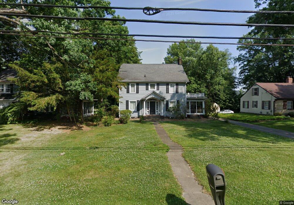
This home is located at 7419 State Route 43, Kent, OH 44240 and is currently estimated at $339,840, approximately $149 per square foot. 7419 State Route 43 is a home located in Portage County with nearby schools including Walls Elementary School, Stanton Middle School, and Theodore Roosevelt High School.
Ownership History
Date
Name
Owned For
Owner Type
Purchase Details
Closed on
Nov 8, 2004
Sold by
Theiss Irmgard
Bought by
Holm Paul and Holm Kimberly
Current Estimated Value
Home Financials for this Owner
Home Financials are based on the most recent Mortgage that was taken out on this home.
Original Mortgage
$180,000
Outstanding Balance
$89,980
Interest Rate
5.91%
Mortgage Type
Purchase Money Mortgage
Estimated Equity
$249,860
Purchase Details
Closed on
Jan 1, 1990
Bought by
Theiss Ernest S
Create a Home Valuation Report for This Property
The Home Valuation Report is an in-depth analysis detailing your home's value as well as a comparison with similar homes in the area
Home Values in the Area
Average Home Value in this Area
Purchase History
| Date | Buyer | Sale Price | Title Company |
|---|---|---|---|
| Holm Paul | $225,000 | Real Living Title Agency Ltd | |
| Theiss Ernest S | -- | -- |
Source: Public Records
Mortgage History
| Date | Status | Borrower | Loan Amount |
|---|---|---|---|
| Open | Holm Paul | $180,000 | |
| Closed | Holm Paul | $33,700 |
Source: Public Records
Tax History Compared to Growth
Tax History
| Year | Tax Paid | Tax Assessment Tax Assessment Total Assessment is a certain percentage of the fair market value that is determined by local assessors to be the total taxable value of land and additions on the property. | Land | Improvement |
|---|---|---|---|---|
| 2024 | $4,529 | $97,030 | $14,810 | $82,220 |
| 2023 | $3,577 | $61,290 | $14,810 | $46,480 |
| 2022 | $3,566 | $61,290 | $14,810 | $46,480 |
| 2021 | $3,555 | $61,290 | $14,810 | $46,480 |
| 2020 | $3,500 | $53,870 | $14,810 | $39,060 |
| 2019 | $3,456 | $53,870 | $14,810 | $39,060 |
| 2018 | $3,087 | $46,280 | $14,810 | $31,470 |
| 2017 | $3,087 | $46,280 | $14,810 | $31,470 |
| 2016 | $3,057 | $46,280 | $14,810 | $31,470 |
| 2015 | $3,058 | $46,280 | $14,810 | $31,470 |
| 2014 | $3,112 | $46,280 | $14,810 | $31,470 |
| 2013 | $3,089 | $46,280 | $14,810 | $31,470 |
Source: Public Records
Map
Nearby Homes
- 7263 State Route 43
- 7532 State Route 43
- 7447 Sylvan Dr
- 1367 Mockingbird Dr
- 7723 W Lake Blvd
- 1508 Ridgecrest Dr
- 7663 Diagonal Rd
- 7693 Ferguson Rd
- 1939 Pine Dr Unit 8M
- 7775 Diagonal Rd
- 8158 State Route 43
- 1985 Walton Rd
- 8291 State Route 14
- 409 W Grant St
- 474 W Grant St
- 2242 Coffeen St
- 2646 Dawley Rd
- 1448 Jude Ave
- 1046 Hudson Rd
- 1675 Duncan Way
- 7439 State Route 43
- 7406 State Route 43
- 1480 Merrill Ave
- 7401 State Route 43
- 1490 Merrill Ave
- 7420 State Route 43
- 7437 Knoll Rd
- 7429 Knoll Rd
- 7447 State Route 43
- 7394 State Route 43
- 7424 State Route 43
- 7384 State Route 43
- 7395 State Route 43
- 1450 Merrill Ave
- 7430 State Route 43
- 1471 Merrill Ave
- 1491 Merrill Ave
- 7453 State Route 43
- 7434 State Route 43
- 7457 Knoll Rd