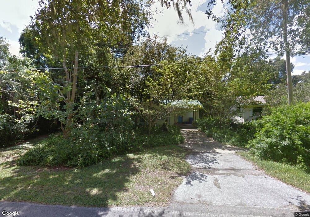
742 Lindley Blvd Deland, FL 32724
North DeLand NeighborhoodEstimated Value: $228,884 - $262,000
3
Beds
2
Baths
1,374
Sq Ft
$182/Sq Ft
Est. Value
About This Home
This home is located at 742 Lindley Blvd, Deland, FL 32724 and is currently estimated at $250,221, approximately $182 per square foot. 742 Lindley Blvd is a home located in Volusia County with nearby schools including Deland High School, George W. Marks Elementary School, and Deland Middle School.
Ownership History
Date
Name
Owned For
Owner Type
Purchase Details
Closed on
Feb 27, 2023
Sold by
Camarota Elizabeth Gayle Shepard
Bought by
Camarota Elizabeth Gayle Shepar
Current Estimated Value
Purchase Details
Closed on
Dec 30, 1997
Sold by
Earnest Beatrice B and Earnest Dewey Lee
Bought by
Camarota Elizabeth Gayle Shepard
Purchase Details
Closed on
Dec 29, 1996
Sold by
Earnest Beatrice B and Earnest Kendall L
Bought by
Earnest Beatrice B and Earnest Dewey Lee
Purchase Details
Closed on
May 15, 1983
Bought by
Camar Elizabeth Gayle Shepard
Create a Home Valuation Report for This Property
The Home Valuation Report is an in-depth analysis detailing your home's value as well as a comparison with similar homes in the area
Home Values in the Area
Average Home Value in this Area
Purchase History
| Date | Buyer | Sale Price | Title Company |
|---|---|---|---|
| Camarota Elizabeth Gayle Shepar | $100 | -- | |
| Camarota Elizabeth Gayle Shepard | $64,000 | -- | |
| Earnest Beatrice B | -- | -- | |
| Camar Elizabeth Gayle Shepard | $40,000 | -- |
Source: Public Records
Tax History Compared to Growth
Tax History
| Year | Tax Paid | Tax Assessment Tax Assessment Total Assessment is a certain percentage of the fair market value that is determined by local assessors to be the total taxable value of land and additions on the property. | Land | Improvement |
|---|---|---|---|---|
| 2025 | $774 | $64,957 | -- | -- |
| 2024 | $774 | $63,127 | -- | -- |
| 2023 | $774 | $61,289 | $0 | $0 |
| 2022 | $833 | $59,504 | $0 | $0 |
| 2021 | $862 | $57,771 | $0 | $0 |
| 2020 | $853 | $56,973 | $0 | $0 |
| 2019 | $879 | $55,692 | $0 | $0 |
| 2018 | $871 | $54,654 | $0 | $0 |
| 2017 | $858 | $53,530 | $0 | $0 |
| 2016 | $821 | $52,429 | $0 | $0 |
| 2015 | $835 | $52,065 | $0 | $0 |
| 2014 | $832 | $51,652 | $0 | $0 |
Source: Public Records
Map
Nearby Homes
- 717 E Grove Place
- 931 Azalea Walk Cir
- 927 Azalea Walk Cir
- 1150 Orangewood Ave
- 708 Montreville Ave
- 1103 Lindley Cove Cir
- 818 Eastover Cir
- 605 John Thomas Ave
- 528 Compton Ct
- 907 Marlboro Dr
- 915 Marlboro Dr
- 612 E Plymouth Ave
- 569 Parkdale Ct
- 1300 Benton Lake Dr E
- 526 Cumberland Rd
- 505 E Plymouth Ave
- 851 E Pennsylvania Ave
- 1401 Hendren Dr
- 1410 Heather Glen Dr
- 1403 Island Cove Dr
- 740 Lindley Blvd
- 100 Kendra Ave
- 102 Kendra Ave
- 104 Kendra Ave
- 738 Lindley Blvd
- 731 E Grove Place
- 729 E Grove Place
- 821 Lindley Blvd
- 1101 N McDonald Ave
- 106 Kendra Ave
- 723 E Grove Place
- 736 Lindley Blvd
- 101 Kendra Ave
- 103 Kendra Ave
- 105 Kendra Ave
- 721 E Grove Place
- 841 Lindley Blvd
- 812 Orangewood Ave
- 820 Orangewood Ave