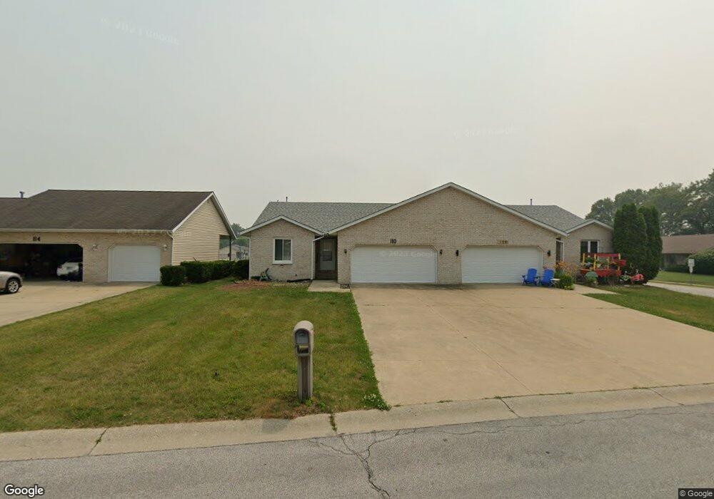
742 Potawatomi Dr New Carlisle, IN 46552
Estimated Value: $310,000 - $350,000
4
Beds
3
Baths
2,490
Sq Ft
$133/Sq Ft
Est. Value
About This Home
This home is located at 742 Potawatomi Dr, New Carlisle, IN 46552 and is currently estimated at $330,927, approximately $132 per square foot. 742 Potawatomi Dr is a home with nearby schools including New Prairie High School.
Ownership History
Date
Name
Owned For
Owner Type
Purchase Details
Closed on
Aug 12, 2024
Sold by
Sabie Matthew James
Bought by
Sabie Matthew James and Sabie Melody Dawn
Current Estimated Value
Home Financials for this Owner
Home Financials are based on the most recent Mortgage that was taken out on this home.
Original Mortgage
$50,000
Outstanding Balance
$49,433
Interest Rate
6.86%
Mortgage Type
New Conventional
Estimated Equity
$281,494
Purchase Details
Closed on
Aug 6, 2024
Sold by
Sabie Matthew James
Bought by
Sabie Matthew James and Sabie Melody Dawn
Home Financials for this Owner
Home Financials are based on the most recent Mortgage that was taken out on this home.
Original Mortgage
$50,000
Outstanding Balance
$49,433
Interest Rate
6.86%
Mortgage Type
New Conventional
Estimated Equity
$281,494
Purchase Details
Closed on
Jan 31, 2022
Sold by
Sabie Erik N
Bought by
Sabie Matthew J
Home Financials for this Owner
Home Financials are based on the most recent Mortgage that was taken out on this home.
Original Mortgage
$212,657
Interest Rate
3.56%
Mortgage Type
FHA
Purchase Details
Closed on
Jan 25, 2022
Sold by
Sabie Erik N
Bought by
Sabie Matthew J
Home Financials for this Owner
Home Financials are based on the most recent Mortgage that was taken out on this home.
Original Mortgage
$212,657
Interest Rate
3.56%
Mortgage Type
FHA
Purchase Details
Closed on
Sep 16, 2011
Sold by
Sabie Crystal L
Bought by
Sabie Erik N
Home Financials for this Owner
Home Financials are based on the most recent Mortgage that was taken out on this home.
Original Mortgage
$110,500
Interest Rate
4.22%
Mortgage Type
New Conventional
Purchase Details
Closed on
Mar 27, 2006
Sold by
Graveline Mae K
Bought by
Ziola Jim and Ziola Jessica
Purchase Details
Closed on
Feb 25, 2005
Sold by
Turner Patrick and Turner Sandra
Bought by
Sabie Erik N and Sabie Crystal L
Home Financials for this Owner
Home Financials are based on the most recent Mortgage that was taken out on this home.
Original Mortgage
$104,000
Interest Rate
5.8%
Mortgage Type
New Conventional
Create a Home Valuation Report for This Property
The Home Valuation Report is an in-depth analysis detailing your home's value as well as a comparison with similar homes in the area
Home Values in the Area
Average Home Value in this Area
Purchase History
| Date | Buyer | Sale Price | Title Company |
|---|---|---|---|
| Sabie Matthew James | -- | None Listed On Document | |
| Sabie Matthew J | -- | None Listed On Document | |
| Sabie Erik N | -- | Metropolitan Title In Llc | |
| Ziola Jim | -- | Merdian Title Corp | |
| Sabie Erik N | -- | None Available | |
| Sabie Matthew James | -- | None Listed On Document | |
| Sabie Matthew James | -- | None Listed On Document | |
| Sabie Matthew J | $220,000 | Drake Andrew R |
Source: Public Records
Mortgage History
| Date | Status | Borrower | Loan Amount |
|---|---|---|---|
| Open | Sabie Matthew James | $50,000 | |
| Closed | Sabie Matthew James | $50,000 | |
| Previous Owner | Sabie Matthew J | $212,657 | |
| Previous Owner | Sabie Matthew J | $212,657 | |
| Previous Owner | Sabie Erik N | $110,500 | |
| Previous Owner | Sabie Erik N | $104,000 |
Source: Public Records
Tax History Compared to Growth
Tax History
| Year | Tax Paid | Tax Assessment Tax Assessment Total Assessment is a certain percentage of the fair market value that is determined by local assessors to be the total taxable value of land and additions on the property. | Land | Improvement |
|---|---|---|---|---|
| 2024 | $3,723 | $288,400 | $90,800 | $197,600 |
| 2023 | $3,673 | $282,600 | $90,800 | $191,800 |
| 2022 | $3,493 | $282,600 | $90,800 | $191,800 |
| 2021 | $2,788 | $206,600 | $26,000 | $180,600 |
| 2020 | $2,589 | $192,100 | $23,600 | $168,500 |
| 2019 | $1,595 | $119,100 | $16,300 | $102,800 |
| 2018 | $1,634 | $120,000 | $16,300 | $103,700 |
| 2017 | $1,578 | $110,700 | $16,300 | $94,400 |
| 2016 | $3,361 | $110,700 | $16,300 | $94,400 |
| 2014 | $1,443 | $113,500 | $16,300 | $97,200 |
Source: Public Records
Map
Nearby Homes
- 710 Thunderbird Dr
- 732 W Michigan St
- 750 W Michigan St
- 528 W Elm St
- 114 S Cherry St
- 55584 County Line Rd
- 55564 County Line Rd
- 55544 County Line Rd
- 55574 County Line Rd
- 55594 County Line Rd
- 55420 County Line Rd
- 54760 County Line Rd
- 54850 County Line Rd
- 55330 Timothy Rd
- 33811 Ferncrest Ct
- 33671 Woodmont Ridge Dr
- 0 E John Emery Rd
- 54654 Wintergreen Rd
- 0 Wintergreen Rd
- 55420 Forest Cove Ct
- 740 Potowatomi Dr
- 751 Potowatomi Dr
- 712 Thunderbird Dr
- 738 Potawatomi Dr
- 707 Thunderbird Dr
- 753 Potawatomi Dr
- 749 Potowatomi Dr
- 736 Potowatomi Dr
- 705 Thunderbird Dr
- 711 Thunderbird Dr
- 714 Thunderbird Dr
- 747 Potowatomi Dr
- 732 Potawatomi Dr
- 713 Thunderbird Dr
- 737 Potowatomi Dr
- 418 E Chestnut St
- 741 Potowatomi Dr
- 526 W Michigan St
- 530 W Michigan St
- 716 Thunderbird Dr