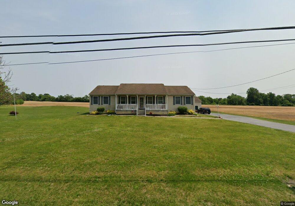
742 Union Rd Mickleton, NJ 08056
Estimated Value: $473,442 - $582,000
Studio
--
Bath
1,800
Sq Ft
$299/Sq Ft
Est. Value
About This Home
This home is located at 742 Union Rd, Mickleton, NJ 08056 and is currently estimated at $537,611, approximately $298 per square foot. 742 Union Rd is a home located in Gloucester County with nearby schools including Jeffrey Clark School, Samuel Mickle School, and Kingsway Regional Middle School.
Ownership History
Date
Name
Owned For
Owner Type
Purchase Details
Closed on
Apr 23, 2010
Sold by
Lawall John J and Lawall Lori B
Bought by
Lawall John J
Current Estimated Value
Purchase Details
Closed on
Mar 10, 2009
Sold by
Lawall John J and Timmons Lori B
Bought by
Lawall John J and Lawall Lori B
Home Financials for this Owner
Home Financials are based on the most recent Mortgage that was taken out on this home.
Original Mortgage
$138,500
Interest Rate
5.25%
Mortgage Type
New Conventional
Purchase Details
Closed on
Jul 13, 2001
Sold by
Maccherone Santo J and Lawall Sara M
Bought by
Lawall John J and Timmons Lori B
Create a Home Valuation Report for This Property
The Home Valuation Report is an in-depth analysis detailing your home's value as well as a comparison with similar homes in the area
Home Values in the Area
Average Home Value in this Area
Purchase History
| Date | Buyer | Sale Price | Title Company |
|---|---|---|---|
| Lawall John J | -- | None Available | |
| Lawall John J | -- | Old Republic National Title | |
| Lawall John J | -- | -- |
Source: Public Records
Mortgage History
| Date | Status | Borrower | Loan Amount |
|---|---|---|---|
| Closed | Lawall John J | $138,500 |
Source: Public Records
Tax History
| Year | Tax Paid | Tax Assessment Tax Assessment Total Assessment is a certain percentage of the fair market value that is determined by local assessors to be the total taxable value of land and additions on the property. | Land | Improvement |
|---|---|---|---|---|
| 2025 | $9,076 | $285,500 | $105,800 | $179,700 |
| 2024 | $8,788 | $285,500 | $105,800 | $179,700 |
| 2023 | $8,788 | $285,500 | $105,800 | $179,700 |
| 2022 | $8,539 | $285,500 | $105,800 | $179,700 |
| 2021 | $8,596 | $285,500 | $105,800 | $179,700 |
| 2020 | $8,636 | $285,500 | $105,800 | $179,700 |
| 2019 | $8,548 | $285,500 | $105,800 | $179,700 |
| 2018 | $8,625 | $261,600 | $77,400 | $184,200 |
| 2017 | $8,512 | $261,600 | $77,400 | $184,200 |
| 2016 | $8,413 | $261,600 | $77,400 | $184,200 |
| 2015 | $8,063 | $261,600 | $77,400 | $184,200 |
| 2014 | $7,565 | $261,600 | $77,400 | $184,200 |
Source: Public Records
Map
Nearby Homes
- 253 Jennings Way
- 67 E Rattling Run Rd
- 325 Windsor Rd
- 0 Tomlin Station Rd Unit NJGL2061600
- 642 Bainbridge Dr
- 552 Hereford Ln
- 607 Apple Dr
- 6 Burton Ln
- 126 Cider Press Dr
- 41 Redkist Dr
- 53 Redkist Dr
- 55 Redkist Dr
- 34 Redkist Dr
- 57 Redkist Dr
- 32 Redkist Dr
- 59 Redkist Dr
- 30 Redkist Dr
- 18 Millwood Dr
- 28 Redkist Dr
- 72 Redkist Dr
Your Personal Tour Guide
Ask me questions while you tour the home.