Estimated Value: $137,000 - $174,000
2
Beds
1
Bath
768
Sq Ft
$210/Sq Ft
Est. Value
About This Home
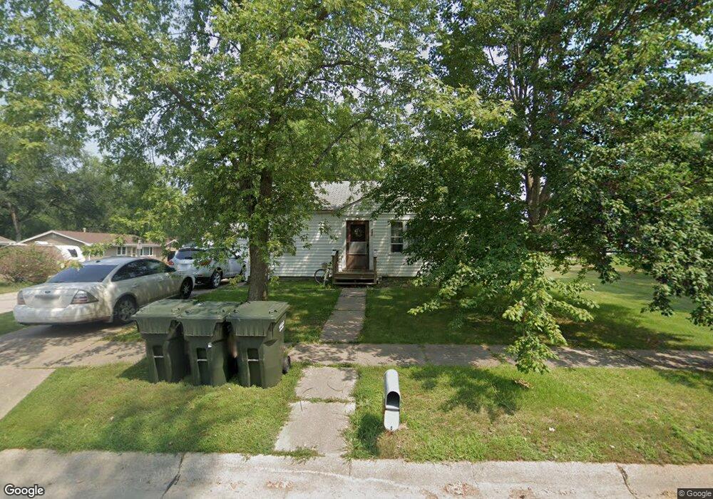
This home is located at 742 W 6th St, Wahoo, NE 68066 and is currently estimated at $161,333, approximately $210 per square foot. 742 W 6th St is a home located in Saunders County with nearby schools including Wahoo Elementary School, Wahoo Middle School, and Wahoo High School.
Ownership History
Date
Name
Owned For
Owner Type
Purchase Details
Closed on
Jul 10, 2013
Sold by
Brown Marilyn L
Bought by
Hancock William F and Hancock Michael G
Current Estimated Value
Home Financials for this Owner
Home Financials are based on the most recent Mortgage that was taken out on this home.
Original Mortgage
$75,000
Outstanding Balance
$36,497
Interest Rate
3.93%
Estimated Equity
$124,836
Purchase Details
Closed on
Jul 9, 2013
Sold by
Nordstrom Daniel L and Nordstrom Jody F
Bought by
Hancock Ii William F and Hancock Michael G
Home Financials for this Owner
Home Financials are based on the most recent Mortgage that was taken out on this home.
Original Mortgage
$75,000
Outstanding Balance
$36,497
Interest Rate
3.93%
Estimated Equity
$124,836
Create a Home Valuation Report for This Property
The Home Valuation Report is an in-depth analysis detailing your home's value as well as a comparison with similar homes in the area
Home Values in the Area
Average Home Value in this Area
Purchase History
| Date | Buyer | Sale Price | Title Company |
|---|---|---|---|
| Hancock William F | -- | -- | |
| Hancock Ii William F | -- | -- |
Source: Public Records
Mortgage History
| Date | Status | Borrower | Loan Amount |
|---|---|---|---|
| Open | Hancock William F | $75,000 | |
| Closed | Hancock Ii William F | $75,000 |
Source: Public Records
Tax History Compared to Growth
Tax History
| Year | Tax Paid | Tax Assessment Tax Assessment Total Assessment is a certain percentage of the fair market value that is determined by local assessors to be the total taxable value of land and additions on the property. | Land | Improvement |
|---|---|---|---|---|
| 2024 | $1,438 | $106,515 | $17,545 | $88,970 |
| 2023 | $1,824 | $104,229 | $17,545 | $86,684 |
| 2022 | $1,726 | $92,000 | $17,545 | $74,455 |
| 2021 | $1,524 | $79,061 | $17,545 | $61,516 |
| 2020 | $1,495 | $77,058 | $17,545 | $59,513 |
| 2019 | $1,484 | $74,769 | $17,545 | $57,224 |
| 2018 | $1,349 | $65,100 | $17,550 | $47,550 |
| 2017 | $1,345 | $65,100 | $17,550 | $47,550 |
| 2016 | $1,378 | $65,700 | $17,550 | $48,150 |
| 2015 | $1,388 | $65,700 | $17,550 | $48,150 |
| 2014 | $1,412 | $65,700 | $17,550 | $48,150 |
| 2012 | $1,495 | $65,700 | $17,550 | $48,150 |
Source: Public Records
Map
Nearby Homes
- 758 W Park Cir
- 878 W 8th St
- 453 W 7th St
- 453 W 4th St
- 565 W 10th St
- 720 W 10th St
- 649 W 2nd St
- 1039 N Laurel St
- 1530 Highway 77 Unit 4.55 Ac.
- 122 E 10th St
- 327 E 7th St
- 820 W 15th St
- 1365 N Chestnut St
- 651 W 16th St
- 243 S Linden St
- 2689 N Oak St
- 1775 17th Avenue Rd Unit 2.36 Acres
- 428 E 14th St
- 30 Acres NW County Road 19 & Q
- 26.26 Acres NW 19th & County Road Q