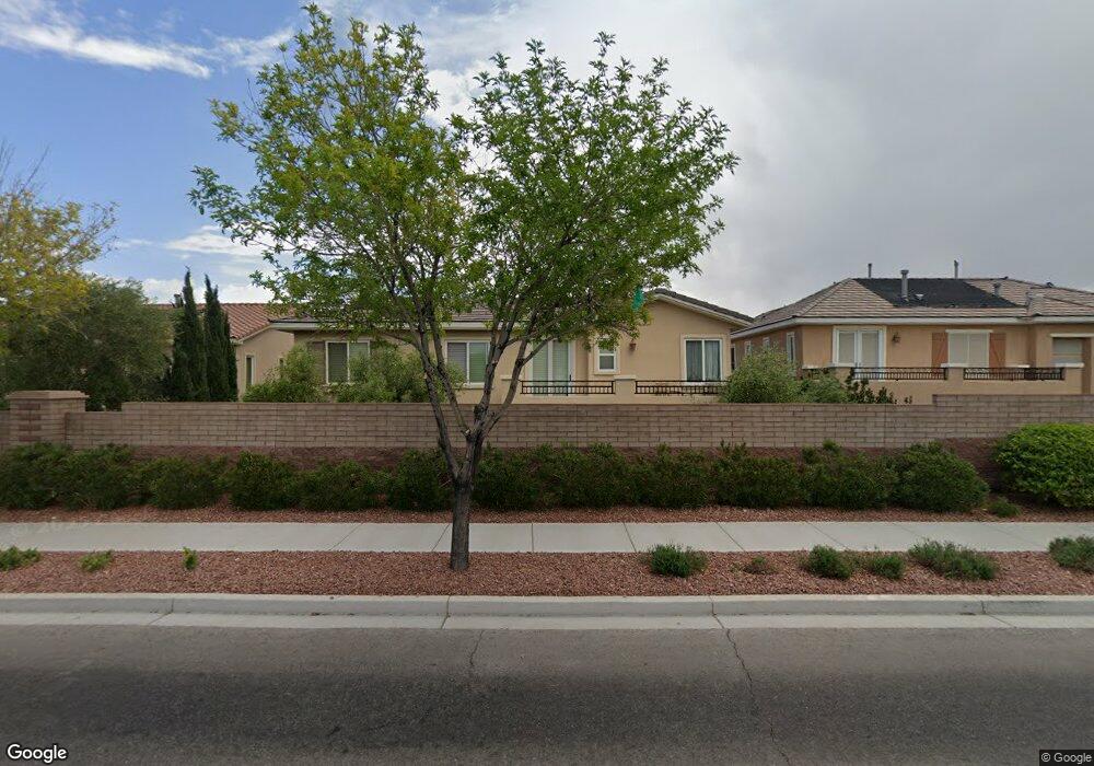
7423 Olmstead St Las Vegas, NV 89166
La Madre Foothills NeighborhoodEstimated Value: $684,000 - $1,049,000
3
Beds
3
Baths
3,401
Sq Ft
$244/Sq Ft
Est. Value
About This Home
This home is located at 7423 Olmstead St, Las Vegas, NV 89166 and is currently estimated at $831,292, approximately $244 per square foot. 7423 Olmstead St is a home located in Clark County with nearby schools including Henry & Evelyn Bozarth Elementary School, Edmundo "Eddie" Escobedo, Sr. Middle School, and Centennial High School.
Ownership History
Date
Name
Owned For
Owner Type
Purchase Details
Closed on
Jun 23, 2016
Sold by
Conger Alexia S
Bought by
Skandros Stephanie
Current Estimated Value
Purchase Details
Closed on
May 13, 2010
Sold by
Skandros Georgia F
Bought by
Skandros Georgia F and The Georgia F Skandros Trust
Purchase Details
Closed on
Jul 31, 2009
Sold by
Toll North Lv Llc
Bought by
Skandros Stephanie and Skandros Georgia F
Home Financials for this Owner
Home Financials are based on the most recent Mortgage that was taken out on this home.
Original Mortgage
$380,000
Outstanding Balance
$248,897
Interest Rate
5.3%
Mortgage Type
Unknown
Estimated Equity
$582,395
Purchase Details
Closed on
Jan 29, 2008
Sold by
Toll Nv Holdings Llc
Bought by
Toll North Lv Llc
Create a Home Valuation Report for This Property
The Home Valuation Report is an in-depth analysis detailing your home's value as well as a comparison with similar homes in the area
Home Values in the Area
Average Home Value in this Area
Purchase History
| Date | Buyer | Sale Price | Title Company |
|---|---|---|---|
| Skandros Stephanie | -- | None Available | |
| Skandros Georgia F | -- | None Available | |
| Skandros Stephanie | $475,000 | First American Title Centra | |
| Toll North Lv Llc | -- | None Available | |
| Toll Nv Holdings Llc | -- | None Available |
Source: Public Records
Mortgage History
| Date | Status | Borrower | Loan Amount |
|---|---|---|---|
| Open | Skandros Stephanie | $380,000 |
Source: Public Records
Tax History Compared to Growth
Tax History
| Year | Tax Paid | Tax Assessment Tax Assessment Total Assessment is a certain percentage of the fair market value that is determined by local assessors to be the total taxable value of land and additions on the property. | Land | Improvement |
|---|---|---|---|---|
| 2025 | $4,857 | $228,130 | $53,200 | $174,930 |
| 2024 | $4,716 | $228,130 | $53,200 | $174,930 |
| 2023 | $3,849 | $237,696 | $50,400 | $187,296 |
| 2022 | $4,579 | $204,970 | $46,550 | $158,420 |
| 2021 | $4,446 | $168,431 | $39,550 | $128,881 |
| 2020 | $4,313 | $158,791 | $39,200 | $119,591 |
| 2019 | $4,188 | $149,307 | $35,000 | $114,307 |
| 2018 | $4,066 | $138,765 | $29,400 | $109,365 |
| 2017 | $4,573 | $139,450 | $28,350 | $111,100 |
| 2016 | $3,849 | $133,023 | $21,350 | $111,673 |
| 2015 | $3,842 | $126,824 | $17,500 | $109,324 |
| 2014 | $3,730 | $119,060 | $10,500 | $108,560 |
Source: Public Records
Map
Nearby Homes
- 7431 Bretton Oaks St
- 7563 Captain Lord Ct
- 10424 Burkehaven Ave
- 7335 Quaking Aspen St
- 10425 Scotch Elm Ave
- 7460 Tucker William St
- 7342 Tanglewood Park St
- 10271 Headrick Dr
- 10449 Yew Blossom Ave
- 10225 Headrick Dr
- 7613 Pulpit Rock Ct
- 10256 Headrick Dr
- 10262 Headrick Dr
- 7125 Silver Ridge Peak St Unit 1
- 7810 Sundial Peak St
- 7119 Saddle Back Peak St
- 7605 Lake Fork Peak St
- 8984 Rolling Pietra St
- 10590 Dryades Ave
- 10614 Mount Blackburn Ave
- 7427 Olmstead St
- 7419 Olmstead St
- 7415 Olmstead St
- 7431 Olmstead St
- 10259 Madison Grove Ave
- 7430 Olmstead St
- 10251 Madison Grove Ave
- 10244 Scopes Ave
- 10240 Scopes Ave
- 7411 Olmstead St
- 7423 Bretton Oaks St
- 7427 Bretton Oaks St
- 10236 Scopes Ave
- 10232 Scopes Ave
- 7507 Edgartown Harbor St
- 7407 Olmstead St
- 7506 Edgartown Harbor St
- 10228 Scopes Ave
- 10229 Madison Grove Ave
- 7507 Salem Cross Ct