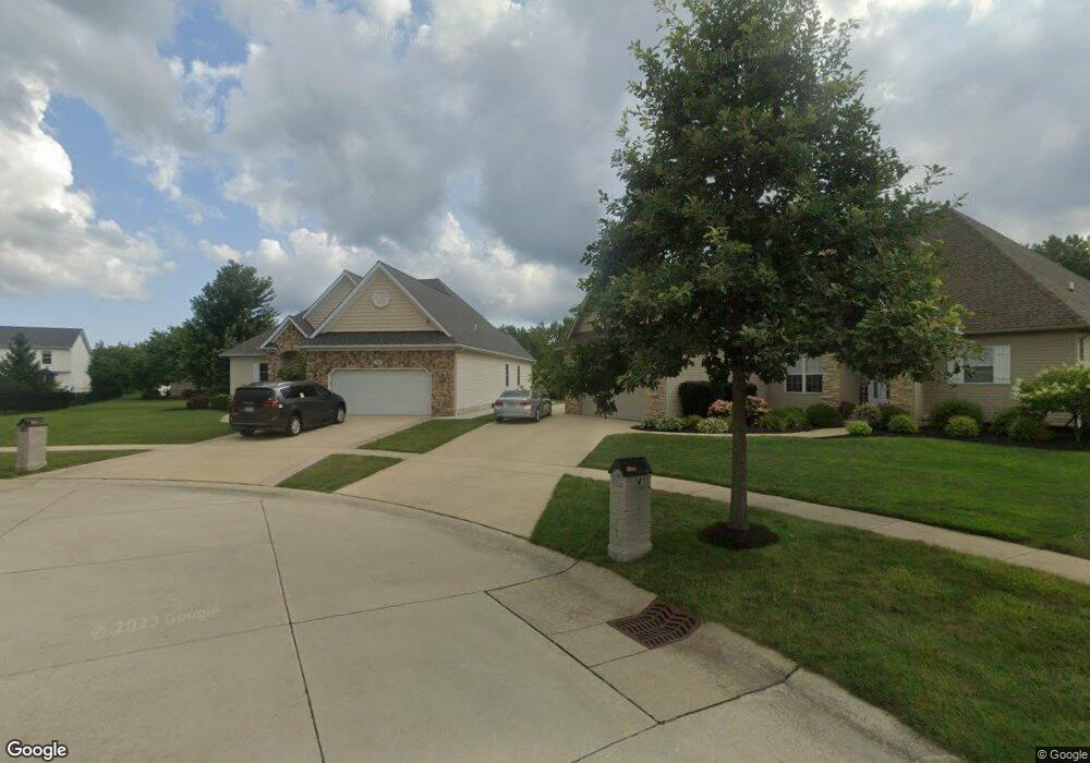
743 Brookside Cir Avon Lake, OH 44012
Estimated Value: $539,188 - $575,000
3
Beds
2
Baths
2,284
Sq Ft
$245/Sq Ft
Est. Value
About This Home
This home is located at 743 Brookside Cir, Avon Lake, OH 44012 and is currently estimated at $558,547, approximately $244 per square foot. 743 Brookside Cir is a home located in Lorain County with nearby schools including Eastview Elementary School, Troy Intermediate Elementary School, and Learwood Middle School.
Ownership History
Date
Name
Owned For
Owner Type
Purchase Details
Closed on
Oct 13, 2010
Sold by
Primacy Relocation Llc
Bought by
Shepherd Matthew W and Shepherd Mary L
Current Estimated Value
Home Financials for this Owner
Home Financials are based on the most recent Mortgage that was taken out on this home.
Original Mortgage
$279,142
Outstanding Balance
$183,735
Interest Rate
4.3%
Mortgage Type
FHA
Estimated Equity
$374,812
Purchase Details
Closed on
Oct 11, 2010
Sold by
Kane Christopher and Kane Eileen
Bought by
Primacy Relocation Llc
Home Financials for this Owner
Home Financials are based on the most recent Mortgage that was taken out on this home.
Original Mortgage
$279,142
Outstanding Balance
$183,735
Interest Rate
4.3%
Mortgage Type
FHA
Estimated Equity
$374,812
Purchase Details
Closed on
Oct 18, 2007
Sold by
August Homes Co
Bought by
Kane Christopher and Kane Eileen
Home Financials for this Owner
Home Financials are based on the most recent Mortgage that was taken out on this home.
Original Mortgage
$265,640
Interest Rate
6.5%
Mortgage Type
Unknown
Create a Home Valuation Report for This Property
The Home Valuation Report is an in-depth analysis detailing your home's value as well as a comparison with similar homes in the area
Home Values in the Area
Average Home Value in this Area
Purchase History
| Date | Buyer | Sale Price | Title Company |
|---|---|---|---|
| Shepherd Matthew W | $283,000 | First American Title Ins Co | |
| Primacy Relocation Llc | $278,000 | First American Title Ins Co | |
| Kane Christopher | $332,100 | 1St Nationwide Title Agency |
Source: Public Records
Mortgage History
| Date | Status | Borrower | Loan Amount |
|---|---|---|---|
| Open | Shepherd Matthew W | $279,142 | |
| Previous Owner | Kane Christopher | $265,640 |
Source: Public Records
Tax History Compared to Growth
Tax History
| Year | Tax Paid | Tax Assessment Tax Assessment Total Assessment is a certain percentage of the fair market value that is determined by local assessors to be the total taxable value of land and additions on the property. | Land | Improvement |
|---|---|---|---|---|
| 2024 | $7,314 | $154,578 | $42,063 | $112,515 |
| 2023 | $7,239 | $136,098 | $37,559 | $98,539 |
| 2022 | $7,164 | $136,098 | $37,559 | $98,539 |
| 2021 | $7,067 | $136,098 | $37,559 | $98,539 |
| 2020 | $6,581 | $116,100 | $32,920 | $83,180 |
| 2019 | $6,546 | $116,100 | $32,920 | $83,180 |
Source: Public Records
Map
Nearby Homes
- 742 Brookside Cir
- 717 Schiller Ct
- 693 Coronado Cir
- 31628 Winners Cir
- 588 S Port Dr
- 725 Rock Harbor
- 544 Port Side Dr
- 552 Marvis Dr
- 0 Lear Rd Unit 5155467
- Castleton Plan at Port Side - Estates
- Oakmont Plan at Port Side - Reserve
- Continental II Plan at Port Side - Crossings
- Willwood Plan at Port Side - Estates
- Pebble Beach Plan at Port Side - Reserve
- Mercer II Plan at Port Side - Crossings
- Waverly Plan at Port Side - Crossings
- Augusta Plan at Port Side - Reserve
- Newberry II Plan at Port Side - Crossings
- Allison II Plan at Port Side - Estates
- Woodside Plan at Port Side - Estates
- 747 Brookside Cir
- 31903 Pondside Dr
- 31899 Pondside Dr
- 31907 Pondside Dr
- 31873 Pondside Dr
- 31869 Pondside Dr
- 746 Brookside Cir Unit 4
- 31889 Pondside Dr
- 31889 Pondside Dr
- 31863 Pondside Dr
- 31911 Pondside Dr
- 31981 Pondside Dr
- 31971 Pondside Dr
- 31859 Pondside Dr
- 31935 Pondside Dr
- 31939 Pondside Dr
- 31904 Pondside Dr
- 31943 Pondside Dr
- 31908 Pondside Dr
- 31900 Pondside Dr