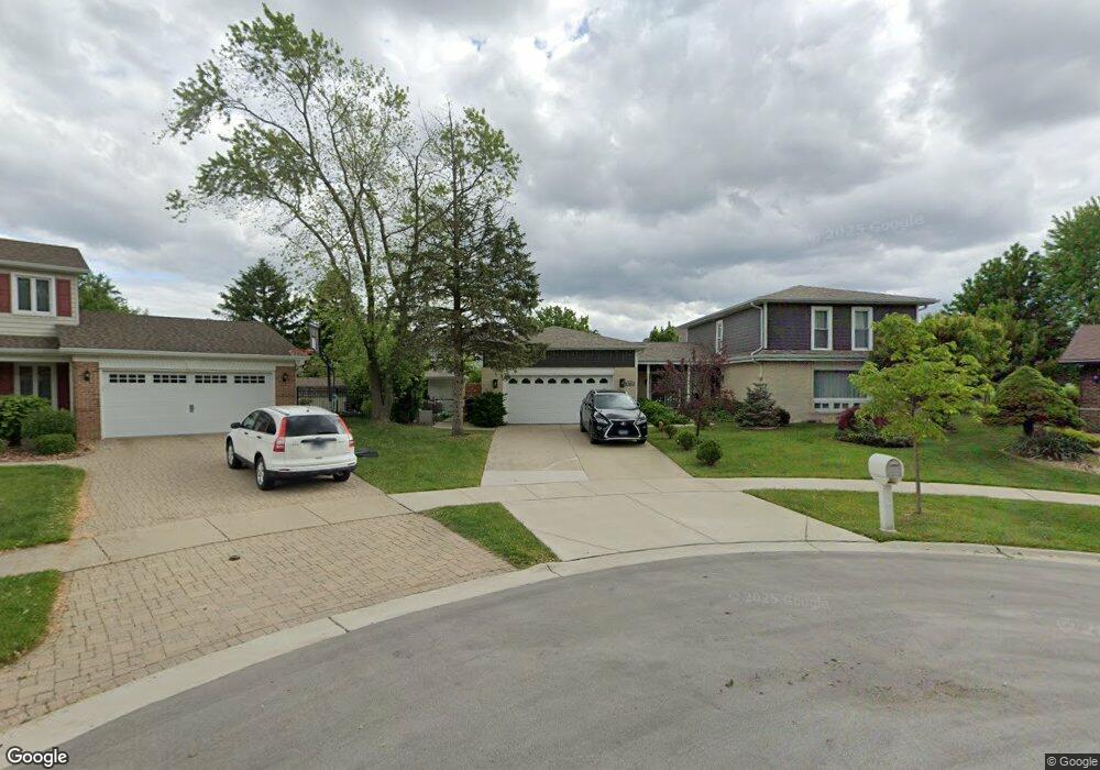
743 Highpoint Ct Schaumburg, IL 60193
East Schaumburg NeighborhoodEstimated Value: $552,000 - $674,000
3
Beds
2
Baths
2,544
Sq Ft
$238/Sq Ft
Est. Value
About This Home
This home is located at 743 Highpoint Ct, Schaumburg, IL 60193 and is currently estimated at $605,879, approximately $238 per square foot. 743 Highpoint Ct is a home located in Cook County with nearby schools including Michael Collins Elementary School, Robert Frost Junior High School, and J B Conant High School.
Ownership History
Date
Name
Owned For
Owner Type
Purchase Details
Closed on
Jul 25, 2017
Sold by
Chicago Title Land Trust Co
Bought by
Angelov Biser and Angelov Zlatina
Current Estimated Value
Home Financials for this Owner
Home Financials are based on the most recent Mortgage that was taken out on this home.
Original Mortgage
$276,000
Outstanding Balance
$231,288
Interest Rate
4.12%
Mortgage Type
New Conventional
Estimated Equity
$374,591
Purchase Details
Closed on
Sep 21, 1998
Sold by
Bruzga Vincent and Bruzga Catherine
Bought by
Continental Community Bk & Tr Company and Trust #10281
Create a Home Valuation Report for This Property
The Home Valuation Report is an in-depth analysis detailing your home's value as well as a comparison with similar homes in the area
Home Values in the Area
Average Home Value in this Area
Purchase History
| Date | Buyer | Sale Price | Title Company |
|---|---|---|---|
| Angelov Biser | $345,000 | None Available | |
| Continental Community Bk & Tr Company | -- | -- |
Source: Public Records
Mortgage History
| Date | Status | Borrower | Loan Amount |
|---|---|---|---|
| Open | Angelov Biser | $276,000 |
Source: Public Records
Tax History Compared to Growth
Tax History
| Year | Tax Paid | Tax Assessment Tax Assessment Total Assessment is a certain percentage of the fair market value that is determined by local assessors to be the total taxable value of land and additions on the property. | Land | Improvement |
|---|---|---|---|---|
| 2024 | $11,957 | $46,001 | $9,950 | $36,051 |
| 2023 | $11,566 | $46,001 | $9,950 | $36,051 |
| 2022 | $11,566 | $46,001 | $9,950 | $36,051 |
| 2021 | $8,402 | $31,050 | $7,462 | $23,588 |
| 2020 | $8,325 | $31,050 | $7,462 | $23,588 |
| 2019 | $8,328 | $34,500 | $7,462 | $27,038 |
| 2018 | $10,267 | $37,647 | $6,356 | $31,291 |
| 2017 | $11,906 | $40,306 | $6,356 | $33,950 |
| 2016 | $5,720 | $40,306 | $6,356 | $33,950 |
| 2015 | $6,508 | $36,367 | $5,527 | $30,840 |
| 2014 | $6,303 | $36,367 | $5,527 | $30,840 |
| 2013 | $6,287 | $36,367 | $5,527 | $30,840 |
Source: Public Records
Map
Nearby Homes
- 916 Manchester Cir Unit 91A
- 126 Manchester Ct Unit 61B
- 1100 Boston Harbor Unit 7004
- 718 N Point Dr
- 722 Merlin Dr Unit 16
- 421 Summit Dr
- 421 E Wise Rd
- 36 Shore Dr
- 205 Nantucket Harbor Unit 104
- 426 E Niagara Ave
- 711 Tipperary Ct Unit 2D
- 712 Tipperary Ct Unit 1C
- 733 Limerick Ln Unit 7333D
- 1871 Fox Run Dr Unit A
- 727 Killarney Ct Unit 1C
- 620 S Point Dr
- 251 University Ln
- 263 Doral Ct Unit 1
- 1910 Baltimore Dr
- 826 Thornton Ct Unit 2AL
- 736 Highpoint Ct
- 739 Highpoint Ct
- 732 Highpoint Ct
- 735 Highpoint Ct
- 430 Scholten Dr
- 434 Scholten Dr
- 426 Scholten Dr
- 749 Summit Dr
- 740 Terrace Ct
- 745 Summit Dr
- 438 Scholten Dr
- 731 Highpoint Ct
- 728 Highpoint Ct
- 736 Terrace Ct
- 422 Scholten Dr
- 741 Summit Dr
- 442 Scholten Dr
- 732 Terrace Ct
- 741 Terrace Ct
- 446 Scholten Dr