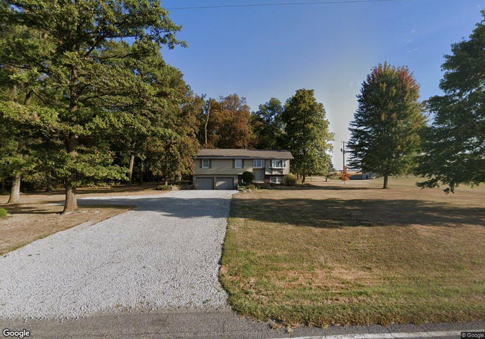
743 Mercer Darke Co Line Rd Fort Recovery, OH 45846
Estimated Value: $523,000 - $624,000
4
Beds
3
Baths
2,310
Sq Ft
$240/Sq Ft
Est. Value
About This Home
This home is located at 743 Mercer Darke Co Line Rd, Fort Recovery, OH 45846 and is currently estimated at $553,316, approximately $239 per square foot. 743 Mercer Darke Co Line Rd is a home located in Mercer County with nearby schools including Fort Recovery Elementary School, Fort Recovery Middle School, and Fort Recovery High School.
Ownership History
Date
Name
Owned For
Owner Type
Purchase Details
Closed on
Nov 22, 2024
Sold by
Badgett Steven C and Badgett Mary Ann
Bought by
Dan W Lochtefeld Trust and Mary F Lochtefeld Trust
Current Estimated Value
Purchase Details
Closed on
Apr 16, 1985
Bought by
Badgett Steven C and Mary Ann M
Create a Home Valuation Report for This Property
The Home Valuation Report is an in-depth analysis detailing your home's value as well as a comparison with similar homes in the area
Home Values in the Area
Average Home Value in this Area
Purchase History
| Date | Buyer | Sale Price | Title Company |
|---|---|---|---|
| Dan W Lochtefeld Trust | $583,333 | None Listed On Document | |
| Badgett Steven C | $82,000 | -- |
Source: Public Records
Tax History Compared to Growth
Tax History
| Year | Tax Paid | Tax Assessment Tax Assessment Total Assessment is a certain percentage of the fair market value that is determined by local assessors to be the total taxable value of land and additions on the property. | Land | Improvement |
|---|---|---|---|---|
| 2024 | -- | $91,140 | $22,890 | $68,250 |
| 2023 | $2,579 | $91,140 | $22,890 | $68,250 |
| 2022 | $2,103 | $66,990 | $18,760 | $48,230 |
| 2021 | $2,110 | $66,990 | $18,760 | $48,230 |
| 2020 | $2,106 | $66,990 | $18,760 | $48,230 |
| 2019 | $1,878 | $57,440 | $16,630 | $40,810 |
| 2018 | $1,947 | $57,440 | $16,630 | $40,810 |
| 2017 | $1,961 | $57,440 | $16,630 | $40,810 |
| 2016 | $1,793 | $53,830 | $17,080 | $36,750 |
| 2015 | $1,721 | $53,830 | $17,080 | $36,750 |
| 2014 | $1,749 | $53,830 | $17,080 | $36,750 |
| 2013 | $1,735 | $50,750 | $16,100 | $34,650 |
Source: Public Records
Map
Nearby Homes
- 201 W Wiggs St
- 304 S Wayne St
- 4475 Ohio 705
- 3709 Rossburg-Lightsville Rd
- 2729 S 300 E
- 4543 Lange Rd
- 1291 State Route 219
- 0 County Road 400 N
- 0 Ohio 118
- 1200 N Jackson Pike
- 509 Indiana 28
- 0 W Deerfield Rd Unit 23016117
- 0 W Deerfield Rd Unit 837795
- 0 W Deerfield Rd
- 3052 State Route 47
- 811 N Columbia St
- 811 N Columbia St
- 543 N Walnut St
- 718 Lynwood Ct
- 706 Lynwood Ct