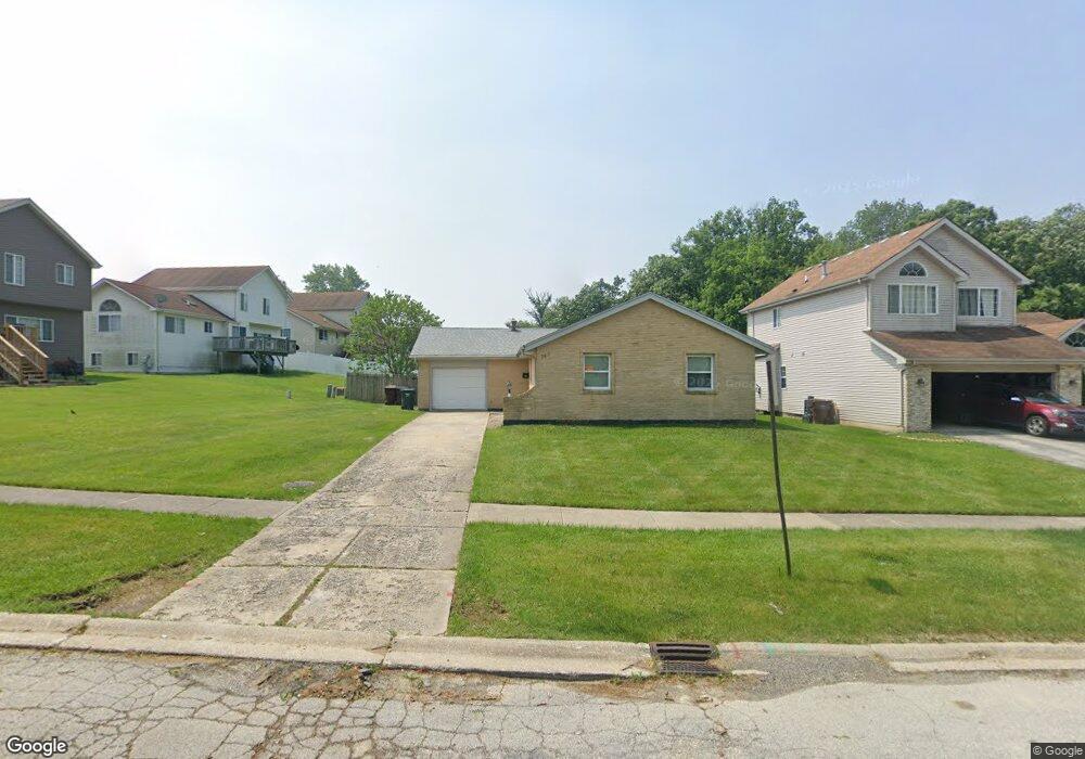
743 Mission St University Park, IL 60484
Estimated Value: $179,872 - $242,000
3
Beds
2
Baths
1,150
Sq Ft
$175/Sq Ft
Est. Value
About This Home
This home is located at 743 Mission St, University Park, IL 60484 and is currently estimated at $200,718, approximately $174 per square foot. 743 Mission St is a home located in Will County with nearby schools including Monee Elementary School, Crete-Monee Middle School, and Crete-Monee High School.
Ownership History
Date
Name
Owned For
Owner Type
Purchase Details
Closed on
May 18, 2009
Sold by
Lasalle Bank Na
Bought by
Groce Enda
Current Estimated Value
Home Financials for this Owner
Home Financials are based on the most recent Mortgage that was taken out on this home.
Original Mortgage
$36,000
Interest Rate
5.62%
Mortgage Type
Purchase Money Mortgage
Purchase Details
Closed on
Feb 4, 2009
Sold by
Sutherland Ian Cheddi and Case #07 Ch 4188
Bought by
Lasalle Bank National Association
Purchase Details
Closed on
Nov 5, 2008
Sold by
Sutherland Ian Cheddi and Capital One Bank
Bought by
Lasalle Bank Na
Purchase Details
Closed on
May 27, 2004
Sold by
Lyke Carl
Bought by
Sutherland Ian Cheddi
Home Financials for this Owner
Home Financials are based on the most recent Mortgage that was taken out on this home.
Original Mortgage
$95,500
Interest Rate
9.99%
Mortgage Type
Purchase Money Mortgage
Create a Home Valuation Report for This Property
The Home Valuation Report is an in-depth analysis detailing your home's value as well as a comparison with similar homes in the area
Home Values in the Area
Average Home Value in this Area
Purchase History
| Date | Buyer | Sale Price | Title Company |
|---|---|---|---|
| Groce Enda | $45,000 | First American Title | |
| Lasalle Bank National Association | -- | None Available | |
| Lasalle Bank Na | $109,500 | None Available | |
| Sutherland Ian Cheddi | $95,500 | -- |
Source: Public Records
Mortgage History
| Date | Status | Borrower | Loan Amount |
|---|---|---|---|
| Previous Owner | Groce Enda | $36,000 | |
| Previous Owner | Sutherland Ian Cheddi | $95,500 |
Source: Public Records
Tax History Compared to Growth
Tax History
| Year | Tax Paid | Tax Assessment Tax Assessment Total Assessment is a certain percentage of the fair market value that is determined by local assessors to be the total taxable value of land and additions on the property. | Land | Improvement |
|---|---|---|---|---|
| 2024 | $5,700 | $45,411 | $8,402 | $37,009 |
| 2023 | $5,700 | $39,147 | $7,243 | $31,904 |
| 2022 | $4,853 | $34,436 | $6,371 | $28,065 |
| 2021 | $4,627 | $31,373 | $5,852 | $25,521 |
| 2020 | $4,588 | $30,356 | $5,662 | $24,694 |
| 2019 | $4,668 | $28,787 | $5,369 | $23,418 |
| 2018 | $4,584 | $27,704 | $5,255 | $22,449 |
| 2017 | $4,486 | $26,521 | $5,138 | $21,383 |
| 2016 | $4,259 | $25,133 | $4,941 | $20,192 |
| 2015 | $3,659 | $22,951 | $4,503 | $18,448 |
| 2014 | $3,659 | $22,634 | $4,441 | $18,193 |
| 2013 | $3,659 | $23,700 | $4,650 | $19,050 |
Source: Public Records
Map
Nearby Homes
- 740 Mission St
- 1031 Blackhawk Dr
- 537 Nathan Rd
- 1039 Barrow Ct
- 607 Sullivan Ln
- 1109 Abbot Ln
- 608 Sullivan Ln
- 543 Regent Rd
- 903 Blackhawk Dr
- 662 Sullivan Ln
- 655 Sullivan Ln
- 1039 Abbot Ln
- 815 Blackhawk Dr
- 1032 Samson Dr
- 807 Blackhawk Dr
- 612 Hickok Ave
- 882 White Oak Ln Unit 3
- 1029 Samson Dr
- 735 Union Dr
- 610 Sandra Dr
- 743 Mission Ave
- 745 Mission St
- 1026 Blackhawk Dr
- 1024 Blackhawk Dr
- 1028 Blackhawk Dr
- 747 Mission St Unit 4
- 742 Mission Dr
- 1030 Blackhawk Dr
- 740 Mission Dr
- 742 Mission St
- 1032 Blackhawk Dr Unit 4
- 754 Mission St
- 746 Mission St
- 1018 Blackhawk Dr
- 749 Mission St
- 750 Mission St
- 1034 Blackhawk Dr
- 1016 Blackhawk Dr
- 753 Mission St
- 1036 Blackhawk Dr