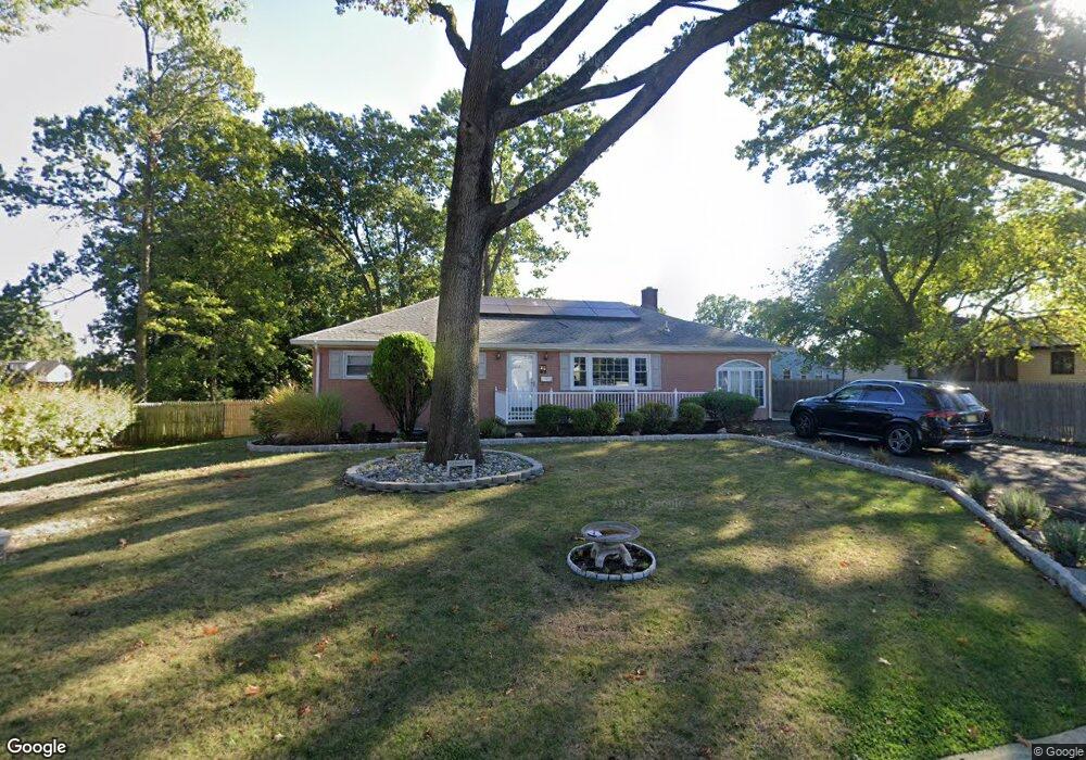
743 Wadsworth Ave South Plainfield, NJ 07080
Estimated Value: $548,000 - $662,000
--
Bed
--
Bath
--
Sq Ft
0.35
Acres
About This Home
This home is located at 743 Wadsworth Ave, South Plainfield, NJ 07080 and is currently estimated at $593,003. 743 Wadsworth Ave is a home located in Middlesex County with nearby schools including South Plainfield High School, The Queen City Academy Charter School, and Koinonia Academy.
Ownership History
Date
Name
Owned For
Owner Type
Purchase Details
Closed on
Jan 18, 2000
Sold by
Steinman Joel
Bought by
Milteer Andre
Current Estimated Value
Home Financials for this Owner
Home Financials are based on the most recent Mortgage that was taken out on this home.
Original Mortgage
$167,200
Outstanding Balance
$53,403
Interest Rate
7.91%
Estimated Equity
$539,600
Purchase Details
Closed on
Aug 31, 1998
Sold by
Malinowski Thomas
Bought by
Steinman Joel and Macdonald Lucy
Home Financials for this Owner
Home Financials are based on the most recent Mortgage that was taken out on this home.
Original Mortgage
$124,000
Interest Rate
6.92%
Create a Home Valuation Report for This Property
The Home Valuation Report is an in-depth analysis detailing your home's value as well as a comparison with similar homes in the area
Home Values in the Area
Average Home Value in this Area
Purchase History
| Date | Buyer | Sale Price | Title Company |
|---|---|---|---|
| Milteer Andre | $176,000 | -- | |
| Steinman Joel | $155,000 | -- |
Source: Public Records
Mortgage History
| Date | Status | Borrower | Loan Amount |
|---|---|---|---|
| Open | Milteer Andre | $167,200 | |
| Previous Owner | Steinman Joel | $124,000 |
Source: Public Records
Tax History Compared to Growth
Tax History
| Year | Tax Paid | Tax Assessment Tax Assessment Total Assessment is a certain percentage of the fair market value that is determined by local assessors to be the total taxable value of land and additions on the property. | Land | Improvement |
|---|---|---|---|---|
| 2025 | $8,588 | $123,000 | $34,600 | $88,400 |
| 2024 | $8,214 | $123,000 | $34,600 | $88,400 |
| 2023 | $8,214 | $123,000 | $34,600 | $88,400 |
| 2022 | $8,112 | $123,000 | $34,600 | $88,400 |
| 2021 | $7,921 | $123,000 | $34,600 | $88,400 |
| 2020 | $7,806 | $123,000 | $34,600 | $88,400 |
| 2019 | $7,489 | $123,000 | $34,600 | $88,400 |
| 2018 | $7,296 | $123,000 | $34,600 | $88,400 |
| 2017 | $7,203 | $123,000 | $34,600 | $88,400 |
| 2016 | $7,130 | $123,000 | $34,600 | $88,400 |
| 2015 | $7,007 | $123,000 | $34,600 | $88,400 |
| 2014 | $6,806 | $123,000 | $34,600 | $88,400 |
Source: Public Records
Map
Nearby Homes
- 1221 Grant Ave Unit 23
- 909 Sherman Ave
- 1210 Maltby Ave
- 916 Sherman Ave
- 139 Palmer Ave
- 814 Sherman Ave Unit 18
- 905 Stelle Ave Unit 7
- 824 Monroe Ave Unit 26
- 105 Firth St
- 917 Tompkins Ave
- 551 Melrose Ave
- 946 W 7th St Unit 48
- 413 W 8th St
- 717 W 7th St
- 4 Rauer Ct
- 950 W 6th St Unit 52
- 610 Darrow Ave Unit 16
- 1400 Kenyon Ave
- 1119 S 9th St
- 1227 W 6th St
- 977 Maltby Ave
- 739 Wadsworth Ave
- 983 Maltby Ave
- 520 Ellis Place
- 989 Maltby Ave
- 510 Ellis Place
- 957 Maltby Ave Unit 61
- 818-20 Wadsworth Ave
- 822 Wadsworth Ave Unit 26
- 822-26 Wadsworth Ave
- 818 Wadsworth Ave Unit 20
- 1330 Grant Ave
- 1324 Grant Ave
- 1334 Grant Ave
- 812 Wadsworth Ave Unit 16
- 976 Maltby Ave
- 1338 Grant Ave
- 951 Maltby Ave Unit 55
- 978 Maltby Ave
- 1318-22 Grant Ave