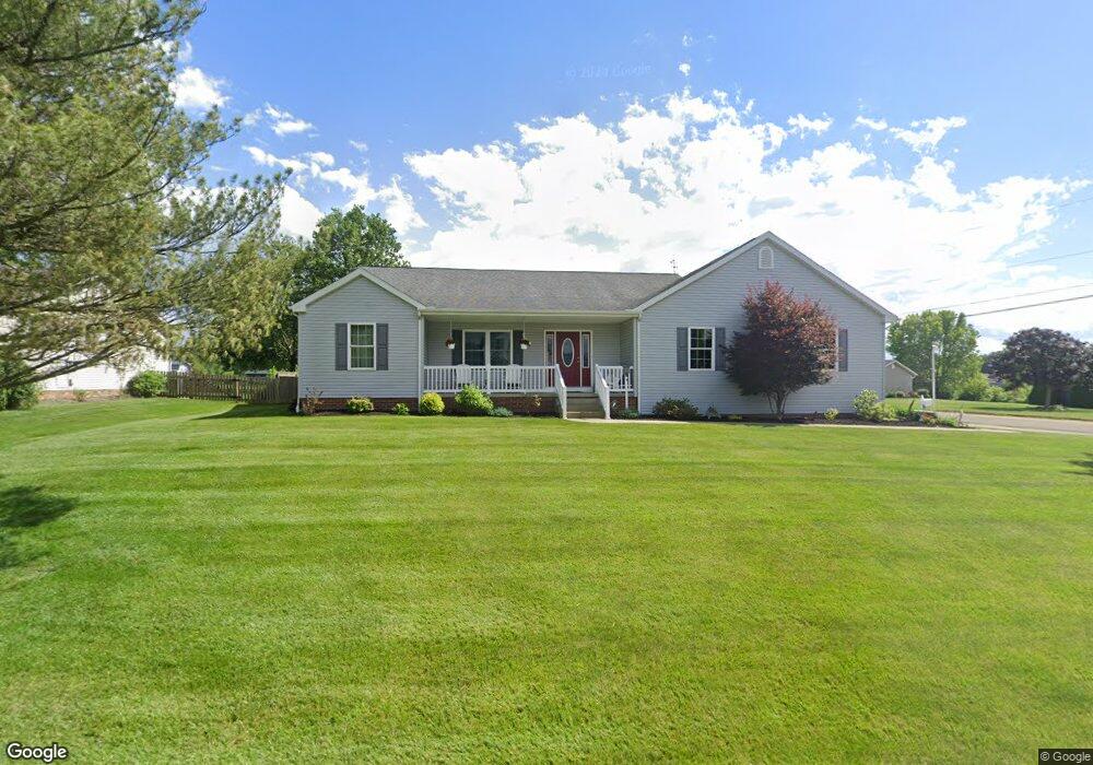
7430 Roni St SW Massillon, OH 44646
Southeast Massillon NeighborhoodEstimated Value: $322,000 - $370,000
3
Beds
3
Baths
2,232
Sq Ft
$158/Sq Ft
Est. Value
About This Home
This home is located at 7430 Roni St SW, Massillon, OH 44646 and is currently estimated at $353,025, approximately $158 per square foot. 7430 Roni St SW is a home located in Stark County with nearby schools including Pfeiffer Intermediate School, Edison Middle School, and Perry High School.
Ownership History
Date
Name
Owned For
Owner Type
Purchase Details
Closed on
Apr 4, 2005
Sold by
Ciesielczyk Regina R and Young Regina R
Bought by
Ciesielczyk Peter A
Current Estimated Value
Home Financials for this Owner
Home Financials are based on the most recent Mortgage that was taken out on this home.
Original Mortgage
$140,000
Outstanding Balance
$72,714
Interest Rate
5.88%
Mortgage Type
Stand Alone Refi Refinance Of Original Loan
Estimated Equity
$280,311
Purchase Details
Closed on
Aug 26, 1991
Create a Home Valuation Report for This Property
The Home Valuation Report is an in-depth analysis detailing your home's value as well as a comparison with similar homes in the area
Home Values in the Area
Average Home Value in this Area
Purchase History
| Date | Buyer | Sale Price | Title Company |
|---|---|---|---|
| Ciesielczyk Peter A | -- | -- | |
| -- | $18,800 | -- |
Source: Public Records
Mortgage History
| Date | Status | Borrower | Loan Amount |
|---|---|---|---|
| Open | Ciesielczyk Peter A | $140,000 |
Source: Public Records
Tax History Compared to Growth
Tax History
| Year | Tax Paid | Tax Assessment Tax Assessment Total Assessment is a certain percentage of the fair market value that is determined by local assessors to be the total taxable value of land and additions on the property. | Land | Improvement |
|---|---|---|---|---|
| 2025 | -- | $119,600 | $27,970 | $91,630 |
| 2024 | -- | $119,600 | $27,970 | $91,630 |
| 2023 | $4,683 | $93,420 | $15,370 | $78,050 |
| 2022 | $4,704 | $93,420 | $15,370 | $78,050 |
| 2021 | $5,010 | $93,420 | $15,370 | $78,050 |
| 2020 | $4,350 | $77,810 | $12,920 | $64,890 |
| 2019 | $3,923 | $77,810 | $12,920 | $64,890 |
| 2018 | $3,875 | $77,810 | $12,920 | $64,890 |
| 2017 | $4,343 | $80,790 | $10,610 | $70,180 |
| 2016 | $3,990 | $80,790 | $10,610 | $70,180 |
| 2015 | $1,500 | $61,780 | $10,610 | $51,170 |
| 2014 | $964 | $62,240 | $10,680 | $51,560 |
| 2013 | $1,411 | $62,240 | $10,680 | $51,560 |
Source: Public Records
Map
Nearby Homes
- 4657 Stevie Ave SW
- 7503 Kenny St SW
- 4716 Stevie Ave SW
- 4691 Stevie Ave SW
- 7216 Crusader St SW
- 4703 Stevie Ave SW
- 7245 Jimmie St SW
- 7349 Navarre Rd SW
- 8160 Navarre Rd SW
- 8202 Navarre Rd SW
- 4401 Kemary Ave SW
- 6534 Highton St SW
- 4111 Harbrook St SW
- 8471 Henry St SW
- 248 Bender St NE
- 19 Sprankle St NE
- 5190 Emil Ave SW Unit 407
- 0 Navarre Rd SW Unit 5093073
- 5240 Emil Ave SW Unit 107
- 5936 Drenta Cir SW
- 7404 Roni St SW
- 4594 Barbie Ave SW
- 7460 Roni St SW
- 4593 Barbie Ave SW
- 7427 Roni St SW
- 7386 Roni St SW
- 4612 Barbie Ave SW
- 7395 Roni St SW
- 4613 Barbie Ave SW
- 7457 Roni St SW
- 7490 Roni St SW
- 4500 Barbie Ave SW
- 4630 Barbie Ave SW
- 4631 Barbie Ave SW
- 4505 Shirlie Ave SW
- 7489 Roni St SW
- 4501 Barbie Ave SW
- 4530 Shirlie Ave SW
- 7350 Roni St SW
- 7513 Roni St SW