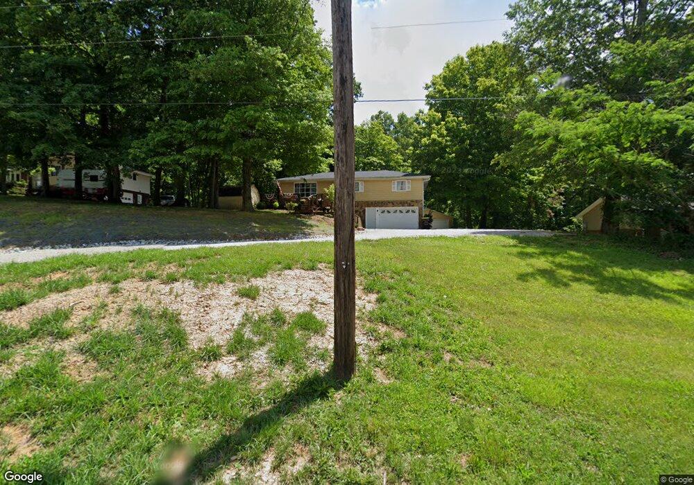
7431 W Airport Rd Bloomington, IN 47403
Estimated Value: $196,000 - $277,000
3
Beds
2
Baths
1,104
Sq Ft
$214/Sq Ft
Est. Value
About This Home
This home is located at 7431 W Airport Rd, Bloomington, IN 47403 and is currently estimated at $236,379, approximately $214 per square foot. 7431 W Airport Rd is a home located in Monroe County with nearby schools including Highland Park Elementary School, Lora L. Batchelor Middle School, and Bloomington High School North.
Ownership History
Date
Name
Owned For
Owner Type
Purchase Details
Closed on
Mar 5, 2019
Sold by
Corbin Michael J and Corbin Karen L
Bought by
Rothrock Kim Mark and Rothrock Tracy
Current Estimated Value
Home Financials for this Owner
Home Financials are based on the most recent Mortgage that was taken out on this home.
Original Mortgage
$94,400
Outstanding Balance
$60,951
Interest Rate
4.4%
Mortgage Type
Purchase Money Mortgage
Estimated Equity
$175,428
Create a Home Valuation Report for This Property
The Home Valuation Report is an in-depth analysis detailing your home's value as well as a comparison with similar homes in the area
Home Values in the Area
Average Home Value in this Area
Purchase History
| Date | Buyer | Sale Price | Title Company |
|---|---|---|---|
| Rothrock Kim Mark | -- | None Available |
Source: Public Records
Mortgage History
| Date | Status | Borrower | Loan Amount |
|---|---|---|---|
| Open | Rothrock Kim Mark | $94,400 |
Source: Public Records
Tax History Compared to Growth
Tax History
| Year | Tax Paid | Tax Assessment Tax Assessment Total Assessment is a certain percentage of the fair market value that is determined by local assessors to be the total taxable value of land and additions on the property. | Land | Improvement |
|---|---|---|---|---|
| 2024 | $3,010 | $199,900 | $38,500 | $161,400 |
| 2023 | $3,117 | $198,200 | $38,500 | $159,700 |
| 2022 | $2,780 | $187,700 | $38,500 | $149,200 |
| 2021 | $2,645 | $171,200 | $33,700 | $137,500 |
| 2020 | $2,627 | $161,600 | $28,900 | $132,700 |
| 2019 | $2,202 | $147,700 | $26,500 | $121,200 |
| 2018 | $2,254 | $149,600 | $26,500 | $123,100 |
| 2017 | $2,249 | $148,500 | $26,500 | $122,000 |
| 2016 | $2,208 | $148,400 | $26,500 | $121,900 |
| 2014 | $2,113 | $141,300 | $26,500 | $114,800 |
Source: Public Records
Map
Nearby Homes
- 3993 S Eller Ln
- 3425 S Garrison Chapel Rd
- 8155 W Gardner Rd
- 7700 W Eller Rd
- 1796 S Garrison Chapel Rd
- 7279 W Holland Hill Ln
- 5850 W State Road 45
- 2410 Daphne Dr
- 825 S Kirby Rd
- 5333 W Gifford Rd
- 4899 S Harmony Rd
- 4801 S Abington Ave
- 5190 W Leonard Springs Rd
- 5672 W Gunnar Ct
- 4930 W Bedrock Rd
- 5713 W Monarch Ct
- 5733 W Monarch Ct
- 5398 W Bedrock Rd
- 447 S Woodfield Ln
- 5611 W Tensleep Rd
- 7395 W Airport Rd
- 7451 W Airport Rd
- 7300 W Airport Rd
- 7280 W Airport Rd
- 7375 W Airport Rd
- 7585 W Airport Rd
- 7311 W Airport Rd
- 7587 W Airport Rd
- 7301 W Airport Rd
- 7221 W Airport Rd
- 7574 W Airport Rd
- 7590 W Airport Rd
- 7307 W Airport Rd
- 7645 W Airport Rd
- 7305 W Airport Rd
- W Airport Rd
- 7650 W Airport Rd
- 7303 W Airport Rd
- 7240 W Airport Rd
- 7211 W Airport Rd