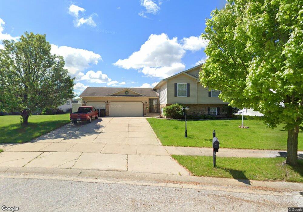
7433 Cedar Creek Cir Portage, IN 46368
Estimated Value: $315,000 - $366,000
4
Beds
2
Baths
1,605
Sq Ft
$211/Sq Ft
Est. Value
About This Home
This home is located at 7433 Cedar Creek Cir, Portage, IN 46368 and is currently estimated at $338,126, approximately $210 per square foot. 7433 Cedar Creek Cir is a home with nearby schools including Ethel R Jones Elementary School, Willowcreek Middle School, and Portage High School.
Ownership History
Date
Name
Owned For
Owner Type
Purchase Details
Closed on
Jun 6, 2014
Sold by
Todd Gore Homes Llc
Bought by
Yates Aubry W and Yates Monica L
Current Estimated Value
Home Financials for this Owner
Home Financials are based on the most recent Mortgage that was taken out on this home.
Original Mortgage
$211,450
Interest Rate
4.18%
Mortgage Type
VA
Create a Home Valuation Report for This Property
The Home Valuation Report is an in-depth analysis detailing your home's value as well as a comparison with similar homes in the area
Home Values in the Area
Average Home Value in this Area
Purchase History
| Date | Buyer | Sale Price | Title Company |
|---|---|---|---|
| Yates Aubry W | -- | Fidelity National Title | |
| Todd Gore Homes Llc | -- | Fidelity National Title Co |
Source: Public Records
Mortgage History
| Date | Status | Borrower | Loan Amount |
|---|---|---|---|
| Previous Owner | Todd Gore Homes Llc | $211,450 |
Source: Public Records
Tax History Compared to Growth
Tax History
| Year | Tax Paid | Tax Assessment Tax Assessment Total Assessment is a certain percentage of the fair market value that is determined by local assessors to be the total taxable value of land and additions on the property. | Land | Improvement |
|---|---|---|---|---|
| 2024 | $2,996 | $303,500 | $41,800 | $261,700 |
| 2023 | $2,753 | $297,600 | $39,800 | $257,800 |
| 2022 | $2,733 | $273,300 | $39,800 | $233,500 |
| 2021 | $2,434 | $241,400 | $39,800 | $201,600 |
| 2020 | $2,196 | $217,600 | $34,600 | $183,000 |
| 2019 | $2,103 | $208,300 | $34,600 | $173,700 |
| 2018 | $2,038 | $201,800 | $34,600 | $167,200 |
| 2017 | $2,017 | $199,700 | $34,600 | $165,100 |
| 2016 | $1,937 | $191,700 | $34,000 | $157,700 |
| 2014 | $20 | $700 | $700 | $0 |
| 2013 | -- | $600 | $600 | $0 |
Source: Public Records
Map
Nearby Homes
- 0 St Rd 149 Unit NRA824925
- TBD Lenburg Rd
- 2513 Springdale St
- 2375 Arrow St
- Tbd- 60.04 Creasy St
- 2419 Orange St
- 2141 Larchwood Ave
- 2528 Mccool Rd
- 2621 Mccool Rd
- 2176 Mccool Rd
- 2131 Pepperbush Ave
- 2449 Ontario St
- 2420 Ontario St
- The Duneland Plan at Village in Burns Harbor
- 357 Melton Rd
- 2829 Cheryl St
- V/L U S 20
- 1138 Weaver Way
- 1136 Weaver Way
- 1151 Burns Blvd
- 7420 Longcommon Rd
- 7425 Cedar Creek Cir
- 2360 Longcommon Rd
- 2381 Longcommon Rd
- 7409 Cedar Creek Cir
- 7410 Longcommon Rd
- 7431 Longcommon Rd
- 7421 Longcommon Rd
- 7432 Cedar Creek Cir
- 7403 Cedar Creek Cir
- 7422 Cedar Creek Cir
- 7411 Longcommon Rd
- 2350 Longcommon Rd
- 7412 Cedar Creek Cir
- 7441 Wrencote Ct
- 7446 Wrencote Ct
- 2414 Michaux St
- 7401 Longcommon Rd
- 7420 Belplane Ct
- 7402 Cedar Creek Cir