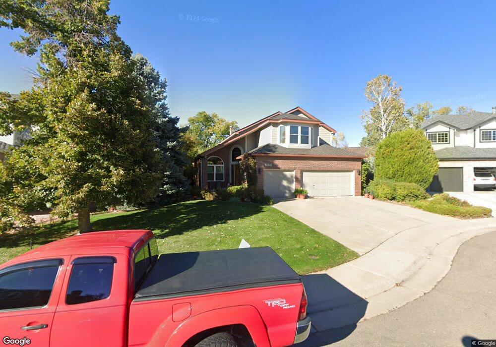
7437 Bluefox Ct Lone Tree, CO 80124
Estimated Value: $771,864 - $868,000
3
Beds
3
Baths
2,754
Sq Ft
$299/Sq Ft
Est. Value
About This Home
This home is located at 7437 Bluefox Ct, Lone Tree, CO 80124 and is currently estimated at $823,466, approximately $299 per square foot. 7437 Bluefox Ct is a home located in Douglas County with nearby schools including Eagle Ridge Elementary School, Cresthill Middle School, and Highlands Ranch High School.
Ownership History
Date
Name
Owned For
Owner Type
Purchase Details
Closed on
Dec 27, 1991
Sold by
Colonial Homes New Mexico Inc
Bought by
Vanwinkle Stephen G and Vanwinkle Van Winkle
Current Estimated Value
Purchase Details
Closed on
Jun 4, 1991
Sold by
Leslea Colo Partnership
Bought by
Colonial Homes New Mexico Inc
Purchase Details
Closed on
Jul 30, 1989
Sold by
Leslea Corp
Bought by
Leslea Colo Partnership
Purchase Details
Closed on
Jul 17, 1989
Sold by
Lone Tree Joint Venture
Bought by
Leslea Corp
Create a Home Valuation Report for This Property
The Home Valuation Report is an in-depth analysis detailing your home's value as well as a comparison with similar homes in the area
Home Values in the Area
Average Home Value in this Area
Purchase History
| Date | Buyer | Sale Price | Title Company |
|---|---|---|---|
| Vanwinkle Stephen G | $159,600 | -- | |
| Colonial Homes New Mexico Inc | $23,000 | -- | |
| Leslea Colo Partnership | -- | -- | |
| Leslea Corp | -- | -- |
Source: Public Records
Tax History
| Year | Tax Paid | Tax Assessment Tax Assessment Total Assessment is a certain percentage of the fair market value that is determined by local assessors to be the total taxable value of land and additions on the property. | Land | Improvement |
|---|---|---|---|---|
| 2025 | $4,072 | $45,450 | $9,460 | $35,990 |
| 2024 | $4,072 | $53,870 | $10,950 | $42,920 |
| 2023 | $4,113 | $53,870 | $10,950 | $42,920 |
| 2022 | $2,969 | $39,600 | $7,430 | $32,170 |
| 2021 | $3,087 | $39,600 | $7,430 | $32,170 |
| 2020 | $2,941 | $39,030 | $7,130 | $31,900 |
| 2019 | $2,951 | $39,030 | $7,130 | $31,900 |
| 2018 | $2,323 | $34,040 | $6,210 | $27,830 |
| 2017 | $2,360 | $34,040 | $6,210 | $27,830 |
| 2016 | $2,241 | $32,910 | $6,190 | $26,720 |
| 2015 | $2,290 | $32,910 | $6,190 | $26,720 |
| 2014 | $1,339 | $27,370 | $6,530 | $20,840 |
Source: Public Records
Map
Nearby Homes
- 9314 Wiltshire Dr
- 7191 Palisade Dr
- 789 Mercury Cir
- 9466 Wiltshire Dr
- 6945 Mountain Brush Cir
- 9377 Newport Ln
- 8049 Sweet Water Rd
- 7459 La Quinta Place
- 9631 Kemper Dr
- 13226 Canopus Dr
- 8159 Lodgepole Trail
- 9390 Yale Ln
- 9320 Miles Dr
- 6823 Edgewood Place
- 8852 Chestnut Hill Ln
- 9395 Princeton Cir
- 7057 Chestnut Hill St
- 8356 Green Island Cir
- 9522 Silver Spur Ln
- 8666 Ainsdale Ct Unit 12B
- 7407 Bluefox Ct
- 7467 Bluefox Ct
- 9238 Wolfdale Dr
- 9221 Ptarmigan Trail
- 9255 Ptarmigan Trail
- 7487 Bluefox Ct
- 9273 Ptarmigan Trail
- 9224 Wolfdale Dr
- 7408 Bluefox Ct
- 7438 Bluefox Ct
- 9297 Ptarmigan Trail
- 7468 Bluefox Ct
- 9253 Wolfdale Dr
- 9237 Wolfdale Dr
- 9267 Wolfdale Dr
- 9315 Ptarmigan Trail
- 9314 Wolfdale Dr
- 9223 Wolfdale Dr
- 9331 Ptarmigan Trail
- 9283 Wolfdale Dr
Your Personal Tour Guide
Ask me questions while you tour the home.