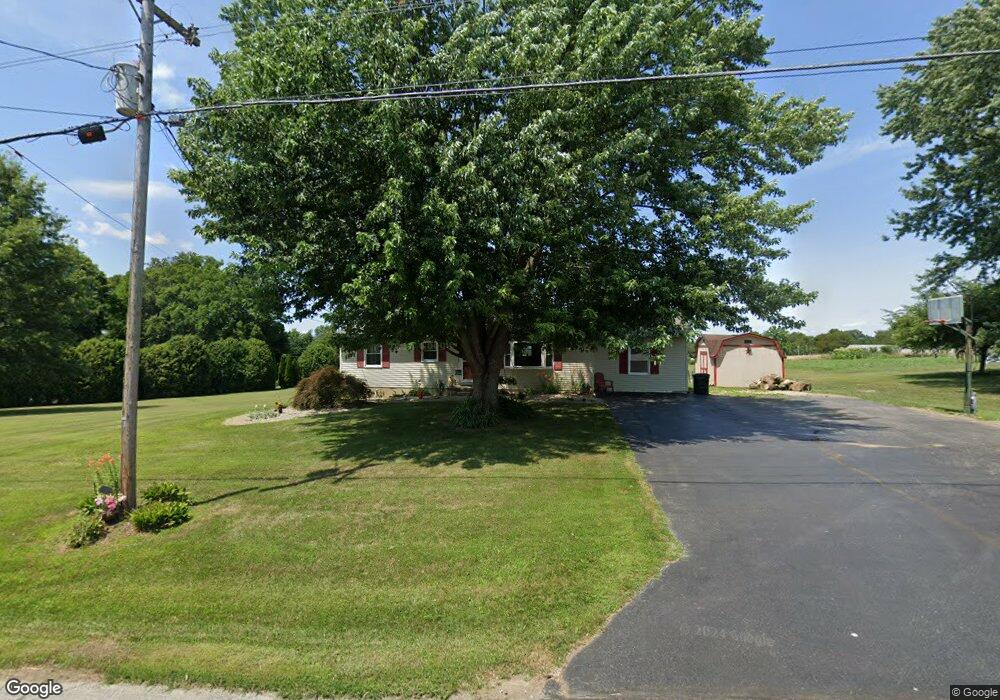
744 E Messner Rd Wooster, OH 44691
Estimated Value: $273,978 - $317,000
2
Beds
1
Bath
1,008
Sq Ft
$288/Sq Ft
Est. Value
About This Home
This home is located at 744 E Messner Rd, Wooster, OH 44691 and is currently estimated at $290,245, approximately $287 per square foot. 744 E Messner Rd is a home located in Wayne County with nearby schools including Triway High School, Moreland School, and Sunny Meadow.
Ownership History
Date
Name
Owned For
Owner Type
Purchase Details
Closed on
Nov 9, 2000
Sold by
Myers Richard D
Bought by
Bickel John J and Bickel Heather L
Current Estimated Value
Home Financials for this Owner
Home Financials are based on the most recent Mortgage that was taken out on this home.
Original Mortgage
$94,605
Outstanding Balance
$32,141
Interest Rate
7.91%
Mortgage Type
VA
Estimated Equity
$258,104
Purchase Details
Closed on
Jan 14, 2000
Sold by
Walentik John J
Bought by
Myers Richard D
Home Financials for this Owner
Home Financials are based on the most recent Mortgage that was taken out on this home.
Original Mortgage
$46,400
Interest Rate
7.89%
Mortgage Type
New Conventional
Purchase Details
Closed on
Dec 17, 1992
Bought by
Walentik John J and Walentik Pamela
Purchase Details
Closed on
Dec 2, 1991
Sold by
Reinhardt Allen P and Reinhardt Alic
Bought by
Ambilt Corporation
Create a Home Valuation Report for This Property
The Home Valuation Report is an in-depth analysis detailing your home's value as well as a comparison with similar homes in the area
Purchase History
| Date | Buyer | Sale Price | Title Company |
|---|---|---|---|
| Bickel John J | $92,750 | -- | |
| Myers Richard D | $58,000 | -- | |
| Walentik John J | $10,000 | -- | |
| Ambilt Corporation | $21,000 | -- |
Source: Public Records
Mortgage History
| Date | Status | Borrower | Loan Amount |
|---|---|---|---|
| Open | Bickel John J | $94,605 | |
| Previous Owner | Myers Richard D | $46,400 |
Source: Public Records
Tax History
| Year | Tax Paid | Tax Assessment Tax Assessment Total Assessment is a certain percentage of the fair market value that is determined by local assessors to be the total taxable value of land and additions on the property. | Land | Improvement |
|---|---|---|---|---|
| 2025 | $2,836 | $82,460 | $19,350 | $63,110 |
| 2024 | $2,836 | $75,640 | $19,350 | $56,290 |
| 2023 | $2,617 | $67,030 | $19,350 | $47,680 |
| 2022 | $1,732 | $45,910 | $13,250 | $32,660 |
| 2021 | $1,712 | $45,280 | $13,250 | $32,030 |
| 2020 | $1,732 | $45,280 | $13,250 | $32,030 |
| 2019 | $1,736 | $44,060 | $12,400 | $31,660 |
| 2018 | $1,767 | $44,060 | $12,400 | $31,660 |
| 2017 | $1,760 | $44,060 | $12,400 | $31,660 |
| 2016 | $1,550 | $38,310 | $10,780 | $27,530 |
| 2015 | $1,515 | $38,310 | $10,780 | $27,530 |
| 2014 | $1,516 | $38,310 | $10,780 | $27,530 |
| 2013 | $1,476 | $37,090 | $9,940 | $27,150 |
Source: Public Records
Map
Nearby Homes
- 2535 Millersburg Rd
- 3419 Fredericksburg Rd
- 8383 Hoy Rd
- 3065 Dover Rd
- 4348 Buss Rd
- 2430 S Columbus Rd
- 9718 James Rd
- 0 Heyl Rd
- 3315 Sylvan Rd
- 140 Ohio St
- 219 Mulberry St
- 3682 Blachleyville Rd
- 4859 Prosperity Way
- 5 E Melrose Unit 5
- 3299 Crestview Dr
- 227 N Walnut St
- 223 E Larwill St
- 419 Nold Ave
- 423 N Market St
- 230 Clark Ave
- 800 E Messner Rd
- 777 E Messner Rd
- 822 E Messner Rd
- 668 E Messner Rd
- 5353 Millersburg Rd
- 876 E Messner Rd
- 641 E Messner Rd
- 578 E Messner Rd
- 5492 Millersburg Rd
- 5453 Millersburg Rd
- 914 E Messner Rd
- 531 E Messner Rd
- 5487 Millersburg Rd
- 895 E Messner Rd
- 502 E Messner Rd
- 5110 Millersburg Rd
- 972 E Messner Rd
- 469 E Messner Rd
- 442 E Messner Rd
- 5531 Millersburg Rd
Your Personal Tour Guide
Ask me questions while you tour the home.