Estimated Value: $225,000 - $252,000
2
Beds
2
Baths
1,602
Sq Ft
$147/Sq Ft
Est. Value
About This Home
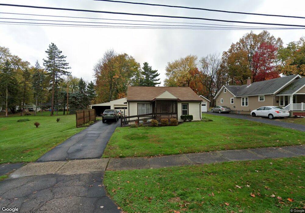
This home is located at 744 Mae St, Kent, OH 44240 and is currently estimated at $235,648, approximately $147 per square foot. 744 Mae St is a home located in Portage County with nearby schools including Holden Elementary School, Stanton Middle School, and Theodore Roosevelt High School.
Ownership History
Date
Name
Owned For
Owner Type
Purchase Details
Closed on
Sep 20, 2021
Sold by
Decapito Vincent E and Decapito Charlotte L
Bought by
Decapito Vincent E and Decapito Charlotte L
Current Estimated Value
Purchase Details
Closed on
Jan 1, 1990
Bought by
Decapito Vincent E
Create a Home Valuation Report for This Property
The Home Valuation Report is an in-depth analysis detailing your home's value as well as a comparison with similar homes in the area
Home Values in the Area
Average Home Value in this Area
Purchase History
| Date | Buyer | Sale Price | Title Company |
|---|---|---|---|
| Decapito Vincent E | -- | None Available | |
| Decapito Vincent E | -- | -- |
Source: Public Records
Tax History
| Year | Tax Paid | Tax Assessment Tax Assessment Total Assessment is a certain percentage of the fair market value that is determined by local assessors to be the total taxable value of land and additions on the property. | Land | Improvement |
|---|---|---|---|---|
| 2024 | $2,896 | $62,970 | $10,500 | $52,470 |
| 2023 | $2,435 | $53,210 | $11,520 | $41,690 |
| 2022 | $2,457 | $53,210 | $11,520 | $41,690 |
| 2021 | $2,462 | $53,210 | $11,520 | $41,690 |
| 2020 | $2,102 | $42,640 | $11,520 | $31,120 |
| 2019 | $2,102 | $42,640 | $11,520 | $31,120 |
| 2017 | $2,089 | $39,910 | $13,130 | $26,780 |
| 2016 | $2,084 | $39,910 | $13,130 | $26,780 |
Source: Public Records
Map
Nearby Homes
- 835 Mae St
- 1005 Vine St
- 4363 Ohio 43
- 0 S Water St
- 1426 Loop Rd Unit 1426
- 209 Dodge St
- 1204 Franklin Ave
- 410 Beryl Dr
- 1103 Oakwood Dr
- 1233 Cedar Ridge Rd
- 5096 Spruce Knoll Run
- 1737 Holly Dr
- 0 Meloy Rd Unit 5162435
- 6235 1st Ave
- 1585 Kent St
- 5088 Spruce Knoll Run
- 6318 1st Ave
- 876 Middlebury Rd
- 326 Pleasant Ave
- 4808 Sherman Rd
Your Personal Tour Guide
Ask me questions while you tour the home.