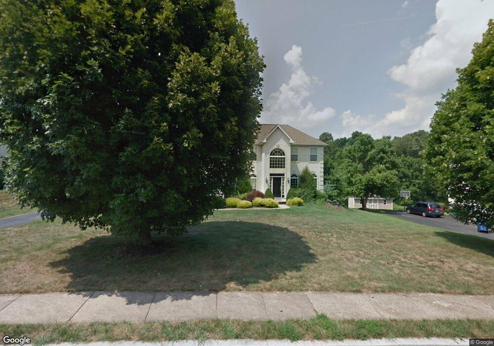
744 Meadowbank Rd Kennett Square, PA 19348
East Marlborough Township NeighborhoodEstimated Value: $888,533 - $964,000
4
Beds
4
Baths
3,394
Sq Ft
$269/Sq Ft
Est. Value
About This Home
This home is located at 744 Meadowbank Rd, Kennett Square, PA 19348 and is currently estimated at $911,383, approximately $268 per square foot. 744 Meadowbank Rd is a home located in Chester County with nearby schools including Unionville Elementary School, Charles F. Patton Middle School, and Unionville High School.
Ownership History
Date
Name
Owned For
Owner Type
Purchase Details
Closed on
Feb 29, 1996
Sold by
Clx Realty Co
Bought by
Lindblade David R and Lindblade Debra A
Current Estimated Value
Home Financials for this Owner
Home Financials are based on the most recent Mortgage that was taken out on this home.
Original Mortgage
$273,000
Outstanding Balance
$10,647
Interest Rate
6.97%
Estimated Equity
$900,736
Create a Home Valuation Report for This Property
The Home Valuation Report is an in-depth analysis detailing your home's value as well as a comparison with similar homes in the area
Home Values in the Area
Average Home Value in this Area
Purchase History
| Date | Buyer | Sale Price | Title Company |
|---|---|---|---|
| Lindblade David R | $342,462 | -- |
Source: Public Records
Mortgage History
| Date | Status | Borrower | Loan Amount |
|---|---|---|---|
| Open | Lindblade David R | $273,000 |
Source: Public Records
Tax History Compared to Growth
Tax History
| Year | Tax Paid | Tax Assessment Tax Assessment Total Assessment is a certain percentage of the fair market value that is determined by local assessors to be the total taxable value of land and additions on the property. | Land | Improvement |
|---|---|---|---|---|
| 2025 | $2,122 | $315,060 | $66,650 | $248,410 |
| 2024 | $2,122 | $315,060 | $66,650 | $248,410 |
| 2023 | $2,122 | $315,060 | $66,650 | $248,410 |
| 2022 | $1,765 | $315,060 | $66,650 | $248,410 |
| 2021 | $2,122 | $315,060 | $66,650 | $248,410 |
| 2020 | $1,707 | $315,060 | $66,650 | $248,410 |
| 2019 | $2,064 | $315,060 | $66,650 | $248,410 |
| 2018 | $2,064 | $315,060 | $66,650 | $248,410 |
| 2017 | $2,064 | $315,060 | $66,650 | $248,410 |
| 2016 | $1,249 | $315,060 | $66,650 | $248,410 |
| 2015 | $1,249 | $315,060 | $66,650 | $248,410 |
| 2014 | $1,249 | $315,060 | $66,650 | $248,410 |
Source: Public Records
Map
Nearby Homes
- 820 Waverly Rd
- 302 Manor Dr
- 804 Waverly Rd
- 191 W Street Rd
- 312 Riverbirch Cir Unit 802
- 347 Astilbe Dr
- 113 Lantana Dr
- 617 Unionville Rd
- 1776 W Doe Run Rd
- 119 Violet Dr
- 213 Katsura Dr
- 443 Larkspur Dr
- 380 Upland Rd
- 907 Mitchell Farm Ln
- 326 Redbud Ln
- 332 Redbud Ln
- 491 N Mill Rd
- 211 Daylesford Ct
- 907 Unionville Wawaset Rd
- 736 Cascade Way
- 746 Meadowbank Rd
- 742 Meadowbank Rd
- 747 Meadowbank Rd
- 740 Meadowbank Rd
- 749 Meadowbank Rd
- 741 Meadowbank Rd
- 748 Meadowbank Rd
- 738 Meadowbank Rd
- 739 Meadowbank Rd
- 751 Meadowbank Rd
- 750 Meadowbank Rd
- 613 Monticello Ln
- 736 Meadowbank Rd
- 737 Meadowbank Rd
- 752 Meadowbank Rd
- 611 Monticello Ln
- 515 Silver Fox Rd
- 733 Meadowbank Rd
- 754 Meadowbank Rd
- 755 Meadowbank Rd