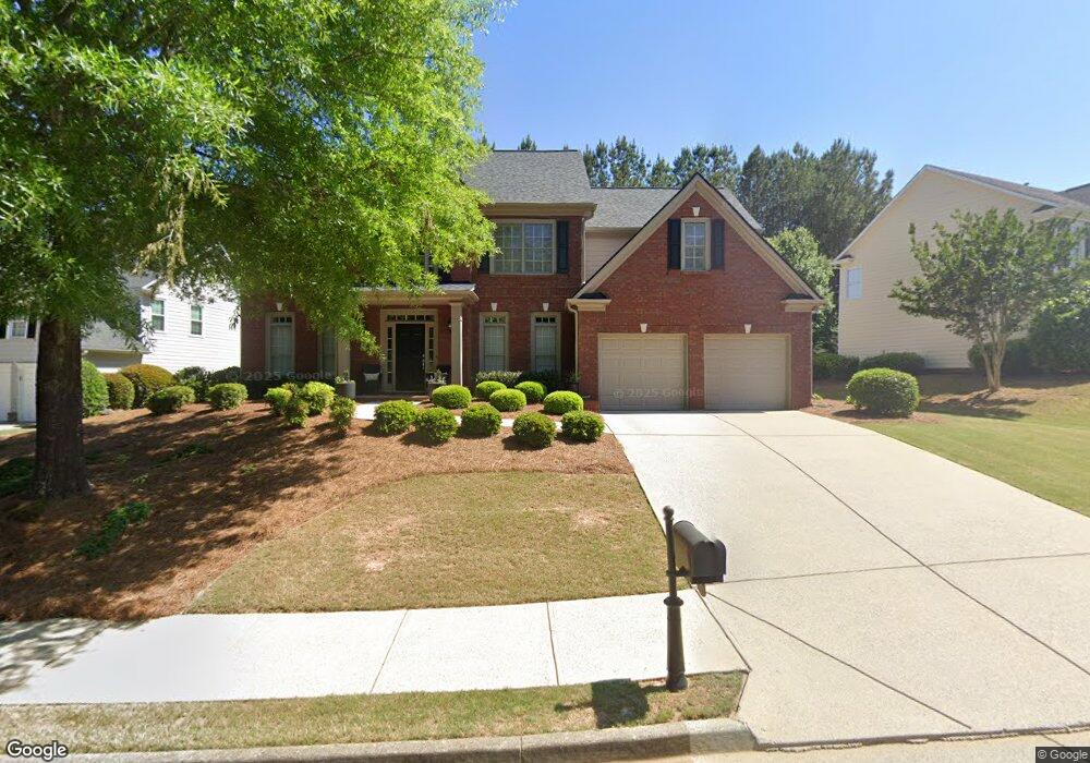
7440 Bronson Way Cumming, GA 30041
Estimated Value: $657,506 - $712,000
4
Beds
3
Baths
2,890
Sq Ft
$241/Sq Ft
Est. Value
About This Home
This home is located at 7440 Bronson Way, Cumming, GA 30041 and is currently estimated at $695,127, approximately $240 per square foot. 7440 Bronson Way is a home located in Forsyth County with nearby schools including Haw Creek Elementary School, Lakeside Middle School, and South Forsyth High School.
Ownership History
Date
Name
Owned For
Owner Type
Purchase Details
Closed on
Jul 30, 2001
Sold by
Mccar Development Corp
Bought by
Gaalema Harold and Gaalema Tamara
Current Estimated Value
Home Financials for this Owner
Home Financials are based on the most recent Mortgage that was taken out on this home.
Original Mortgage
$203,550
Outstanding Balance
$79,000
Interest Rate
7.08%
Mortgage Type
New Conventional
Estimated Equity
$616,127
Create a Home Valuation Report for This Property
The Home Valuation Report is an in-depth analysis detailing your home's value as well as a comparison with similar homes in the area
Home Values in the Area
Average Home Value in this Area
Purchase History
| Date | Buyer | Sale Price | Title Company |
|---|---|---|---|
| Gaalema Harold | $254,500 | -- |
Source: Public Records
Mortgage History
| Date | Status | Borrower | Loan Amount |
|---|---|---|---|
| Open | Gaalema Harold | $203,550 |
Source: Public Records
Tax History Compared to Growth
Tax History
| Year | Tax Paid | Tax Assessment Tax Assessment Total Assessment is a certain percentage of the fair market value that is determined by local assessors to be the total taxable value of land and additions on the property. | Land | Improvement |
|---|---|---|---|---|
| 2025 | $846 | $247,756 | $76,000 | $171,756 |
| 2024 | $846 | $233,200 | $68,000 | $165,200 |
| 2023 | $754 | $220,320 | $60,000 | $160,320 |
| 2022 | $3,901 | $145,108 | $32,000 | $113,108 |
| 2021 | $3,636 | $145,108 | $32,000 | $113,108 |
| 2020 | $3,533 | $140,124 | $32,000 | $108,124 |
| 2019 | $3,646 | $145,340 | $32,000 | $113,340 |
| 2018 | $3,496 | $137,400 | $32,000 | $105,400 |
| 2017 | $3,251 | $125,148 | $32,000 | $93,148 |
| 2016 | $3,040 | $115,188 | $26,000 | $89,188 |
| 2015 | $3,046 | $115,188 | $26,000 | $89,188 |
| 2014 | $2,741 | $107,528 | $0 | $0 |
Source: Public Records
Map
Nearby Homes
- 7029 Bennington Ln
- 7047 Bennington Ln
- 2216 Trammel Rd
- Manchester Plan at The Glade
- Belville Plan at The Glade
- Milton Plan at The Glade
- 8355 Ainsworth Dr
- 8640 Amsbury Way
- 2390 Colchester Ct
- 5349 Davenport Manor
- 1920 Daves Creek Trail
- 2640 Blackstock Dr
- 2625 Blackstock Dr
- 2090 Beckham St
- 2945 Links View Way
- 5613 Lancashire Ln
- 4865 Cheltenham Place
- 5303 Davenport Manor
- 7450 Bronson Way
- 7430 Bronson Way Unit 5430
- 7430 Bronson Way
- 7460 Bronson Way
- 7215 Bradbury Place
- 7420 Bronson Way
- 7220 Bradbury Place
- 7435 Bronson Way
- 0 Bronson Way Unit 8818593
- 7445 Bronson Way Unit Ga1444
- 7445 Bronson Way
- 7445 Bronson Way Unit GA14445
- 7445 Bronson Way
- 7425 Bronson Way
- 7470 Bronson Way
- 7455 Bronson Way
- 7410 Bronson Way
- 7465 Bronson Way
- 7210 Bradbury Place
- 7012 Bennington Ln