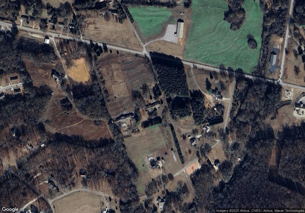
7441 Highway 145 Rd Carnesville, GA 30521
Estimated Value: $449,000 - $524,000
3
Beds
4
Baths
3,636
Sq Ft
$136/Sq Ft
Est. Value
About This Home
This home is located at 7441 Highway 145 Rd, Carnesville, GA 30521 and is currently estimated at $494,039, approximately $135 per square foot. 7441 Highway 145 Rd is a home with nearby schools including Franklin County High School.
Ownership History
Date
Name
Owned For
Owner Type
Purchase Details
Closed on
Nov 26, 2018
Sold by
Sullivan Robert F
Bought by
Royston Stanley W
Current Estimated Value
Home Financials for this Owner
Home Financials are based on the most recent Mortgage that was taken out on this home.
Original Mortgage
$185,000
Outstanding Balance
$161,675
Interest Rate
4.8%
Mortgage Type
New Conventional
Estimated Equity
$332,365
Purchase Details
Closed on
Jun 2, 2015
Sold by
Sullivan June W
Bought by
Sullivan Robert F
Create a Home Valuation Report for This Property
The Home Valuation Report is an in-depth analysis detailing your home's value as well as a comparison with similar homes in the area
Home Values in the Area
Average Home Value in this Area
Purchase History
| Date | Buyer | Sale Price | Title Company |
|---|---|---|---|
| Royston Stanley W | $235,000 | -- | |
| Sullivan Robert F | -- | -- |
Source: Public Records
Mortgage History
| Date | Status | Borrower | Loan Amount |
|---|---|---|---|
| Open | Royston Stanley W | $185,000 |
Source: Public Records
Tax History Compared to Growth
Tax History
| Year | Tax Paid | Tax Assessment Tax Assessment Total Assessment is a certain percentage of the fair market value that is determined by local assessors to be the total taxable value of land and additions on the property. | Land | Improvement |
|---|---|---|---|---|
| 2024 | $4,195 | $164,209 | $13,202 | $151,007 |
| 2023 | $4,178 | $149,463 | $12,002 | $137,461 |
| 2022 | $3,758 | $134,630 | $9,534 | $125,096 |
| 2021 | $3,459 | $117,764 | $9,534 | $108,230 |
| 2020 | $2,948 | $98,846 | $9,534 | $89,312 |
| 2019 | $2,714 | $98,846 | $9,534 | $89,312 |
| 2018 | $2,422 | $84,090 | $9,158 | $74,932 |
| 2017 | $2,510 | $84,090 | $9,158 | $74,932 |
| 2016 | $2,273 | $73,402 | $9,158 | $64,244 |
| 2015 | -- | $73,401 | $9,158 | $64,244 |
| 2014 | -- | $73,402 | $9,158 | $64,244 |
| 2013 | -- | $78,204 | $9,157 | $69,046 |
Source: Public Records
Map
Nearby Homes
- 7690 Royston Rd
- 110 Telford Rd
- 735 Bowersville Rd
- 0 Manley St Unit 10611784
- 0 Turkey Creek Rd Unit 10589237
- 2556 Turkey Creek Rd
- 210 Nora Moss Ln
- 228 Franklin Hills Dr
- 228 Franklin Hills Dr Unit B14
- 10170 Lavonia Rd
- 456 Aderhold Rd
- 499 Aderhold Rd
- 7 Crest View Cir
- 0 Murphy Rd Unit 10585891
- 110 Adaline Ct
- 2985 Jackson Bridge Rd
- 5821 Georgia 320
- 00 Hall Carson Rd
- 1845 Old Stagecoach Rd
- 2695 Brays Lake Rd
- 7381 Royston Rd
- 180 Roebuck Rd
- 7441 Royston Rd
- 284 Roebuck Rd
- 7355 Royston Rd
- 416 Roebuck Rd
- 181 Roebuck Rd
- 211 Roebuck Rd
- 7571 Royston Rd
- 7571 Ga-145 Unit TRACT
- 0 Royston Rd Unit 7213580
- 0 Royston Rd Unit 8441297
- 0 Royston Rd Unit 8083029
- 0 Royston Rd Unit 8187863
- 0 Royston Rd Unit 8238671
- 0 Royston Rd
- 115 Roebuck Rd
- 303 Roebuck Rd
- 460 Roebuck Rd
- 7643 Royston Rd
