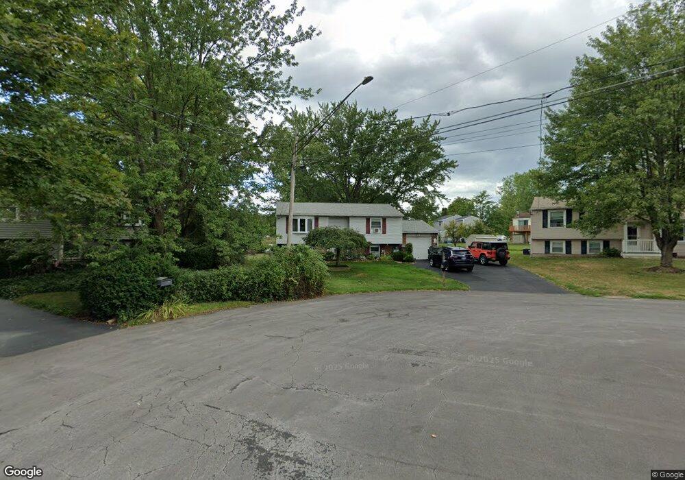
7444 Farmstead Rd Liverpool, NY 13088
Estimated Value: $258,389 - $279,000
3
Beds
2
Baths
1,356
Sq Ft
$200/Sq Ft
Est. Value
About This Home
This home is located at 7444 Farmstead Rd, Liverpool, NY 13088 and is currently estimated at $271,847, approximately $200 per square foot. 7444 Farmstead Rd is a home located in Onondaga County with nearby schools including Donlin Drive Elementary School, Chestnut Hill Elementary School, and Chestnut Hill Middle School.
Ownership History
Date
Name
Owned For
Owner Type
Purchase Details
Closed on
Jul 9, 2025
Sold by
Short Michael T and Short Teresa A
Bought by
Coelho
Current Estimated Value
Create a Home Valuation Report for This Property
The Home Valuation Report is an in-depth analysis detailing your home's value as well as a comparison with similar homes in the area
Home Values in the Area
Average Home Value in this Area
Purchase History
| Date | Buyer | Sale Price | Title Company |
|---|---|---|---|
| Coelho | -- | -- |
Source: Public Records
Tax History Compared to Growth
Tax History
| Year | Tax Paid | Tax Assessment Tax Assessment Total Assessment is a certain percentage of the fair market value that is determined by local assessors to be the total taxable value of land and additions on the property. | Land | Improvement |
|---|---|---|---|---|
| 2024 | $4,534 | $4,900 | $1,000 | $3,900 |
| 2023 | $5,393 | $4,900 | $1,000 | $3,900 |
| 2022 | $5,532 | $4,900 | $1,000 | $3,900 |
| 2021 | $5,469 | $4,900 | $1,000 | $3,900 |
| 2020 | $4,339 | $4,900 | $1,000 | $3,900 |
| 2019 | $1,694 | $4,900 | $1,000 | $3,900 |
| 2018 | $4,211 | $4,900 | $1,000 | $3,900 |
| 2017 | $1,633 | $4,900 | $1,000 | $3,900 |
| 2016 | $4,066 | $4,900 | $1,000 | $3,900 |
| 2015 | -- | $4,900 | $1,000 | $3,900 |
| 2014 | -- | $4,900 | $1,000 | $3,900 |
Source: Public Records
Map
Nearby Homes
- 7369 Cedar Post Rd
- 4936 Windgate Rd
- 7385 Oakpost Rd
- 0 Buckley Rd
- 4960 Harvest Ln
- 5039 Briarledge Rd
- 7479 Thunderbird Rd
- 4913 Look Kinney Cir
- 4316 Lazybrook Cir
- 4987 Dahlia Cir
- 4976 W Taft Rd
- 4910 Dahlia Cir
- 7504 Meadow Wood Dr
- 7593 Daphne Dr
- 4959 Wintersweet Dr
- 5065 Bear Rd
- 7617 Fitzpatrick Dr
- 4970 Woodmark Dr
- 4777 Glencrest Ave
- 105 Rebecca St
- 7446 Farmstead Rd
- 7442 Farmstead Rd
- 4983 Windgate Rd
- 7445 Farmstead Rd
- 4981 Windgate Rd
- 7440 Farmstead Rd
- 4985 Windgate Rd
- 7360 Cedar Post Rd
- 4977 Windgate Rd
- 7362 Cedar Post Rd
- 4983 Surrey Ln
- 7443 Farmstead Rd
- 7441 Farmstead Rd
- 4987 Surrey Ln
- 4990 Cassidy Ln
- 7438 Farmstead Rd
- 7358 Cedar Post Rd
- 4987 Windgate Rd
- 7364 Cedar Post Rd
- 4982 Windgate Rd