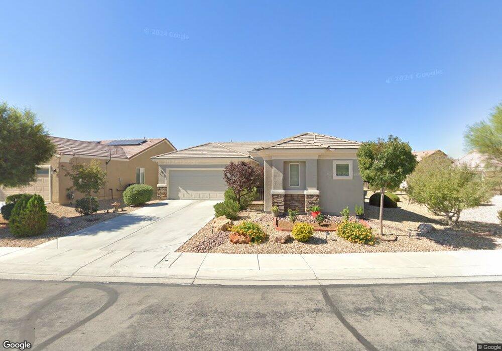
7445 Grassquit St North Las Vegas, NV 89084
Aliante NeighborhoodEstimated Value: $417,000 - $444,000
3
Beds
3
Baths
1,570
Sq Ft
$273/Sq Ft
Est. Value
About This Home
This home is located at 7445 Grassquit St, North Las Vegas, NV 89084 and is currently estimated at $428,913, approximately $273 per square foot. 7445 Grassquit St is a home located in Clark County with nearby schools including Vincent L. Triggs Elementary School, Anthony Saville Middle School, and Shadow Ridge High School.
Ownership History
Date
Name
Owned For
Owner Type
Purchase Details
Closed on
Sep 7, 2021
Sold by
Stone Robert G and Stone Joanne S
Bought by
Joanne And Robert Stone Living Trust and Stone
Current Estimated Value
Purchase Details
Closed on
Feb 24, 2012
Sold by
Adams Francis C and Adams Mimsy
Bought by
Stone Robert G and Stone Joanne S
Home Financials for this Owner
Home Financials are based on the most recent Mortgage that was taken out on this home.
Original Mortgage
$132,000
Interest Rate
3.83%
Mortgage Type
New Conventional
Purchase Details
Closed on
Aug 1, 2008
Sold by
Adams Frank C and Adams Mimsy
Bought by
Adams Francis C and Adams Mimsy
Purchase Details
Closed on
Oct 29, 2007
Sold by
Pn Ii Inc
Bought by
Adams Frank C and Adams Mimsy
Create a Home Valuation Report for This Property
The Home Valuation Report is an in-depth analysis detailing your home's value as well as a comparison with similar homes in the area
Home Values in the Area
Average Home Value in this Area
Purchase History
| Date | Buyer | Sale Price | Title Company |
|---|---|---|---|
| Joanne And Robert Stone Living Trust | -- | None Listed On Document | |
| Stone Robert G | $165,000 | Nevada Title Las Vegas | |
| Adams Francis C | -- | None Available | |
| Adams Frank C | $275,440 | Lawyers Title Of Nevada |
Source: Public Records
Mortgage History
| Date | Status | Borrower | Loan Amount |
|---|---|---|---|
| Previous Owner | Stone Robert G | $132,000 |
Source: Public Records
Tax History Compared to Growth
Tax History
| Year | Tax Paid | Tax Assessment Tax Assessment Total Assessment is a certain percentage of the fair market value that is determined by local assessors to be the total taxable value of land and additions on the property. | Land | Improvement |
|---|---|---|---|---|
| 2025 | $2,448 | $115,564 | $30,800 | $84,764 |
| 2024 | $2,377 | $115,564 | $30,800 | $84,764 |
| 2023 | $2,377 | $113,190 | $33,110 | $80,080 |
| 2022 | $1,936 | $101,906 | $28,490 | $73,416 |
| 2021 | $2,241 | $95,010 | $25,410 | $69,600 |
| 2020 | $2,169 | $93,370 | $24,640 | $68,730 |
| 2019 | $2,106 | $89,971 | $22,330 | $67,641 |
| 2018 | $2,044 | $82,802 | $17,710 | $65,092 |
| 2017 | $2,727 | $80,442 | $15,400 | $65,042 |
| 2016 | $1,936 | $79,035 | $13,475 | $65,560 |
| 2015 | $1,932 | $63,693 | $10,780 | $52,913 |
| 2014 | $1,875 | $53,426 | $7,700 | $45,726 |
Source: Public Records
Map
Nearby Homes
- 7465 Widewing Dr
- 7453 Widewing Dr
- 7556 Wingspread St
- 7429 Widewing Dr
- 2509 Great Auk Ave
- 2525 Great Auk Ave
- 7831 Nestor Creek Ln
- 7543 Marie Brook Ln
- 1885 Vass Springs Place
- 7509 Chaffinch St
- 2508 Mourning Warbler Ave
- 7460 Chaffinch St
- 7469 Crested Quail St
- 7511 Phoenix Falls St
- 7751 Widewing Dr
- 7713 Songster St
- 7757 Coast Jay St
- 7773 Wading Bird Way
- 7617 Fieldfare Dr
- 1943 Marks River Place
- 7441 Grassquit St
- 7482 Widewing Dr
- 7478 Widewing Dr
- 7437 Grassquit St
- 7449 Goosander St
- 7474 Widewing Dr
- 7444 Grassquit St
- 7440 Grassquit St
- 7448 Grassquit St
- 7433 Grassquit St
- 7470 Widewing Dr
- 7436 Grassquit St
- 7490 Widewing Dr
- 7445 Goosander St
- 7432 Grassquit St
- 7466 Widewing Dr
- 7429 Grassquit St
- 7428 Grassquit St
- 7462 Widewing Dr
- 7425 Grassquit St