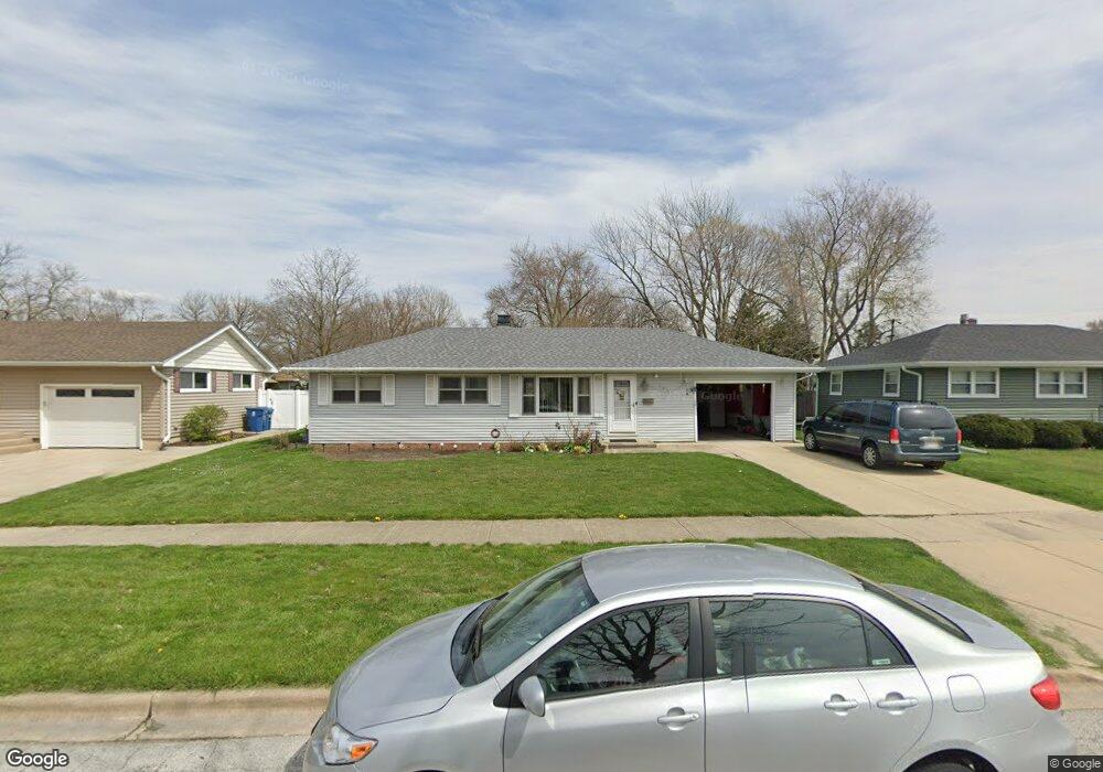
745 Duncan Dr Aurora, IL 60506
Edgelawn Randall NeighborhoodEstimated Value: $249,502 - $269,000
3
Beds
1
Bath
1,008
Sq Ft
$260/Sq Ft
Est. Value
About This Home
This home is located at 745 Duncan Dr, Aurora, IL 60506 and is currently estimated at $261,876, approximately $259 per square foot. 745 Duncan Dr is a home located in Kane County with nearby schools including Hall Elementary School, Jefferson Middle School, and West Aurora High School.
Ownership History
Date
Name
Owned For
Owner Type
Purchase Details
Closed on
Jul 21, 2015
Sold by
Galan Wilfredo and Galan Nilsa
Bought by
Galan Wilfredo and Galan Nilsa
Current Estimated Value
Purchase Details
Closed on
Sep 23, 1994
Sold by
Assell Bernard F and Assell Deborah A
Bought by
Galan Wilfredo and Galan Nilsa
Home Financials for this Owner
Home Financials are based on the most recent Mortgage that was taken out on this home.
Original Mortgage
$84,000
Interest Rate
8.53%
Create a Home Valuation Report for This Property
The Home Valuation Report is an in-depth analysis detailing your home's value as well as a comparison with similar homes in the area
Home Values in the Area
Average Home Value in this Area
Purchase History
| Date | Buyer | Sale Price | Title Company |
|---|---|---|---|
| Galan Wilfredo | -- | Attorney | |
| Galan Wilfredo | $105,000 | Chicago Title Insurance Co |
Source: Public Records
Mortgage History
| Date | Status | Borrower | Loan Amount |
|---|---|---|---|
| Closed | Galan Wilfredo | $84,000 |
Source: Public Records
Tax History
| Year | Tax Paid | Tax Assessment Tax Assessment Total Assessment is a certain percentage of the fair market value that is determined by local assessors to be the total taxable value of land and additions on the property. | Land | Improvement |
|---|---|---|---|---|
| 2024 | $4,899 | $69,870 | $13,876 | $55,994 |
| 2023 | $4,662 | $62,428 | $12,398 | $50,030 |
| 2022 | $4,511 | $56,960 | $11,312 | $45,648 |
| 2021 | $4,297 | $53,031 | $10,532 | $42,499 |
| 2020 | $4,583 | $54,958 | $9,783 | $45,175 |
| 2019 | $4,392 | $50,920 | $9,064 | $41,856 |
| 2018 | $4,021 | $46,283 | $8,384 | $37,899 |
| 2017 | $3,641 | $41,378 | $7,725 | $33,653 |
| 2016 | $3,724 | $41,051 | $6,622 | $34,429 |
| 2015 | -- | $35,956 | $5,694 | $30,262 |
| 2014 | -- | $33,400 | $5,233 | $28,167 |
| 2013 | -- | $33,849 | $5,158 | $28,691 |
Source: Public Records
Map
Nearby Homes
- 1421 Heather Dr
- 1734 Rosedale Ct
- 833 N Randall Rd Unit C4
- 123 N Rosedale Ave
- 1387 S Glen Cir Unit D
- 106 Hillwood Place Unit 5A
- 115 N Western Ave
- 1730 W Galena Blvd Unit 402E
- 980 Sapphire Ln
- 968 Sapphire Ln
- 960 Sapphire Ln
- 972 Sapphire Ln
- 988 Sapphire Ln
- 976 Sapphire Ln
- 984 Sapphire Ln
- 991 Sapphire Ln
- 959 Sapphire Ln
- 975 Sapphire Ln
- 963 Sapphire Ln
- 987 Sapphire Ln
- 739 Duncan Dr
- 751 Duncan Dr
- 744 Westgate Dr
- 757 Duncan Dr
- 740 Westgate Dr
- 750 Westgate Dr
- 1651 Roanoke Ave
- 1645 Roanoke Ave
- 744 Duncan Dr
- 756 Westgate Dr
- 738 Duncan Dr
- 750 Duncan Dr
- 1641 Roanoke Ave
- 761 Duncan Dr
- 756 Duncan Dr
- 1703 Roanoke Ave
- 762 Westgate Dr
- 1633 Roanoak Ave
- 765 Duncan Dr
- 760 Duncan Dr
Your Personal Tour Guide
Ask me questions while you tour the home.