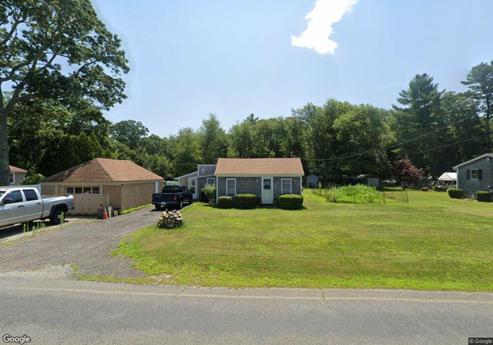
745 Hixbridge Rd Westport, MA 02790
South Westport NeighborhoodEstimated Value: $406,721 - $622,000
2
Beds
1
Bath
1,096
Sq Ft
$432/Sq Ft
Est. Value
About This Home
This home is located at 745 Hixbridge Rd, Westport, MA 02790 and is currently estimated at $473,180, approximately $431 per square foot. 745 Hixbridge Rd is a home located in Bristol County with nearby schools including Alice A. Macomber Primary School, Westport Elementary School, and Westport Middle-High School.
Ownership History
Date
Name
Owned For
Owner Type
Purchase Details
Closed on
Feb 11, 2022
Sold by
Smeaton Eric S
Bought by
Demello James C
Current Estimated Value
Home Financials for this Owner
Home Financials are based on the most recent Mortgage that was taken out on this home.
Original Mortgage
$264,000
Outstanding Balance
$244,238
Interest Rate
3.56%
Mortgage Type
Purchase Money Mortgage
Estimated Equity
$228,942
Purchase Details
Closed on
Sep 26, 2011
Sold by
Smeaton Eric S and Smeaton Shannon
Bought by
Smeaton Eric S
Purchase Details
Closed on
Sep 13, 1989
Sold by
Smeaton Stanley
Bought by
Smeaton Eric S
Home Financials for this Owner
Home Financials are based on the most recent Mortgage that was taken out on this home.
Original Mortgage
$40,000
Interest Rate
9.58%
Mortgage Type
Purchase Money Mortgage
Create a Home Valuation Report for This Property
The Home Valuation Report is an in-depth analysis detailing your home's value as well as a comparison with similar homes in the area
Home Values in the Area
Average Home Value in this Area
Purchase History
| Date | Buyer | Sale Price | Title Company |
|---|---|---|---|
| Demello James C | $330,000 | None Available | |
| Smeaton Eric S | -- | -- | |
| Smeaton Eric S | -- | -- | |
| Smeaton Eric S | $40,000 | -- | |
| Smeaton Eric S | $40,000 | -- |
Source: Public Records
Mortgage History
| Date | Status | Borrower | Loan Amount |
|---|---|---|---|
| Open | Demello James C | $264,000 | |
| Previous Owner | Smeaton Eric S | $45,500 | |
| Previous Owner | Smeaton Eric S | $31,900 | |
| Previous Owner | Smeaton Eric S | $40,000 |
Source: Public Records
Tax History Compared to Growth
Tax History
| Year | Tax Paid | Tax Assessment Tax Assessment Total Assessment is a certain percentage of the fair market value that is determined by local assessors to be the total taxable value of land and additions on the property. | Land | Improvement |
|---|---|---|---|---|
| 2025 | $2,414 | $324,000 | $183,800 | $140,200 |
| 2024 | $2,347 | $303,600 | $170,300 | $133,300 |
| 2023 | $2,131 | $261,100 | $143,500 | $117,600 |
| 2022 | $2,125 | $250,600 | $143,500 | $107,100 |
| 2021 | $1,619 | $187,800 | $130,400 | $57,400 |
| 2020 | $1,539 | $182,600 | $125,200 | $57,400 |
| 2019 | $1,452 | $175,600 | $119,800 | $55,800 |
| 2018 | $1,402 | $171,600 | $121,700 | $49,900 |
| 2017 | $1,376 | $172,700 | $124,000 | $48,700 |
| 2016 | $1,411 | $178,400 | $128,700 | $49,700 |
| 2015 | $1,387 | $174,900 | $131,000 | $43,900 |
Source: Public Records
Map
Nearby Homes
- 73 White Oak Run
- 2 Slades Farm Ln
- 225 Hixbridge Rd
- 920 Drift Rd
- 1150 Russells Mills Rd
- 99 Sylvia Ln
- 47 Fallon Dr
- 0 Hidden Glen Ln
- 118 Charlotte White Rd Extension
- Lot 0 Marcotte
- 837 Main Rd
- Lot 2E Horseneck Rd
- 8 Village Way
- 7 Village Way
- 15 Village Way
- 8 Strawberry Ln
- 101 Adamsville Rd
- 118 Charlotte White Rd
- 1346 Main Rd Unit B
- 248 Bakerville Rd
- 741 Hixbridge Rd
- 755 Hixbridge Rd
- 733 Hixbridge Rd
- 1 Shadow Wood Ln
- 765 Hixbridge Rd
- 5 Shadow Woods Ln
- 708 Hix Bridge Rd
- 3 Shadow Wood Ln
- 5 Division Rd
- 0 Division Rd Unit 72368540
- 0 Division Rd
- 0 Division Rd Unit 730720
- 0 Division Rd Unit 1199108
- 0 Division Rd Unit 1213581
- 0 Division Rd Unit 70493743
- 0 Division Rd Unit 70410592
- 0 Division Rd Unit 72444979
- 2 Shadow Wood Ln
- 7 Division Rd
- 0 Division Rd Unit 30649733