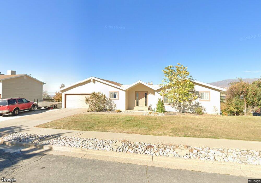
745 Independence Way North Salt Lake, UT 84054
Estimated Value: $612,000 - $713,000
5
Beds
3
Baths
1,656
Sq Ft
$395/Sq Ft
Est. Value
About This Home
This home is located at 745 Independence Way, North Salt Lake, UT 84054 and is currently estimated at $654,412, approximately $395 per square foot. 745 Independence Way is a home located in Davis County with nearby schools including Orchard School, South Davis Junior High School, and Woods Cross High School.
Ownership History
Date
Name
Owned For
Owner Type
Purchase Details
Closed on
Oct 1, 2004
Sold by
Millard Kenneth R and Millard Carolyn S
Bought by
Millard Kenneth R and Millard Carolyn S
Current Estimated Value
Home Financials for this Owner
Home Financials are based on the most recent Mortgage that was taken out on this home.
Original Mortgage
$150,000
Interest Rate
5.72%
Mortgage Type
Credit Line Revolving
Purchase Details
Closed on
Jun 1, 1997
Sold by
Millard Kenneth R and Millard Carolyn S
Bought by
Millard Kenneth R and Millard Carolyn S
Create a Home Valuation Report for This Property
The Home Valuation Report is an in-depth analysis detailing your home's value as well as a comparison with similar homes in the area
Home Values in the Area
Average Home Value in this Area
Purchase History
| Date | Buyer | Sale Price | Title Company |
|---|---|---|---|
| Millard Kenneth R | -- | First American Title Co | |
| Millard Kenneth R | -- | -- |
Source: Public Records
Mortgage History
| Date | Status | Borrower | Loan Amount |
|---|---|---|---|
| Closed | Millard Kenneth R | $150,000 |
Source: Public Records
Tax History Compared to Growth
Tax History
| Year | Tax Paid | Tax Assessment Tax Assessment Total Assessment is a certain percentage of the fair market value that is determined by local assessors to be the total taxable value of land and additions on the property. | Land | Improvement |
|---|---|---|---|---|
| 2024 | $3,138 | $315,700 | $188,010 | $127,690 |
| 2023 | $3,041 | $553,000 | $266,703 | $286,297 |
| 2022 | $3,173 | $316,800 | $167,852 | $148,948 |
| 2021 | $2,865 | $434,000 | $254,018 | $179,982 |
| 2020 | $2,570 | $385,000 | $167,995 | $217,005 |
| 2019 | $2,511 | $367,000 | $163,043 | $203,957 |
| 2018 | $2,380 | $344,000 | $146,941 | $197,059 |
| 2016 | $2,017 | $155,045 | $47,722 | $107,323 |
| 2015 | $1,916 | $141,460 | $47,722 | $93,738 |
| 2014 | $1,473 | $110,860 | $47,722 | $63,138 |
| 2013 | -- | $103,093 | $48,177 | $54,916 |
Source: Public Records
Map
Nearby Homes
- 285 Constitution Way
- 720 Freedom Cir
- 151 S Bernice Way
- 398 Lofty Ln
- 585 Marialana Way
- 275 Eagle Way
- 520 Lacey Way
- 609 Parkway Dr
- 271 E Eagle Ridge Dr
- 93 N Valley View Dr
- 53 N Foxhill Rd
- 311 Edgemont Dr
- 178 N Valley View Dr
- 755 Parkway Dr
- 460 S Sunset Ridge Dr
- 2420 S Orchard Dr
- 79 N Orchard Dr
- 3975 S Monarch Dr E
- 733 Eagle Pass
- 566 S Tanglewood Loop Unit 1327
- 735 Independence Way
- 755 Independence Way
- 730 Centennial Dr
- 740 Centennial Dr
- 750 Centennial Dr
- 744 Independence Way
- 720 Centennial Dr
- 754 Independence Way
- 760 Centennial Dr
- 734 Independence Way
- 715 Independence Way
- 347 Independence Way
- 770 Centennial Dr
- 303 Independence Way
- 764 Independence Way
- 724 Independence Way
- 305 Independence Way
- 745 Ridge Top Cir
- 755 Ridge Top Cir
- 731 Centennial Dr