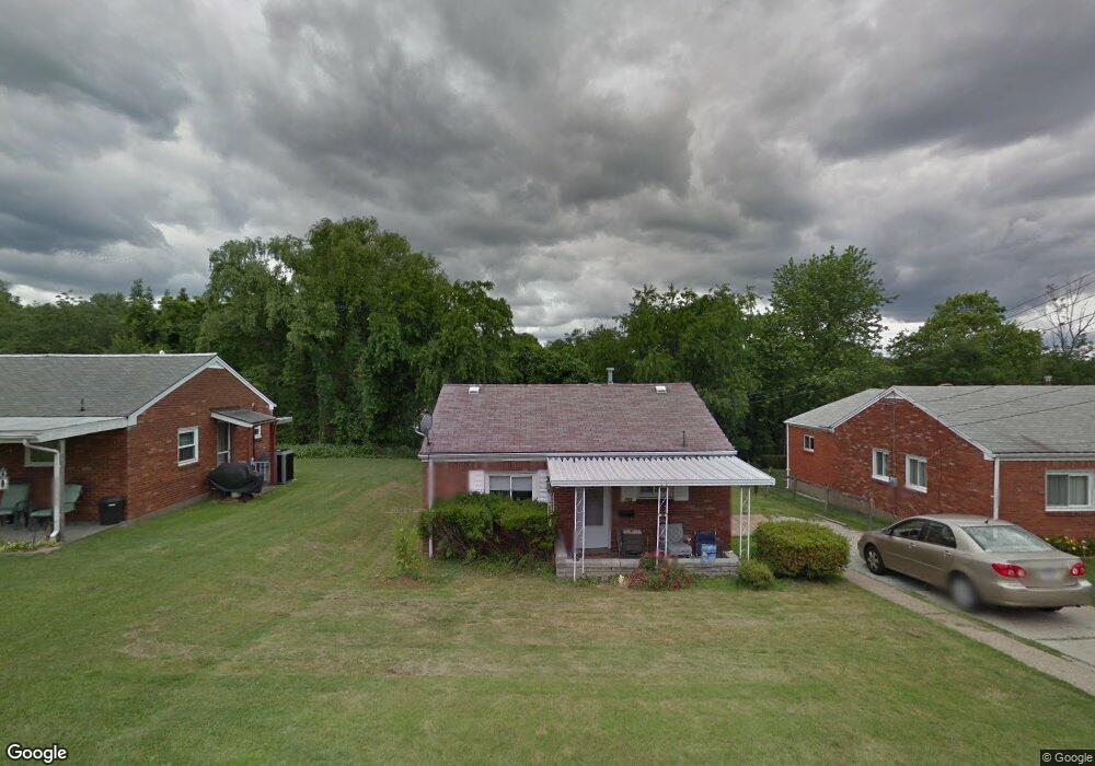
745 Memory Ln McKeesport, PA 15133
Estimated Value: $98,000 - $125,000
2
Beds
1
Bath
1,040
Sq Ft
$106/Sq Ft
Est. Value
About This Home
This home is located at 745 Memory Ln, McKeesport, PA 15133 and is currently estimated at $110,546, approximately $106 per square foot. 745 Memory Ln is a home located in Allegheny County with nearby schools including South Allegheny Elementary School, South Allegheny High School, and Young Scholars of Greater Allegheny Charter School.
Ownership History
Date
Name
Owned For
Owner Type
Purchase Details
Closed on
Feb 14, 1995
Sold by
Dimarco Fiore and Dimarco Patricia
Bought by
Dimarco Patricia A and Dimarco Fiore S
Current Estimated Value
Create a Home Valuation Report for This Property
The Home Valuation Report is an in-depth analysis detailing your home's value as well as a comparison with similar homes in the area
Home Values in the Area
Average Home Value in this Area
Purchase History
| Date | Buyer | Sale Price | Title Company |
|---|---|---|---|
| Dimarco Patricia A | -- | -- |
Source: Public Records
Tax History Compared to Growth
Tax History
| Year | Tax Paid | Tax Assessment Tax Assessment Total Assessment is a certain percentage of the fair market value that is determined by local assessors to be the total taxable value of land and additions on the property. | Land | Improvement |
|---|---|---|---|---|
| 2025 | $1,671 | $44,300 | $12,100 | $32,200 |
| 2024 | $1,605 | $44,300 | $12,100 | $32,200 |
| 2023 | $1,605 | $44,300 | $12,100 | $32,200 |
| 2022 | $1,502 | $44,300 | $12,100 | $32,200 |
| 2021 | $210 | $44,300 | $12,100 | $32,200 |
| 2020 | $1,428 | $44,300 | $12,100 | $32,200 |
| 2019 | $1,355 | $44,300 | $12,100 | $32,200 |
| 2018 | $210 | $44,300 | $12,100 | $32,200 |
| 2017 | $1,239 | $44,300 | $12,100 | $32,200 |
| 2016 | $210 | $44,300 | $12,100 | $32,200 |
| 2015 | $210 | $44,300 | $12,100 | $32,200 |
| 2014 | $1,173 | $44,300 | $12,100 | $32,200 |
Source: Public Records
Map
Nearby Homes
- 2834 Washington Blvd
- 813 Lauck Ave
- 2908 Woodrow St
- 3238 Overlook Dr
- 603 Hays St
- 112 Kollar Dr
- 1817 Gray St
- 2302 Walnut St
- 1120 Portsmouth Dr
- 314 29th St
- 320 Dersam St
- 335-345 Dersam St
- 1317 New York Ave
- 199 Bellbridge Rd
- 0 Washington Blvd
- 419 31st St
- 622 Summit Ave
- 1405/1407 Walnut St
- 317 36th St
- 407 Eden Park Blvd