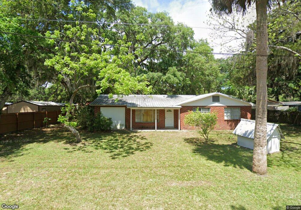
745 Mourning Dove Ln Fernandina Beach, FL 32034
Estimated Value: $336,000 - $427,000
3
Beds
1
Bath
1,170
Sq Ft
$329/Sq Ft
Est. Value
About This Home
This home is located at 745 Mourning Dove Ln, Fernandina Beach, FL 32034 and is currently estimated at $384,451, approximately $328 per square foot. 745 Mourning Dove Ln is a home located in Nassau County with nearby schools including Southside Elementary School, Emma Love Hardee Elementary School, and Fernandina Beach Middle School.
Ownership History
Date
Name
Owned For
Owner Type
Purchase Details
Closed on
Jan 17, 2025
Sold by
Cook Linton Lyman
Bought by
Cook Terry L
Current Estimated Value
Create a Home Valuation Report for This Property
The Home Valuation Report is an in-depth analysis detailing your home's value as well as a comparison with similar homes in the area
Home Values in the Area
Average Home Value in this Area
Purchase History
| Date | Buyer | Sale Price | Title Company |
|---|---|---|---|
| Cook Terry L | $100 | None Listed On Document |
Source: Public Records
Tax History Compared to Growth
Tax History
| Year | Tax Paid | Tax Assessment Tax Assessment Total Assessment is a certain percentage of the fair market value that is determined by local assessors to be the total taxable value of land and additions on the property. | Land | Improvement |
|---|---|---|---|---|
| 2024 | $3,030 | $253,438 | $130,000 | $123,438 |
| 2023 | $3,030 | $238,373 | $120,000 | $118,373 |
| 2022 | $2,499 | $206,786 | $120,000 | $86,786 |
| 2021 | $2,131 | $145,017 | $75,000 | $70,017 |
| 2020 | $1,891 | $119,328 | $60,000 | $59,328 |
| 2019 | $1,718 | $104,823 | $45,000 | $59,823 |
| 2018 | $1,614 | $97,341 | $0 | $0 |
| 2017 | $1,466 | $95,257 | $0 | $0 |
| 2016 | $1,427 | $88,404 | $0 | $0 |
| 2015 | $1,385 | $80,367 | $0 | $0 |
| 2014 | $1,166 | $73,061 | $0 | $0 |
Source: Public Records
Map
Nearby Homes
- 1973 Pine Dr
- 1893 Palm Dr
- 1889 Palm Dr
- 738 Wax Wing Ln
- 730 Wax Wing Ln
- 1874 Clinch Dr
- 2017 Clinch Dr
- 729 Bonnieview Rd
- 765 Adams Rd
- 766 Adams Rd
- 779 Adams Rd
- 2219 Cashen Wood Dr
- 2235 Cashen Wood Dr
- 887 Robinhood Dr
- 2441 Amelia Rd
- 96015 Woodmere Way
- 2361 Cashen Wood Dr
- 96018 Woodmere Way
- 1900 Sycamore Ln
- 1859 Perimeter Park Rd W
- 731 Mourning Dove Ln
- 1961 Palm Dr
- 1952 Pine Dr
- 1967 Pine Dr
- 1967 Palm Dr
- 1951 Palm Dr
- 1943 Palm Dr
- 769 Mourning Dove Ln
- 1973 Palm Dr
- 1951 Pine Dr Unit 2
- 1968 Palm Dr
- 1952 Palm Dr
- 1970 Boles Cir
- 1940 Palm Dr
- 1943 Pine Dr
- 1979 Pine Dr
- 781 Mourning Dove Ln
- 1976 Palm Dr
- 780 Mourning Dove Ln
- 735 Pelican Ln