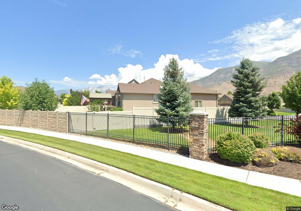
745 N 1300 E American Fork, UT 84003
Estimated Value: $684,000 - $806,000
4
Beds
3
Baths
3,415
Sq Ft
$222/Sq Ft
Est. Value
About This Home
This home is located at 745 N 1300 E, American Fork, UT 84003 and is currently estimated at $758,603, approximately $222 per square foot. 745 N 1300 E is a home located in Utah County with nearby schools including Deerfield Elementary School, Mountain Ridge Junior High School, and American Fork High School.
Ownership History
Date
Name
Owned For
Owner Type
Purchase Details
Closed on
Jul 1, 2016
Sold by
Bloxham Brady
Bought by
Hardy Jason and Hardy Kimberly
Current Estimated Value
Home Financials for this Owner
Home Financials are based on the most recent Mortgage that was taken out on this home.
Original Mortgage
$391,950
Outstanding Balance
$312,894
Interest Rate
3.58%
Mortgage Type
New Conventional
Estimated Equity
$445,709
Purchase Details
Closed on
Jun 7, 2011
Sold by
Perry Homes Utah Inc
Bought by
Bloxham Brady
Home Financials for this Owner
Home Financials are based on the most recent Mortgage that was taken out on this home.
Original Mortgage
$310,507
Interest Rate
4.71%
Mortgage Type
New Conventional
Create a Home Valuation Report for This Property
The Home Valuation Report is an in-depth analysis detailing your home's value as well as a comparison with similar homes in the area
Home Values in the Area
Average Home Value in this Area
Purchase History
| Date | Buyer | Sale Price | Title Company |
|---|---|---|---|
| Hardy Jason | -- | Utah First Title Ins Ag | |
| Bloxham Brady | -- | Meridian Title Company | |
| Perry Homes Utah Inc | -- | Meridian Title Company |
Source: Public Records
Mortgage History
| Date | Status | Borrower | Loan Amount |
|---|---|---|---|
| Open | Hardy Jason | $391,950 | |
| Previous Owner | Bloxham Brady | $310,507 |
Source: Public Records
Tax History
| Year | Tax Paid | Tax Assessment Tax Assessment Total Assessment is a certain percentage of the fair market value that is determined by local assessors to be the total taxable value of land and additions on the property. | Land | Improvement |
|---|---|---|---|---|
| 2025 | $3,361 | $401,390 | -- | -- |
| 2024 | $3,361 | $373,450 | $0 | $0 |
| 2023 | $3,107 | $366,025 | $0 | $0 |
| 2022 | $3,478 | $404,305 | $0 | $0 |
| 2021 | $2,813 | $510,800 | $177,200 | $333,600 |
| 2020 | $2,702 | $475,900 | $164,100 | $311,800 |
| 2019 | $2,453 | $446,800 | $152,900 | $293,900 |
| 2018 | $2,514 | $437,900 | $149,200 | $288,700 |
| 2017 | $2,329 | $218,955 | $0 | $0 |
| 2016 | $2,187 | $191,015 | $0 | $0 |
| 2015 | $2,244 | $185,955 | $0 | $0 |
| 2014 | $2,149 | $175,670 | $0 | $0 |
Source: Public Records
Map
Nearby Homes
- 1121 E 580 N
- 1125 N 1270 E
- 1058 N 930 E Unit 64
- 1045 N 930 E Unit 58
- 1077 N 950 E
- 1089 N 950 E
- 462 N 950 E Unit 5
- 681 W 2760 N
- 912 E Ellens St Unit 1
- 837 E 475 N
- 1897 N 900 W
- 322 N 900 E
- 980 W 1800 N
- 472 W 2760 N
- 1289 W 1670 N
- 9587 N 4500 W
- 9617 N 4500 W
- 9506 N 4000 W
- 1609 N 900 W
- 3810 W Valley View Dr
- 845 N 1300 E
- 757 N 1300 E Unit LOT 26
- 1274 E 760 N
- 732 N 1300 E
- 754 N 1300 E Unit LOT 2
- 754 N 1300 E
- 737 N 1280 E Unit LOT 29
- 766 N 1300 E Unit LOT 3
- 769 N 1280 E
- 769 N 1280 E Unit LOT 24
- 763 N 1280 E
- 1295 E 700 N
- 749 N 1280 E Unit 1
- 749 N 1280 E Unit LOT 28
- 749 N 1280 E
- 1257 E 700 N
- 778 N 1300 E
- 1280 E 700 N
- 546 N 1280 E Unit 10
- 2681 N 1550 W
Your Personal Tour Guide
Ask me questions while you tour the home.