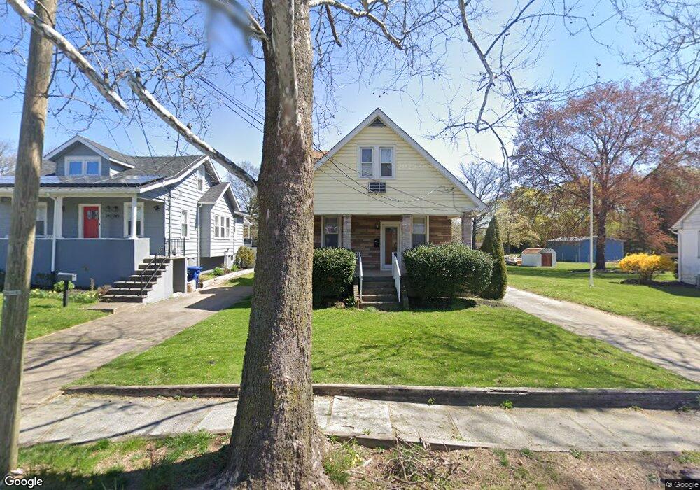
745 N Forklanding Rd Maple Shade, NJ 08052
Estimated Value: $362,970 - $396,000
--
Bed
--
Bath
1,816
Sq Ft
$209/Sq Ft
Est. Value
About This Home
This home is located at 745 N Forklanding Rd, Maple Shade, NJ 08052 and is currently estimated at $379,993, approximately $209 per square foot. 745 N Forklanding Rd is a home located in Burlington County with nearby schools including Ralph J Steinhauer Elementary School, Maude M. Wilkins Elementary School, and Howard R Yocum School.
Ownership History
Date
Name
Owned For
Owner Type
Purchase Details
Closed on
May 29, 2012
Sold by
Saporito Anthony J
Bought by
Powell Denise and Powell Joseph H
Current Estimated Value
Home Financials for this Owner
Home Financials are based on the most recent Mortgage that was taken out on this home.
Original Mortgage
$120,000
Outstanding Balance
$82,650
Interest Rate
3.85%
Mortgage Type
New Conventional
Estimated Equity
$297,343
Create a Home Valuation Report for This Property
The Home Valuation Report is an in-depth analysis detailing your home's value as well as a comparison with similar homes in the area
Home Values in the Area
Average Home Value in this Area
Purchase History
| Date | Buyer | Sale Price | Title Company |
|---|---|---|---|
| Powell Denise | $160,000 | Surety Title Agency |
Source: Public Records
Mortgage History
| Date | Status | Borrower | Loan Amount |
|---|---|---|---|
| Open | Powell Denise | $120,000 |
Source: Public Records
Tax History Compared to Growth
Tax History
| Year | Tax Paid | Tax Assessment Tax Assessment Total Assessment is a certain percentage of the fair market value that is determined by local assessors to be the total taxable value of land and additions on the property. | Land | Improvement |
|---|---|---|---|---|
| 2025 | $8,962 | $236,100 | $53,900 | $182,200 |
| 2024 | $8,703 | $236,100 | $53,900 | $182,200 |
| 2023 | $8,703 | $236,100 | $53,900 | $182,200 |
| 2022 | $8,568 | $236,100 | $53,900 | $182,200 |
| 2021 | $8,485 | $236,100 | $53,900 | $182,200 |
| 2020 | $8,509 | $236,100 | $53,900 | $182,200 |
| 2019 | $8,197 | $236,100 | $53,900 | $182,200 |
| 2018 | $8,056 | $236,100 | $53,900 | $182,200 |
| 2017 | $7,961 | $236,100 | $53,900 | $182,200 |
| 2016 | $7,843 | $236,100 | $53,900 | $182,200 |
| 2015 | $7,673 | $236,100 | $53,900 | $182,200 |
| 2014 | $7,440 | $236,100 | $53,900 | $182,200 |
Source: Public Records
Map
Nearby Homes
- 41 Orchard Ave
- 12 Collins Ln
- 4 W Germantown Ave
- 432 N Coles Ave
- 218 E Germantown Ave
- 301 N Coles Ave
- 3422 Palace Ct
- 505 Greenwood Ave
- 8704 Park Ave
- 3423 New Jersey Ct
- 8534 Orchard Ave
- 29 W Broadway
- 480 W Front St
- 48 N Terrace Ave
- 8337 Herbert Ave
- 8331 Stockton Ave
- 425 Stiles Ave
- 3 Glacier Dr
- 22 Theodore Ave
- Ballad Plan at Villages at Moorestown
- 749 N Forklanding Rd
- 737 N Forklanding Rd
- 753 N Forklanding Rd
- 733 N Forklanding Rd
- 755 N Forklanding Rd
- 729 N Forklanding Rd
- 732 N Forklanding Rd
- 725 N Forklanding Rd
- 730 N Forklanding Rd
- 5 Lanci Rd
- 723 N Forklanding Rd
- 759 N Forklanding Rd
- 6 Lanci Rd
- 721 N Forklanding Rd
- 20 High St
- 7 Lanci Rd
- 12 Lanci Rd
- 30 High St
- 26 High St
- 1036 Fernwood Ave