Estimated Value: $240,018 - $260,000
3
Beds
1
Bath
1,165
Sq Ft
$215/Sq Ft
Est. Value
About This Home
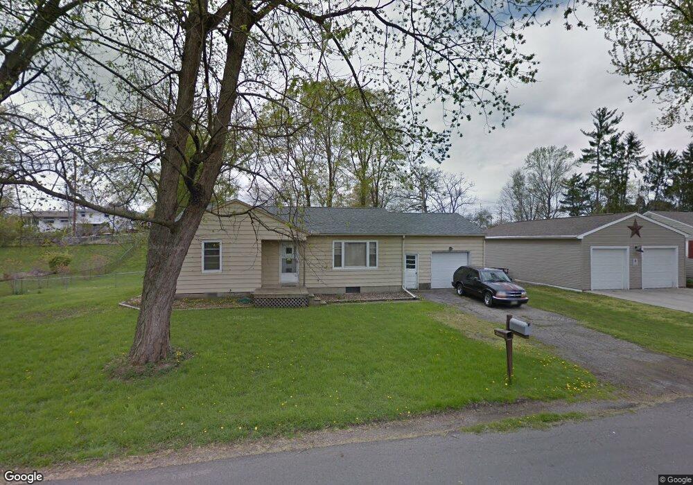
This home is located at 745 Radian Dr, Heath, OH 43056 and is currently estimated at $250,255, approximately $214 per square foot. 745 Radian Dr is a home located in Licking County with nearby schools including Garfield Elementary School, Stevenson Elementary School, and Heath Middle School.
Ownership History
Date
Name
Owned For
Owner Type
Purchase Details
Closed on
Jul 30, 2015
Sold by
Machwart Phillip L and Machwart Sharon K
Bought by
Slan Abhaile Llc
Current Estimated Value
Purchase Details
Closed on
Jun 3, 2015
Sold by
Slan Abhaile Llc
Bought by
Machwart Phillip L and Lowell Machwart Sharon K
Purchase Details
Closed on
Oct 9, 2014
Sold by
Machwart Phillip L and Lowell Machwart Sharon K
Bought by
Slan Abhaile Llc
Purchase Details
Closed on
Jun 28, 1995
Sold by
Warthman Carl A
Bought by
Machwart Phillip L and Machwart Leslie M
Home Financials for this Owner
Home Financials are based on the most recent Mortgage that was taken out on this home.
Original Mortgage
$75,560
Interest Rate
7.88%
Mortgage Type
New Conventional
Create a Home Valuation Report for This Property
The Home Valuation Report is an in-depth analysis detailing your home's value as well as a comparison with similar homes in the area
Home Values in the Area
Average Home Value in this Area
Purchase History
| Date | Buyer | Sale Price | Title Company |
|---|---|---|---|
| Slan Abhaile Llc | -- | Attorney | |
| Machwart Phillip L | -- | None Available | |
| Slan Abhaile Llc | -- | None Available | |
| Machwart Phillip L | $77,900 | -- |
Source: Public Records
Mortgage History
| Date | Status | Borrower | Loan Amount |
|---|---|---|---|
| Previous Owner | Machwart Phillip L | $75,560 |
Source: Public Records
Tax History Compared to Growth
Tax History
| Year | Tax Paid | Tax Assessment Tax Assessment Total Assessment is a certain percentage of the fair market value that is determined by local assessors to be the total taxable value of land and additions on the property. | Land | Improvement |
|---|---|---|---|---|
| 2024 | $2,762 | $62,940 | $17,820 | $45,120 |
| 2023 | $3,059 | $62,940 | $17,820 | $45,120 |
| 2022 | $2,199 | $39,730 | $12,180 | $27,550 |
| 2021 | $2,244 | $39,730 | $12,180 | $27,550 |
| 2020 | $2,258 | $39,730 | $12,180 | $27,550 |
| 2019 | $2,157 | $38,580 | $13,550 | $25,030 |
| 2018 | $2,180 | $0 | $0 | $0 |
| 2017 | $2,203 | $0 | $0 | $0 |
| 2016 | $2,189 | $0 | $0 | $0 |
| 2015 | $2,226 | $0 | $0 | $0 |
| 2014 | $3,061 | $0 | $0 | $0 |
| 2013 | $2,010 | $0 | $0 | $0 |
Source: Public Records
Map
Nearby Homes
- 832 Oberlin Dr
- 878 Oberlin Dr
- 909 Fieldson Dr
- 125 Hillview Ct Unit 109C
- 735 Windsor Ln Unit 735
- 514 S 30th St
- 56 Swainford Dr
- 1055 Weiant Ave
- 1305 Kacey Ct
- 38 Carey Ln
- 89 Maureen Dr
- 301 River Oaks Dr
- 145 Hancock St
- 381 Laurel Oaks Ln
- Cloverly B Plan at River Oaks
- Anderson Plan at River Oaks
- Allister Plan at River Oaks
- Cloverly C Plan at River Oaks
- 387 Laurel Oaks Ln
- 581 Edgewood Dr