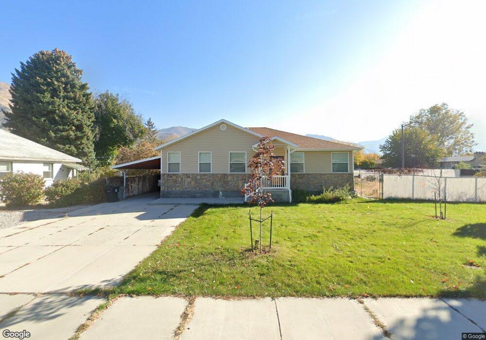
745 S 700 E Springville, UT 84663
East Hobble Creek NeighborhoodEstimated Value: $506,000 - $525,964
3
Beds
2
Baths
1,616
Sq Ft
$321/Sq Ft
Est. Value
About This Home
This home is located at 745 S 700 E, Springville, UT 84663 and is currently estimated at $518,321, approximately $320 per square foot. 745 S 700 E is a home located in Utah County with nearby schools including Brookside School, Springville Junior High School, and Springville High School.
Ownership History
Date
Name
Owned For
Owner Type
Purchase Details
Closed on
Apr 19, 2006
Sold by
Tuttle Donald B and Tuttle Earl W
Bought by
Andersen Glade C and Andersen Donna C
Current Estimated Value
Home Financials for this Owner
Home Financials are based on the most recent Mortgage that was taken out on this home.
Original Mortgage
$84,835
Outstanding Balance
$48,724
Interest Rate
6.35%
Mortgage Type
Fannie Mae Freddie Mac
Estimated Equity
$469,597
Create a Home Valuation Report for This Property
The Home Valuation Report is an in-depth analysis detailing your home's value as well as a comparison with similar homes in the area
Home Values in the Area
Average Home Value in this Area
Purchase History
| Date | Buyer | Sale Price | Title Company |
|---|---|---|---|
| Andersen Glade C | -- | Pro Title & Escrow Inc |
Source: Public Records
Mortgage History
| Date | Status | Borrower | Loan Amount |
|---|---|---|---|
| Open | Andersen Glade C | $84,835 |
Source: Public Records
Tax History
| Year | Tax Paid | Tax Assessment Tax Assessment Total Assessment is a certain percentage of the fair market value that is determined by local assessors to be the total taxable value of land and additions on the property. | Land | Improvement |
|---|---|---|---|---|
| 2025 | $2,496 | $272,525 | -- | -- |
| 2024 | $2,496 | $255,695 | $0 | $0 |
| 2023 | $2,490 | $255,365 | $0 | $0 |
| 2022 | $2,392 | $240,900 | $0 | $0 |
| 2021 | $2,149 | $336,900 | $108,000 | $228,900 |
| 2020 | $1,959 | $297,800 | $80,000 | $217,800 |
| 2019 | $1,876 | $290,200 | $72,400 | $217,800 |
| 2018 | $1,940 | $286,300 | $68,500 | $217,800 |
| 2017 | $1,955 | $153,285 | $0 | $0 |
| 2016 | $1,693 | $130,130 | $0 | $0 |
| 2015 | $1,573 | $123,640 | $0 | $0 |
| 2014 | $1,584 | $123,640 | $0 | $0 |
Source: Public Records
Map
Nearby Homes
- 677 E 800 South St
- 645 Swenson Ave Unit 3
- 883 E 700 S
- 579 E 800 St S
- 629 E 800 St S
- 445 E 535 S
- 968 S 1000 E
- 805 E 400 S
- 949 S 1060 E
- 337 E 600 S
- 1010 S 400 E Unit 21
- 1010 S 400 E Unit 39
- 67 E 775 S Unit 22
- 50 E 750 S Unit 25
- 2554 E 350 S Unit 4
- 1206 E 1150 S
- 978 S 1375 E
- 1185 Hillcrest Dr
- 1518 S 600 E
- 1121 W 1800 N