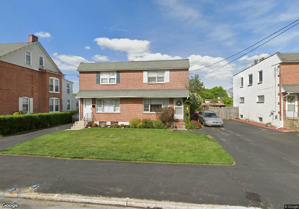
745 S Matlack St West Chester, PA 19382
Estimated Value: $423,000 - $560,000
3
Beds
2
Baths
1,188
Sq Ft
$393/Sq Ft
Est. Value
About This Home
This home is located at 745 S Matlack St, West Chester, PA 19382 and is currently estimated at $467,399, approximately $393 per square foot. 745 S Matlack St is a home located in Chester County with nearby schools including Westtown-Thornbury Elementary School, Stetson Middle School, and Bayard Rustin High School.
Ownership History
Date
Name
Owned For
Owner Type
Purchase Details
Closed on
Dec 5, 2019
Sold by
Hartz Theodore R and Hartz Susan M
Bought by
Hartz Theodore R and Hartz Susan M
Current Estimated Value
Purchase Details
Closed on
Jun 1, 2012
Sold by
Hartz Theodore R
Bought by
Hartz Theodore R and Hartz Susan M
Purchase Details
Closed on
Dec 23, 2006
Sold by
Hartz Theodore R and Estate Of Drusilla B Hartz
Bought by
Hartz Theodore R
Create a Home Valuation Report for This Property
The Home Valuation Report is an in-depth analysis detailing your home's value as well as a comparison with similar homes in the area
Home Values in the Area
Average Home Value in this Area
Purchase History
| Date | Buyer | Sale Price | Title Company |
|---|---|---|---|
| Hartz Theodore R | -- | None Available | |
| Hartz Theodore R | -- | None Available | |
| Hartz Theodore R | -- | None Available |
Source: Public Records
Tax History Compared to Growth
Tax History
| Year | Tax Paid | Tax Assessment Tax Assessment Total Assessment is a certain percentage of the fair market value that is determined by local assessors to be the total taxable value of land and additions on the property. | Land | Improvement |
|---|---|---|---|---|
| 2025 | $3,827 | $109,110 | $46,290 | $62,820 |
| 2024 | $3,827 | $109,110 | $46,290 | $62,820 |
| 2023 | $3,785 | $109,110 | $46,290 | $62,820 |
| 2022 | $3,744 | $109,110 | $46,290 | $62,820 |
| 2021 | $3,668 | $109,110 | $46,290 | $62,820 |
| 2020 | $3,600 | $109,110 | $46,290 | $62,820 |
| 2019 | $3,557 | $109,110 | $46,290 | $62,820 |
| 2018 | $3,493 | $109,110 | $46,290 | $62,820 |
| 2017 | $3,429 | $109,110 | $46,290 | $62,820 |
| 2016 | $2,436 | $109,110 | $46,290 | $62,820 |
| 2015 | $2,436 | $109,110 | $46,290 | $62,820 |
| 2014 | $2,436 | $109,110 | $46,290 | $62,820 |
Source: Public Records
Map
Nearby Homes
- 635 S Matlack St
- 615 S Walnut St
- 538 S Adams St
- 615-617 S Walnut St
- 103 Giunta Ln
- 335 S Adams St
- 317 S Adams St
- 305 S Matlack St
- 138 Justin Dr
- 305 S Walnut St
- 116 Price St
- 412 Danielle Way
- 12 Sherman Alley
- 342 E Barnard St
- 303 S Church St
- 110 S Adams St
- 112 S Matlack St
- 110 S Matlack St
- 122 W Union St
- 110 S High St
- 1440 Spackman Ln
- 747 S Matlack St
- 743 S Matlack St
- 749 S Matlack St
- 739 S Matlack St
- 741 S Matlack St
- 737 S Matlack St
- 205 E Rosedale Ave
- 203 E Rosedale Ave
- 201 E Rosedale Ave
- 735 S Matlack St
- 209 E Rosedale Ave
- 738 S Matlack St
- 715 S Matlack St
- 746 S Matlack St
- 748 S Matlack St
- 740 S Franklin St
- 713 S Matlack St
- 241 E Rosedale Ave Unit A2
- 241 E Rosedale Ave Unit C2