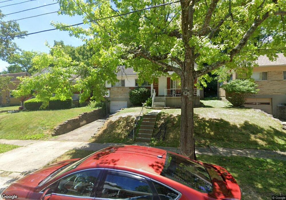
745 Wilbud Dr Cincinnati, OH 45205
West Price Hill NeighborhoodEstimated Value: $122,000 - $153,000
3
Beds
1
Bath
1,265
Sq Ft
$109/Sq Ft
Est. Value
About This Home
This home is located at 745 Wilbud Dr, Cincinnati, OH 45205 and is currently estimated at $137,601, approximately $108 per square foot. 745 Wilbud Dr is a home located in Hamilton County with nearby schools including Carson School, Gilbert A. Dater High School, and Western Hills High School.
Ownership History
Date
Name
Owned For
Owner Type
Purchase Details
Closed on
Jan 31, 2022
Sold by
Earls Jr Michael W
Bought by
Earis Andrea
Current Estimated Value
Purchase Details
Closed on
Nov 9, 2001
Sold by
Fern Michael D
Bought by
Earls Michael W and Bartels Andrea
Home Financials for this Owner
Home Financials are based on the most recent Mortgage that was taken out on this home.
Original Mortgage
$78,300
Interest Rate
6.62%
Purchase Details
Closed on
Mar 2, 2001
Sold by
Renner Timothy E
Bought by
Fern Michael D
Home Financials for this Owner
Home Financials are based on the most recent Mortgage that was taken out on this home.
Original Mortgage
$60,000
Interest Rate
7.03%
Purchase Details
Closed on
Sep 30, 1999
Sold by
Kahny James Barry
Bought by
Renner Timothy E
Home Financials for this Owner
Home Financials are based on the most recent Mortgage that was taken out on this home.
Original Mortgage
$58,200
Interest Rate
7.93%
Create a Home Valuation Report for This Property
The Home Valuation Report is an in-depth analysis detailing your home's value as well as a comparison with similar homes in the area
Home Values in the Area
Average Home Value in this Area
Purchase History
| Date | Buyer | Sale Price | Title Company |
|---|---|---|---|
| Earis Andrea | -- | None Listed On Document | |
| Earls Michael W | $97,900 | Metropolitan Title Company | |
| Fern Michael D | $75,000 | -- | |
| Renner Timothy E | $60,000 | -- |
Source: Public Records
Mortgage History
| Date | Status | Borrower | Loan Amount |
|---|---|---|---|
| Previous Owner | Earls Michael W | $78,300 | |
| Previous Owner | Fern Michael D | $60,000 | |
| Previous Owner | Renner Timothy E | $58,200 |
Source: Public Records
Tax History
| Year | Tax Paid | Tax Assessment Tax Assessment Total Assessment is a certain percentage of the fair market value that is determined by local assessors to be the total taxable value of land and additions on the property. | Land | Improvement |
|---|---|---|---|---|
| 2025 | $2,083 | $32,676 | $4,837 | $27,839 |
| 2024 | $2,081 | $32,676 | $4,837 | $27,839 |
| 2023 | $2,084 | $32,676 | $4,837 | $27,839 |
| 2022 | $1,398 | $19,653 | $4,809 | $14,844 |
| 2021 | $1,370 | $19,653 | $4,809 | $14,844 |
| 2020 | $1,374 | $19,653 | $4,809 | $14,844 |
| 2019 | $1,372 | $17,865 | $4,372 | $13,493 |
| 2018 | $1,373 | $17,865 | $4,372 | $13,493 |
| 2017 | $1,322 | $17,865 | $4,372 | $13,493 |
| 2016 | $1,578 | $20,818 | $4,669 | $16,149 |
| 2015 | $1,411 | $20,818 | $4,669 | $16,149 |
| 2014 | $1,419 | $20,818 | $4,669 | $16,149 |
| 2013 | $1,561 | $23,657 | $5,306 | $18,351 |
Source: Public Records
Map
Nearby Homes
- 734 Wilbud Dr
- 723 Wilbud Dr
- 700 Wilbud Dr
- 4334 W 8th St
- 700 Trenton Ave
- 4340 Eighth St W
- 583 Trenton Ave
- 581 Trenton Ave
- 582 Trenton Ave
- 4305 Saint Lawrence Ave
- 600 Overlook Ave
- 4419 Ridgeview Ave
- 590 Rentz Place
- 4452 Carnation Ave
- 4120 Saint Williams Ave
- 4458 W 8th St
- 4526 Clearview Ave
- 4206 Skylark Dr
- 1019 Rutledge Ave
- 1031 Schiff Ave
- 741 Wilbud Dr
- 737 Wilbud Dr
- 753 Wilbud Dr
- 733 Wilbud Dr
- 748 Wilbud Dr
- 757 Wilbud Dr
- 738 Wilbud Dr
- 727 Wilbud Dr
- 742 Wilbud Dr
- 4301 Schulte Dr
- 4259 Loubell Ln
- 4255 Loubell Ln
- 758 Wilbud Dr
- 758 Wilbud Dr Unit Apartment 2
- 758 Wilbud Dr Unit Apartment 1
- 4251 Loubell Ln
- 4304 Schulte Dr
- 765 Wilbud Dr
- 4247 Loubell Ln
- 719 Wilbud Dr
Your Personal Tour Guide
Ask me questions while you tour the home.