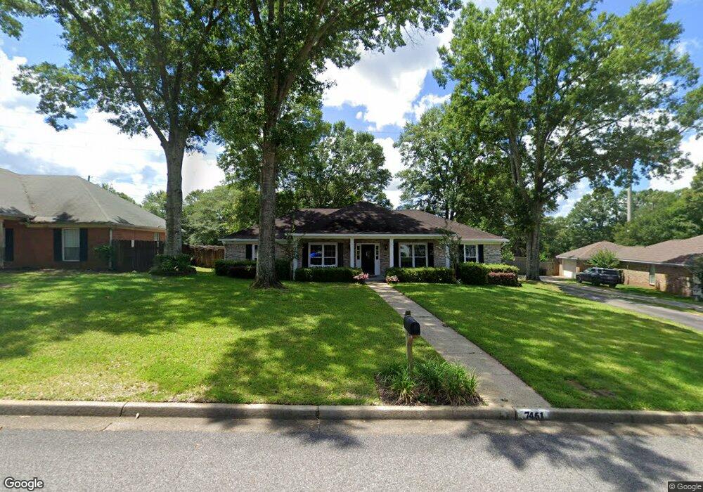
7451 Carson Rd S Mobile, AL 36695
Sheldon NeighborhoodEstimated Value: $264,088 - $287,000
3
Beds
2
Baths
2,146
Sq Ft
$130/Sq Ft
Est. Value
About This Home
This home is located at 7451 Carson Rd S, Mobile, AL 36695 and is currently estimated at $278,522, approximately $129 per square foot. 7451 Carson Rd S is a home located in Mobile County with nearby schools including ER Dickson Elementary School, Burns Middle School, and WP Davidson High School.
Ownership History
Date
Name
Owned For
Owner Type
Purchase Details
Closed on
Nov 8, 2007
Sold by
Papastefan John J and Papastefan Maria K
Bought by
Still Donald J and Still Elizabeth D
Current Estimated Value
Home Financials for this Owner
Home Financials are based on the most recent Mortgage that was taken out on this home.
Original Mortgage
$159,920
Outstanding Balance
$99,742
Interest Rate
6.37%
Mortgage Type
Purchase Money Mortgage
Estimated Equity
$178,780
Create a Home Valuation Report for This Property
The Home Valuation Report is an in-depth analysis detailing your home's value as well as a comparison with similar homes in the area
Home Values in the Area
Average Home Value in this Area
Purchase History
| Date | Buyer | Sale Price | Title Company |
|---|---|---|---|
| Still Donald J | $199,900 | None Available |
Source: Public Records
Mortgage History
| Date | Status | Borrower | Loan Amount |
|---|---|---|---|
| Open | Still Donald J | $159,920 |
Source: Public Records
Tax History
| Year | Tax Paid | Tax Assessment Tax Assessment Total Assessment is a certain percentage of the fair market value that is determined by local assessors to be the total taxable value of land and additions on the property. | Land | Improvement |
|---|---|---|---|---|
| 2025 | $2,105 | $21,600 | $3,500 | $18,100 |
| 2024 | $2,105 | $21,240 | $3,500 | $17,740 |
| 2023 | $2,070 | $20,790 | $3,500 | $17,290 |
| 2022 | $1,816 | $18,720 | $3,500 | $15,220 |
| 2021 | $1,741 | $17,950 | $3,500 | $14,450 |
| 2020 | $1,752 | $18,060 | $3,500 | $14,560 |
| 2019 | $1,742 | $17,960 | $3,500 | $14,460 |
| 2018 | $1,676 | $34,560 | $0 | $0 |
| 2017 | $1,573 | $32,440 | $0 | $0 |
| 2016 | $1,654 | $34,100 | $0 | $0 |
| 2013 | $1,741 | $33,640 | $0 | $0 |
Source: Public Records
Map
Nearby Homes
- 1291 Carson Rd W
- 1337 Carson Rd W
- 7311 Carson Rd S Unit 2
- 1171 Newbury Ln E
- 1361 Dellwyn Ct
- 7315 Bridgewood Ct
- 7601 Cameron Ct
- 1484 Pebble Creek Dr
- 7310 Cheryl Ct
- 1130 Jonathan Ct
- 1542 Stone Hedge Dr W
- 7693 Pembroke Cir
- 1630 Ashmoor Dr E
- 1263 Smithfield Rd E
- 1000 Choctaw Bluff Rd
- 1735 Ashmoor Dr W
- 1630 Pine Station Rd E
- 7676 Rockstone Ln
- 7676 Rockstone Ln S
- 7180 Charlanda Blvd
- 7441 Carson Rd S
- 7471 Carson Rd S
- 7470 Carson Rd S
- 7431 Carson Rd S
- 1356 Wellsley Ct
- 7481 Carson Rd S
- 7450 Brockton Ln N
- 7460 Brockton Ln N
- 7421 Carson Rd S
- 7491 Quency Dr
- 7430 Brockton Ln N Unit 1
- 1343 Carson Rd E
- 1353 Wellsley Ct
- 7470 Brockton Ln N
- 7411 Carson Rd S
- 7410 Brockton Ln N
- 7490 Quency Dr
- 1345 Wellsley Ct
- 1330 Wellsley Ct
- 1333 Carson Rd E
Your Personal Tour Guide
Ask me questions while you tour the home.