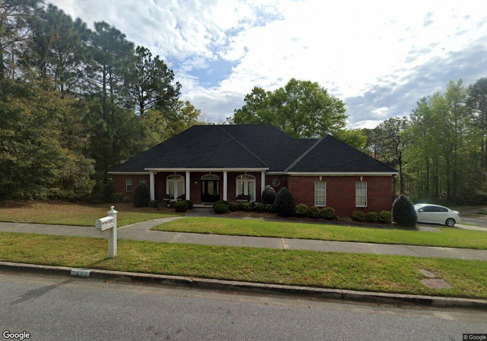
7451 Mallard Dr Mobile, AL 36695
Di Grado NeighborhoodEstimated Value: $333,874 - $360,000
3
Beds
3
Baths
2,660
Sq Ft
$130/Sq Ft
Est. Value
About This Home
This home is located at 7451 Mallard Dr, Mobile, AL 36695 and is currently estimated at $345,719, approximately $129 per square foot. 7451 Mallard Dr is a home located in Mobile County with nearby schools including O'rourke Elementary School, Bernice J Causey Middle School, and Baker High School.
Ownership History
Date
Name
Owned For
Owner Type
Purchase Details
Closed on
Sep 27, 2002
Sold by
Major Kenneth E and Major Sharon C
Bought by
Dial Michael E and Dial Constance A
Current Estimated Value
Home Financials for this Owner
Home Financials are based on the most recent Mortgage that was taken out on this home.
Original Mortgage
$204,750
Outstanding Balance
$86,530
Interest Rate
6.27%
Estimated Equity
$259,189
Purchase Details
Closed on
Feb 26, 1999
Sold by
Glover Melvin R and Glover Debora F
Bought by
Major Kenneth E and Major Sharon C
Home Financials for this Owner
Home Financials are based on the most recent Mortgage that was taken out on this home.
Original Mortgage
$145,000
Interest Rate
6.84%
Create a Home Valuation Report for This Property
The Home Valuation Report is an in-depth analysis detailing your home's value as well as a comparison with similar homes in the area
Home Values in the Area
Average Home Value in this Area
Purchase History
| Date | Buyer | Sale Price | Title Company |
|---|---|---|---|
| Dial Michael E | -- | -- | |
| Major Kenneth E | -- | -- |
Source: Public Records
Mortgage History
| Date | Status | Borrower | Loan Amount |
|---|---|---|---|
| Open | Dial Michael E | $204,750 | |
| Previous Owner | Major Kenneth E | $145,000 |
Source: Public Records
Tax History Compared to Growth
Tax History
| Year | Tax Paid | Tax Assessment Tax Assessment Total Assessment is a certain percentage of the fair market value that is determined by local assessors to be the total taxable value of land and additions on the property. | Land | Improvement |
|---|---|---|---|---|
| 2024 | $1,293 | $27,840 | $3,500 | $24,340 |
| 2023 | $1,293 | $25,510 | $4,200 | $21,310 |
| 2022 | $1,074 | $23,520 | $4,200 | $19,320 |
| 2021 | $1,006 | $22,110 | $4,000 | $18,110 |
| 2020 | $1,016 | $22,340 | $4,000 | $18,340 |
| 2019 | $1,044 | $22,900 | $0 | $0 |
| 2018 | $1,055 | $23,140 | $0 | $0 |
| 2017 | $1,006 | $22,120 | $0 | $0 |
| 2016 | $1,014 | $22,280 | $0 | $0 |
| 2013 | $1,131 | $24,220 | $0 | $0 |
Source: Public Records
Map
Nearby Homes
- 7560 Labrador Ct
- 3057 Isle of Palms Dr W
- 3040 Isle of Palms Dr W
- 7608 Highland Place
- 2858 Lynndell Dr
- 0 Wynngate Way Unit 7490984
- 0 Wynngate Way Unit 7490947
- 0 Wynngate Way Unit 7490982
- 0 Wynngate Way Unit 7490976
- 0 Wynngate Way Unit 7490741
- 2985 Canary Island Dr
- 7259 Wynngate Way
- 7231 Wynngate Way
- 7255 Wynngate Way
- 7243 Wynngate Way
- 7247 Wynngate Way
- 7251 Wynngate Way
- 7179 Wynnridge Dr
- 3505 Schillinger Rd S
- 2687 Lynndell Dr
- 7449 Mallard Dr
- 7460 Mallard Dr
- 7450 Mallard Dr
- 7463 Mallard Dr
- 7441 Mallard Dr
- 7470 Mallard Dr
- 0 Pintail Ct
- 7480 Mallard Dr
- 7439 Mallard Dr
- 7480 Pintail Ct
- 7465 Mallard Dr
- 7500 Pintail Ct
- 7511 Pintail Ct
- 7520 Mallard Dr
- 7469 Mallard Dr Unit 4
- 7437 Mallard Dr
- 7489 Mallard Dr
- 7520 Pintail Ct
- 7499 Pintail Ct
- 7501 Pintail Ct