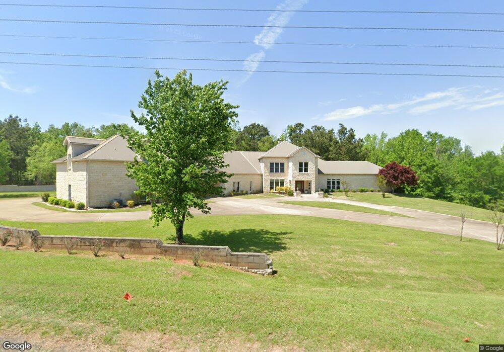
7451 Stone Creek Dr Texarkana, TX 75503
Estimated Value: $566,000 - $934,653
--
Bed
--
Bath
5,679
Sq Ft
$128/Sq Ft
Est. Value
About This Home
This home is located at 7451 Stone Creek Dr, Texarkana, TX 75503 and is currently estimated at $726,413, approximately $127 per square foot. 7451 Stone Creek Dr is a home with nearby schools including Margaret Fischer Davis Elementary School, Pleasant Grove Intermediate School, and Pleasant Grove Middle School.
Ownership History
Date
Name
Owned For
Owner Type
Purchase Details
Closed on
Jan 2, 2025
Sold by
2012 James J Naples Family Trust and Hamilton Patricia J
Bought by
Sweis Jumana and Black Wesley
Current Estimated Value
Home Financials for this Owner
Home Financials are based on the most recent Mortgage that was taken out on this home.
Original Mortgage
$435,000
Outstanding Balance
$431,612
Interest Rate
6.84%
Mortgage Type
New Conventional
Estimated Equity
$294,801
Create a Home Valuation Report for This Property
The Home Valuation Report is an in-depth analysis detailing your home's value as well as a comparison with similar homes in the area
Home Values in the Area
Average Home Value in this Area
Purchase History
| Date | Buyer | Sale Price | Title Company |
|---|---|---|---|
| Sweis Jumana | -- | Twin City Title |
Source: Public Records
Mortgage History
| Date | Status | Borrower | Loan Amount |
|---|---|---|---|
| Open | Sweis Jumana | $435,000 |
Source: Public Records
Tax History Compared to Growth
Tax History
| Year | Tax Paid | Tax Assessment Tax Assessment Total Assessment is a certain percentage of the fair market value that is determined by local assessors to be the total taxable value of land and additions on the property. | Land | Improvement |
|---|---|---|---|---|
| 2025 | $9,425 | $543,736 | $45,271 | $498,465 |
| 2024 | $9,425 | $423,521 | $42,608 | $380,913 |
| 2023 | $9,266 | $411,598 | $42,608 | $368,990 |
| 2022 | $9,460 | $385,267 | $42,608 | $342,659 |
| 2021 | $8,832 | $337,728 | $42,608 | $295,120 |
| 2020 | $8,517 | $323,970 | $42,608 | $281,362 |
| 2019 | $8,386 | $310,871 | $42,608 | $268,263 |
| 2018 | $10,485 | $390,887 | $42,608 | $348,279 |
| 2017 | $12,962 | $484,540 | $42,608 | $441,932 |
| 2016 | $12,962 | $484,540 | $42,608 | $441,932 |
| 2015 | $12,597 | $485,207 | $42,608 | $442,599 |
| 2014 | $12,597 | $468,616 | $42,608 | $426,008 |
Source: Public Records
Map
Nearby Homes
- 0 Shilling Rd Unit 118529
- 7311 Shilling Cir
- 7309 Shilling Cir
- 7208 Shadow Brooke
- 6 High Point Dr
- 3810 Hunters Ridge
- 7202 Shilling Cir
- 3809 Hunters Ridge
- 23 Holly Ridge Dr
- 918 Clear Creek Dr
- 26 Summer Ln
- 4 Holly Ridge Dr
- 8 Wild Oak Cir
- 16 Dogwood Place
- 604 Clear Creek Dr
- 6301 Pecan Cove
- 3501 Clear Creek Cir
- 11 Dogwood Place
- 7 Brittan Place
- 13 Brittan Place
- 960 Shilling Rd
- 3362 Shilling Rd
- 3400 Shilling Rd
- 0 Shilling Rd Unit 21027875
- 0 Shilling Rd
- 7450 Stone Creek Dr
- 7525 Stone Creek Dr
- 3520 Shilling Rd
- 6901 Shadow Brook
- 6902 Shadow Brook
- 7312 Shadow Brooke
- 6903 Shadow Brook
- 6904 Shadow Brook
- 3250 Shilling Rd
- 7310 Shadow Brook
- 7312 Shilling Cir
- 6905 Shadow Brook
- 7550 Stone Creek Dr
- 6906 Shadow Brook
- 12.514 acres Shilling Dr