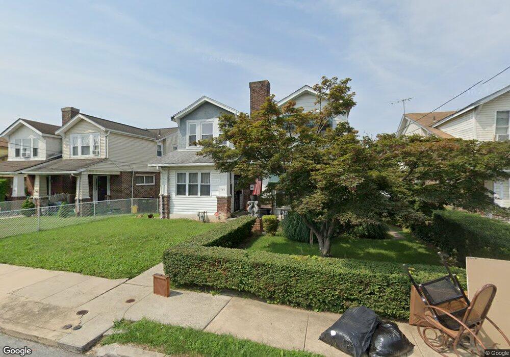
746 Bullock Ave Lansdowne, PA 19050
Estimated Value: $200,000 - $230,000
3
Beds
1
Bath
1,346
Sq Ft
$161/Sq Ft
Est. Value
About This Home
This home is located at 746 Bullock Ave, Lansdowne, PA 19050 and is currently estimated at $216,252, approximately $160 per square foot. 746 Bullock Ave is a home located in Delaware County with nearby schools including Evans Elementary School, Penn Wood Middle School, and Penn Wood High School - Cypress Street Campus.
Ownership History
Date
Name
Owned For
Owner Type
Purchase Details
Closed on
Apr 4, 2006
Sold by
Laforrest Cloraine M and Laforest Cloraine M
Bought by
Laforest Louis V and Laforrest Cloraine M
Current Estimated Value
Purchase Details
Closed on
Jul 9, 1999
Sold by
Barilotti Michael and Barilotti Joseph
Bought by
Laforest Cloraine
Create a Home Valuation Report for This Property
The Home Valuation Report is an in-depth analysis detailing your home's value as well as a comparison with similar homes in the area
Home Values in the Area
Average Home Value in this Area
Purchase History
| Date | Buyer | Sale Price | Title Company |
|---|---|---|---|
| Laforest Louis V | -- | None Available | |
| Laforest Cloraine | $55,500 | T A Title Insurance Company |
Source: Public Records
Tax History Compared to Growth
Tax History
| Year | Tax Paid | Tax Assessment Tax Assessment Total Assessment is a certain percentage of the fair market value that is determined by local assessors to be the total taxable value of land and additions on the property. | Land | Improvement |
|---|---|---|---|---|
| 2025 | $4,496 | $105,300 | $32,420 | $72,880 |
| 2024 | $4,496 | $105,300 | $32,420 | $72,880 |
| 2023 | $4,084 | $105,300 | $32,420 | $72,880 |
| 2022 | $3,894 | $105,300 | $32,420 | $72,880 |
| 2021 | $5,888 | $105,300 | $32,420 | $72,880 |
| 2020 | $3,961 | $63,430 | $18,710 | $44,720 |
| 2019 | $3,891 | $63,430 | $18,710 | $44,720 |
| 2018 | $3,838 | $63,430 | $0 | $0 |
| 2017 | $3,757 | $63,430 | $0 | $0 |
| 2016 | $355 | $63,430 | $0 | $0 |
| 2015 | $355 | $63,430 | $0 | $0 |
| 2014 | $355 | $63,430 | $0 | $0 |
Source: Public Records
Map
Nearby Homes
- 740 Church Ln
- 722 Yeadon Ave
- 711 Yeadon Ave Unit 1
- 800 Bullock Ave
- 702 Cedar Ave
- 808 Serrill Ave
- 825 Laurel Rd
- 813 Arbor Rd
- 908 Yeadon Ave
- 921 Serrill Ave
- 939 Serrill Ave
- 923 Bell Ave
- 1016 Whitby Ave
- 537 Orchard Ave
- 530 Orchard Ave
- 536 Cypress St
- 503 Bonsall Ave
- 1049 Yeadon Ave
- 435 Bonsall Ave
- 407 Church Ln
- 744 Bullock Ave
- 748 Bullock Ave
- 742 Bullock Ave
- 750 Bullock Ave
- 752 Bullock Ave
- 740 Bullock Ave
- 738 Bullock Ave
- 754 Bullock Ave
- 745 Yeadon Ave
- 743 Yeadon Ave
- 747 Yeadon Ave
- 741 Yeadon Ave
- 749 Yeadon Ave
- 739 Yeadon Ave
- 736 Bullock Ave
- 756 Bullock Ave
- 751 Yeadon Ave
- 737 Yeadon Ave
- 753 Yeadon Ave
- 734 Bullock Ave