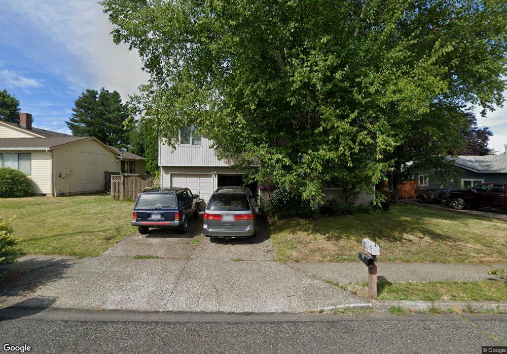
746 SW Birdsdale Dr Gresham, OR 97080
Hollybrook NeighborhoodEstimated Value: $446,000 - $463,000
3
Beds
3
Baths
1,712
Sq Ft
$266/Sq Ft
Est. Value
About This Home
This home is located at 746 SW Birdsdale Dr, Gresham, OR 97080 and is currently estimated at $455,610, approximately $266 per square foot. 746 SW Birdsdale Dr is a home located in Multnomah County with nearby schools including Hollydale Elementary School, Clear Creek Middle School, and Gresham High School.
Ownership History
Date
Name
Owned For
Owner Type
Purchase Details
Closed on
Apr 18, 2006
Sold by
Culver James Paul
Bought by
Stanley Ronald B and Stanley Aileen
Current Estimated Value
Home Financials for this Owner
Home Financials are based on the most recent Mortgage that was taken out on this home.
Original Mortgage
$240,000
Outstanding Balance
$137,076
Interest Rate
6.35%
Mortgage Type
Fannie Mae Freddie Mac
Estimated Equity
$318,534
Purchase Details
Closed on
Mar 26, 1998
Sold by
Culver James Paul
Bought by
Culver James Paul and Culver Kristi Jen
Create a Home Valuation Report for This Property
The Home Valuation Report is an in-depth analysis detailing your home's value as well as a comparison with similar homes in the area
Home Values in the Area
Average Home Value in this Area
Purchase History
| Date | Buyer | Sale Price | Title Company |
|---|---|---|---|
| Stanley Ronald B | $240,000 | First American | |
| Culver James Paul | -- | -- |
Source: Public Records
Mortgage History
| Date | Status | Borrower | Loan Amount |
|---|---|---|---|
| Open | Stanley Ronald B | $240,000 |
Source: Public Records
Tax History
| Year | Tax Paid | Tax Assessment Tax Assessment Total Assessment is a certain percentage of the fair market value that is determined by local assessors to be the total taxable value of land and additions on the property. | Land | Improvement |
|---|---|---|---|---|
| 2025 | $5,070 | $249,140 | -- | -- |
| 2024 | $4,853 | $241,890 | -- | -- |
| 2023 | $4,422 | $234,850 | $0 | $0 |
| 2022 | $4,298 | $228,010 | $0 | $0 |
| 2021 | $4,190 | $221,370 | $0 | $0 |
| 2020 | $3,942 | $214,930 | $0 | $0 |
| 2019 | $3,839 | $208,670 | $0 | $0 |
| 2018 | $3,661 | $202,600 | $0 | $0 |
| 2017 | $3,512 | $196,700 | $0 | $0 |
| 2016 | $3,097 | $190,980 | $0 | $0 |
Source: Public Records
Map
Nearby Homes
- 1175 SW Chastain Dr
- 44 SW Birdsdale Dr
- 1960 SW 13th Ct
- 159 SW Florence Ave Unit 64
- 159 SW Florence Ave
- 1113 W Powell Blvd
- 21 NW Mawrcrest Ave
- 63 NW Mawrcrest Ave
- 85 NW Mawrcrest Ave
- 230 NW Mawrcrest Ave
- 236 NW Mawrcrest Ave
- 181 NW Mawrcrest Ave
- 256 NW Mawrcrest Ave
- 185 NW Mawrcrest Ave
- 284 NW Mawrcrest Ave
- 2095 NW 3rd St
- 1829 SW 17th St
- 638 SW 7th St
- 1488 SW 17th Ct Unit N
- 1488 SW 17th Ct
- 722 SW Birdsdale Dr
- 760 SW Birdsdale Dr
- 1684 SW 5th St
- 1698 SW 5th St
- 710 SW Birdsdale Dr
- 782 SW Birdsdale Dr
- 1670 SW 5th St
- 1670 SW 5 St New Price
- 1730 SW 5th St
- 620 SW Bella Vista Place
- 615 SW Bella Vista Place
- 1658 SW 5th St
- 696 SW Birdsdale Dr
- 796 SW Birdsdale Dr
- 705 SW Birdsdale Dr
- 1754 SW 5th St
- 775 SW Birdsdale Dr
- 1693 SW 5th St
- 1719 SW 5th St
- 654 SW Bella Vista Place
Your Personal Tour Guide
Ask me questions while you tour the home.