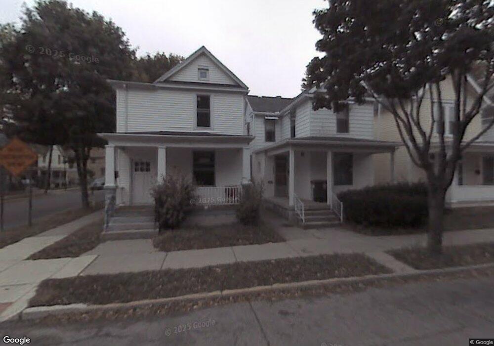
746 W Dewald St Fort Wayne, IN 46802
Poplar NeighborhoodEstimated Value: $59,000
3
Beds
2
Baths
2,033
Sq Ft
$29/Sq Ft
Est. Value
About This Home
This home is located at 746 W Dewald St, Fort Wayne, IN 46802 and is currently priced at $59,000, approximately $29 per square foot. 746 W Dewald St is a home located in Allen County with nearby schools including Fairfield Elementary School, Kekionga Middle School, and South Side High School.
Ownership History
Date
Name
Owned For
Owner Type
Purchase Details
Closed on
Jul 22, 2016
Sold by
Grand Horizons Investments Inc
Bought by
Housing And Neighborhood Development Ser
Current Estimated Value
Purchase Details
Closed on
Mar 18, 2016
Sold by
Najim Basher Abu
Bought by
Grand Horizon Realty Corp
Purchase Details
Closed on
Aug 17, 2014
Sold by
Munoz Freddy
Bought by
Grand Horizons Investments Inc
Purchase Details
Closed on
Aug 17, 2010
Sold by
Grand Horizons Realty Corp
Bought by
Munoz Freddy
Purchase Details
Closed on
Jan 14, 2010
Sold by
Vpu Investments Llc
Bought by
Grand Horizons Realty Corp
Purchase Details
Closed on
Oct 19, 2009
Sold by
Sb Holdings Llc
Bought by
Visio Reo Limited Partnership
Purchase Details
Closed on
Aug 26, 2009
Sold by
Visio Reo Limited Partnership
Bought by
Vpu Investments Llc
Purchase Details
Closed on
Jun 25, 2009
Sold by
U S Bank National Association
Bought by
Sb Holdings Llc
Purchase Details
Closed on
Jan 21, 2009
Sold by
Crum Robert J
Bought by
U S Bank National Association
Purchase Details
Closed on
Oct 21, 2005
Sold by
Sarrazin Properties Llc
Bought by
Crum Robert J
Home Financials for this Owner
Home Financials are based on the most recent Mortgage that was taken out on this home.
Original Mortgage
$50,400
Interest Rate
5.89%
Mortgage Type
Fannie Mae Freddie Mac
Purchase Details
Closed on
Apr 11, 2002
Sold by
Sarrazin Michael T
Bought by
Sarrazin Properties Llc
Purchase Details
Closed on
Oct 3, 2001
Sold by
Vlako Inc
Bought by
Sarrazin Michael T
Home Financials for this Owner
Home Financials are based on the most recent Mortgage that was taken out on this home.
Original Mortgage
$24,000
Interest Rate
6.88%
Purchase Details
Closed on
Sep 28, 2001
Sold by
Alliance Property Management Ltd
Bought by
Vlako Inc
Home Financials for this Owner
Home Financials are based on the most recent Mortgage that was taken out on this home.
Original Mortgage
$24,000
Interest Rate
6.88%
Create a Home Valuation Report for This Property
The Home Valuation Report is an in-depth analysis detailing your home's value as well as a comparison with similar homes in the area
Home Values in the Area
Average Home Value in this Area
Purchase History
| Date | Buyer | Sale Price | Title Company |
|---|---|---|---|
| Housing And Neighborhood Development Ser | -- | None Available | |
| Grand Horizon Realty Corp | -- | None Available | |
| Grand Horizons Investments Inc | -- | None Available | |
| Munoz Freddy | -- | None Available | |
| Grand Horizons Realty Corp | -- | None Available | |
| Visio Reo Limited Partnership | -- | None Available | |
| Vpu Investments Llc | $2,125 | None Available | |
| Sb Holdings Llc | -- | Security Title Services Llc | |
| U S Bank National Association | $15,300 | None Available | |
| Crum Robert J | -- | Integrity Land Title Corp | |
| Sarrazin Properties Llc | -- | -- | |
| Sarrazin Michael T | -- | -- | |
| Vlako Inc | -- | -- |
Source: Public Records
Mortgage History
| Date | Status | Borrower | Loan Amount |
|---|---|---|---|
| Previous Owner | Crum Robert J | $50,400 | |
| Previous Owner | Sarrazin Michael T | $24,000 |
Source: Public Records
Tax History Compared to Growth
Tax History
| Year | Tax Paid | Tax Assessment Tax Assessment Total Assessment is a certain percentage of the fair market value that is determined by local assessors to be the total taxable value of land and additions on the property. | Land | Improvement |
|---|---|---|---|---|
| 2024 | -- | -- | -- | -- |
| 2022 | $0 | $0 | $0 | $0 |
| 2021 | $0 | $0 | $0 | $0 |
| 2020 | $0 | $0 | $0 | $0 |
| 2019 | $111 | $0 | $0 | $0 |
| 2018 | $0 | $0 | $0 | $0 |
| 2017 | $111 | $0 | $0 | $0 |
| 2016 | $111 | $0 | $0 | $0 |
| 2014 | $87 | $4,200 | $2,400 | $1,800 |
| 2013 | $87 | $4,200 | $2,400 | $1,800 |
Source: Public Records
Map
Nearby Homes
- 636 W Creighton Ave
- 2411 Fox Ave
- 2105 Oakley St
- 820 Huestis Ave
- 634 Walnut St
- 2120 Broadway
- 2130 Broadway
- 2402 Broadway
- 602 Taylor St
- 919 Parkview Ave
- 436 W Williams St
- 1013 Stophlet St
- 1004 Lincoln Ave
- 2120 Nelson St
- 401 W Williams St
- 1302 Huestis Ave
- 1243 Huestis Ave
- 939 Lincoln Ave
- 1001 Lincoln Ave
- 1115 Maple Ave
- 744 W Dewald St
- 742 W Dewald St
- 2149 Fox Ave
- 802 W Dewald St
- 2145 Fox Ave
- 747 W Dewald St
- 747 W Dewald St Unit 1
- 747 W Dewald St
- 747 W Dewald St Unit 2
- 2152 Fox Ave
- 734 W Dewald St
- 2148 Fox Ave
- 812 W Dewald St
- 730 W Dewald St
- 801 W Dewald St
- 741 W Dewald St
- 735 W Dewald St
- 2136 Fox Ave
- 818 W Dewald St
- 2213 Fox Ave