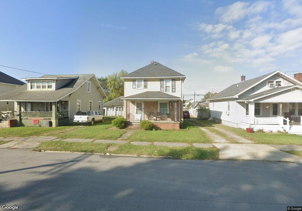
747 Davids St Marion, OH 43302
Estimated Value: $84,000 - $115,196
3
Beds
1
Bath
1,412
Sq Ft
$72/Sq Ft
Est. Value
About This Home
This home is located at 747 Davids St, Marion, OH 43302 and is currently estimated at $101,799, approximately $72 per square foot. 747 Davids St is a home located in Marion County with nearby schools including William McKinley Elementary School, Ulysses S. Grant Middle School, and Harding High School.
Ownership History
Date
Name
Owned For
Owner Type
Purchase Details
Closed on
Oct 1, 2021
Sold by
Rush Randy L and Rush Shelley D
Bought by
Stausbery Zachary Michael and Stansbery Peighton Mackenzie
Current Estimated Value
Home Financials for this Owner
Home Financials are based on the most recent Mortgage that was taken out on this home.
Original Mortgage
$58,900
Interest Rate
2.8%
Mortgage Type
Land Contract Argmt. Of Sale
Purchase Details
Closed on
Mar 29, 2007
Sold by
Furniss Damon F and Furniss Phyllis J
Bought by
Rush Randy L and Rush Shelley D
Create a Home Valuation Report for This Property
The Home Valuation Report is an in-depth analysis detailing your home's value as well as a comparison with similar homes in the area
Home Values in the Area
Average Home Value in this Area
Purchase History
| Date | Buyer | Sale Price | Title Company |
|---|---|---|---|
| Stausbery Zachary Michael | $58,900 | None Available | |
| Rush Randy L | $45,000 | Eagle Title Llc |
Source: Public Records
Mortgage History
| Date | Status | Borrower | Loan Amount |
|---|---|---|---|
| Previous Owner | Stausbery Zachary Michael | $58,900 |
Source: Public Records
Tax History
| Year | Tax Paid | Tax Assessment Tax Assessment Total Assessment is a certain percentage of the fair market value that is determined by local assessors to be the total taxable value of land and additions on the property. | Land | Improvement |
|---|---|---|---|---|
| 2025 | $1,299 | $34,890 | $3,150 | $31,740 |
| 2024 | $1,299 | $25,690 | $3,080 | $22,610 |
| 2023 | $1,299 | $25,690 | $3,080 | $22,610 |
| 2022 | $916 | $25,690 | $3,080 | $22,610 |
| 2021 | $796 | $20,110 | $2,680 | $17,430 |
| 2020 | $798 | $20,110 | $2,680 | $17,430 |
| 2019 | $798 | $20,110 | $2,680 | $17,430 |
| 2018 | $731 | $18,440 | $2,650 | $15,790 |
| 2017 | $741 | $18,440 | $2,650 | $15,790 |
| 2016 | $736 | $18,440 | $2,650 | $15,790 |
| 2015 | $735 | $18,010 | $2,520 | $15,490 |
| 2014 | $737 | $18,010 | $2,520 | $15,490 |
| 2012 | $564 | $13,700 | $2,030 | $11,670 |
Source: Public Records
Map
Nearby Homes
- 681 Davids St
- 645 Henry St
- 793 Congress St
- 602 Uncapher Ave
- 780 Sheridan Rd
- 579 Henry St
- 863 Congress St
- 638 Miami St
- 889 Oak Grove Ave
- 981 Davids St
- 950 Oak Grove Ave
- 545 Blaine Ave
- 491 Olney Ave
- 982 Oak Grove Ave
- 340 Marion Ave
- 426 Bellefontaine Ave
- 447 Olney Ave
- 376 Park Blvd
- 329 Mound St
- 1215 Heritage Ln
Your Personal Tour Guide
Ask me questions while you tour the home.