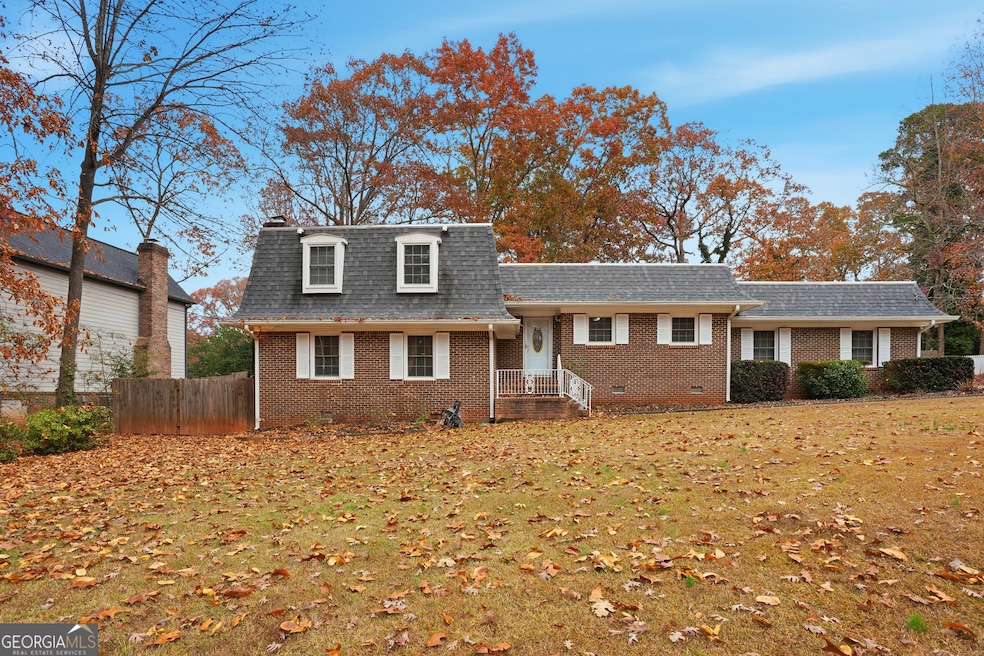


747 John Alden Rd Stone Mountain, GA 30083
Estimated payment $2,444/month
Highlights
- A-Frame Home
- 1 Fireplace
- Den
- Wood Flooring
- No HOA
- Breakfast Area or Nook
About This Home
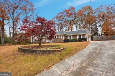
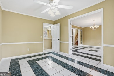
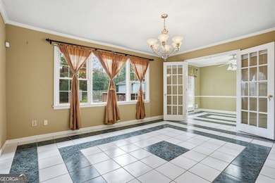
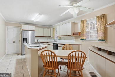
Welcome to your move-in ready retreat in the heart of Stone Mountain, GA! This beautifully maintained 5-bedroom, 3-bathroom, four-sided brick home greets you with fresh, neutral tones throughout-creating a bright, airy canvas ready for your personal touch. The spacious kitchen is a chef's delight, complete with plenty of cabinetry, counter space, island with cooktop and a cozy built-in breakfast nook perfect for morning coffee or casual family meals. Flow effortlessly into the generous living room, where a classic fireplace flanked by custom built-in shelving becomes the natural focal point for gatherings. Upstairs, escape to the expansive owner's suite featuring a luxurious tiled shower, dual vanities, and a roomy walk-in closet you'll never outgrow. Upstairs, accessible by Stair lift if needed. Step outside to your private backyard oasis: a huge fenced yard with mature landscaping, a handy storage shed, and plenty of room for gardening, play, or pets. The oversized deck stretches across the back of the home-ideal for weekend barbecues, evening relaxation, or simply soaking up Georgia's beautiful weather. Additional perks include a true two-car garage and unbeatable convenience: just 10 minutes to the iconic Stone Mountain Park, under 10 minutes to shops, restaurants, and grocery stores, with quick access to I-285 for an easy commute anywhere in metro Atlanta. Brimming with space, storage, and style-this Stone Mountain gem won't last long. Schedule your private tour today and come see why this feels like home the moment you walk through the door!

Home Details
Home Type
- Single Family
Est. Annual Taxes
- $5,327
Year Built
- Built in 1973
Lot Details
- 0.42 Acre Lot
- Privacy Fence
- Back Yard Fenced
- Level Lot
Parking
- Garage
Home Design
- A-Frame Home
- Composition Roof
- Four Sided Brick Exterior Elevation
Interior Spaces
- 2,838 Sq Ft Home
- Multi-Level Property
- Ceiling Fan
- 1 Fireplace
- Family Room
- Formal Dining Room
- Den
Kitchen
- Breakfast Area or Nook
- Cooktop
- Ice Maker
- Dishwasher
Flooring
- Wood
- Tile
Bedrooms and Bathrooms
- In-Law or Guest Suite
Schools
- Allgood Elementary School
- Freedom Middle School
- Clarkston High School
Utilities
- Central Heating and Cooling System
- Underground Utilities
- High Speed Internet
- Cable TV Available
Community Details
- No Home Owners Association
- Carlisle Subdivision
Listing and Financial Details
- Legal Lot and Block 101 / D
Map
Home Values in the Area
Average Home Value in this Area
Tax History
| Year | Tax Paid | Tax Assessment Tax Assessment Total Assessment is a certain percentage of the fair market value that is determined by local assessors to be the total taxable value of land and additions on the property. | Land | Improvement |
|---|---|---|---|---|
| 2025 | $5,750 | $120,840 | $15,040 | $105,800 |
| 2024 | $5,798 | $121,920 | $15,040 | $106,880 |
| 2023 | $5,798 | $124,760 | $15,040 | $109,720 |
| 2022 | $5,010 | $105,920 | $15,040 | $90,880 |
| 2021 | $4,213 | $87,760 | $15,040 | $72,720 |
| 2020 | $3,261 | $66,080 | $15,040 | $51,040 |
| 2019 | $3,147 | $63,480 | $5,920 | $57,560 |
| 2018 | $2,620 | $60,320 | $5,920 | $54,400 |
| 2017 | $3,017 | $60,240 | $5,920 | $54,320 |
| 2016 | $2,512 | $48,680 | $5,920 | $42,760 |
| 2014 | $1,620 | $27,800 | $5,920 | $21,880 |
Property History
| Date | Event | Price | List to Sale | Price per Sq Ft |
|---|---|---|---|---|
| 11/28/2025 11/28/25 | For Sale | $379,900 | -- | $134 / Sq Ft |
Purchase History
| Date | Type | Sale Price | Title Company |
|---|---|---|---|
| Deed | $176,000 | -- |
Mortgage History
| Date | Status | Loan Amount | Loan Type |
|---|---|---|---|
| Open | $158,400 | New Conventional |
Source: Georgia MLS
MLS Number: 10650241
APN: 15-254-01-203
Disclaimer: Certain information contained herein is derived from information provided by parties other than Homes.com. All information provided is deemed reliable, but is not guaranteed to be accurate and should be independently verified.
![]() The data relating to real estate for sale on this web site comes in part from the Broker Reciprocity Program of Georgia MLS. Real estate listings held by brokerage firms other than Redfin are marked with the Broker Reciprocity logo and detailed information about them includes the name of the listing brokers. Information deemed reliable but not guaranteed. Copyright 2025 Georgia MLS. All rights reserved.
The data relating to real estate for sale on this web site comes in part from the Broker Reciprocity Program of Georgia MLS. Real estate listings held by brokerage firms other than Redfin are marked with the Broker Reciprocity logo and detailed information about them includes the name of the listing brokers. Information deemed reliable but not guaranteed. Copyright 2025 Georgia MLS. All rights reserved.
- 1051 Rowland Rd
- 792 Carlisle Club Dr Unit 2
- 4428 Nantucket Cove
- 4147 Scofield Place
- 4218 Durham Cir
- 4298 Nelby Dr
- 4094 Carlisle Place
- 997 Carlisle Rd Unit 1
- 4166 Rue Saint Michel
- 804 Rowland Rd
- 4238 Rue Saint Michel
- 4128 Indian Manor Dr
- 4564 Fountainhead Dr
- 4447 Lake Breeze Dr
- 1113 S Indian Creek Dr
- 905 S Indian Creek Dr
- 1140 Allgood Rd
- 708 Delanie Way
- 4143 Rue st Michel Unit 1, with utilities and lawn included
- 773 Corundum Ct
- 758 Corundum Ct
- 830 Durham Crossing
- 661 Woodcrest Manor Dr
- 1150 Autumn Hill Ct
- 3904 Durham Park Rd
- 1179 Old Coach Rd
- 1081 Brittania Rd
- 1201 Valerie Woods Dr
- 3960 Redan Rd Unit C1
- 3960 Redan Rd Unit B1
- 3960 Redan Rd Unit A1
- 3868 Springleaf Point
- 3852 W Wood Path
- 394 Rays Rd
- 4695 Redan Rd
- 3823 Kingswood Dr
- 4795 Brasac Dr
- 4599 Garden Hills Dr