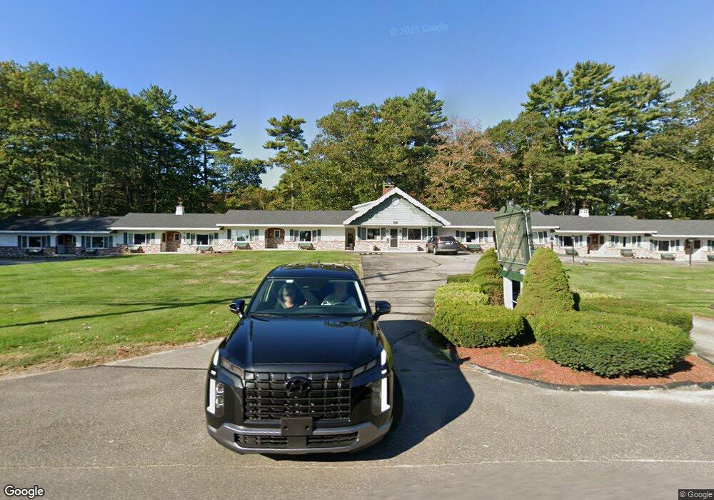
747 Main St Ogunquit, ME 03907
Ogunquit Neighborhood
20
Beds
20
Baths
8,284
Sq Ft
95,832
Sq Ft Lot
About This Home
This home is located at 747 Main St, Ogunquit, ME 03907. 747 Main St is a home located in York County with nearby schools including Wells Junior High School, Wells Elementary School, and Wells High School.
Ownership History
Date
Name
Owned For
Owner Type
Purchase Details
Closed on
Jun 16, 2020
Sold by
Towne Lyne Motel Llc
Bought by
7 Bhavani Hospitality Llc
Home Financials for this Owner
Home Financials are based on the most recent Mortgage that was taken out on this home.
Original Mortgage
$1,056,000
Outstanding Balance
$925,654
Interest Rate
3.2%
Mortgage Type
Purchase Money Mortgage
Purchase Details
Closed on
Apr 12, 2013
Sold by
Doanes Corp
Bought by
Towne Lyne Motel Llc
Create a Home Valuation Report for This Property
The Home Valuation Report is an in-depth analysis detailing your home's value as well as a comparison with similar homes in the area
Home Values in the Area
Average Home Value in this Area
Purchase History
| Date | Buyer | Sale Price | Title Company |
|---|---|---|---|
| 7 Bhavani Hospitality Llc | -- | None Available | |
| 7 Bhavani Hospitality Llc | -- | None Available | |
| 7 Bhavani Hospitality Llc | -- | None Available | |
| Towne Lyne Motel Llc | -- | -- | |
| Towne Lyne Motel Llc | -- | -- |
Source: Public Records
Mortgage History
| Date | Status | Borrower | Loan Amount |
|---|---|---|---|
| Open | 7 Bhavani Hospitality Llc | $1,056,000 | |
| Closed | 7 Bhavani Hospitality Llc | $1,056,000 |
Source: Public Records
Tax History
| Year | Tax Paid | Tax Assessment Tax Assessment Total Assessment is a certain percentage of the fair market value that is determined by local assessors to be the total taxable value of land and additions on the property. | Land | Improvement |
|---|---|---|---|---|
| 2024 | $9,401 | $1,455,200 | $726,700 | $728,500 |
| 2023 | $9,401 | $1,455,200 | $726,700 | $728,500 |
| 2022 | $9,197 | $1,455,200 | $726,700 | $728,500 |
| 2021 | $12,613 | $1,549,500 | $861,400 | $688,100 |
| 2020 | $12,406 | $1,550,800 | $861,400 | $689,400 |
| 2019 | $12,396 | $1,549,500 | $861,400 | $688,100 |
| 2018 | $12,257 | $1,549,500 | $861,400 | $688,100 |
| 2017 | $11,745 | $1,549,500 | $861,400 | $688,100 |
| 2016 | $11,919 | $1,473,300 | $861,400 | $611,900 |
| 2015 | $11,890 | $1,473,300 | $861,400 | $611,900 |
| 2014 | $11,433 | $1,473,300 | $861,400 | $611,900 |
Source: Public Records
Map
Nearby Homes
- 76 Post Rd Unit 21M
- 9 Bourne Ave Unit B6
- 31 Rebecca Rd
- 22 Adams Ln
- 191 Tatnic Rd Unit 73
- 1 Old County Rd Unit 165
- 1 Old County Rd Unit 155
- 168 Ocean Ave
- 488 Main St Unit 7
- 412 Post Rd Unit 304
- 412 Post Rd Unit 145
- 430 Post Rd Unit 320
- 430 Post Rd Unit 181
- 430 Post Rd Unit 256
- 430 Post Rd Unit 177
- 430 Post Rd Unit 40
- 430 Post Rd Unit 184
- 430 Post Rd Unit 186
- 430 Post Rd Unit 55
- 430 Post Rd Unit 323
- 1 Mariner Overlook
- 739 Main St
- 0 Post (Rte 1)
- 00 Post Rd
- 4 Mariner Overlook Dr
- 29 Mariner Overlook Dr
- 11 Mariner's Outlook
- 11 Mariner Overlook Dr
- 2 Post Rd Unit 2
- 8 Mariner Overlook Dr
- 735 Main St
- Lot 6 Tatnic Rd
- Lot 6A Tatnic Rd
- 13 Post
- 36 Tatnic Rd
- 4 Tatnic Rd
- 22 Tatnic Rd
- 16 Tatnic Rd
- 18 Mariner Overlook Dr
- 18 Mariner's Outlook
Your Personal Tour Guide
Ask me questions while you tour the home.