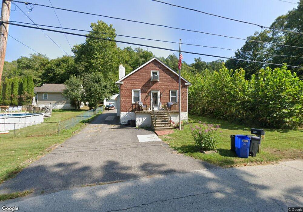
747 Mount Rd Aston, PA 19014
Estimated Value: $343,000 - $385,000
2
Beds
1
Bath
1,142
Sq Ft
$310/Sq Ft
Est. Value
About This Home
This home is located at 747 Mount Rd, Aston, PA 19014 and is currently estimated at $353,928, approximately $309 per square foot. 747 Mount Rd is a home located in Delaware County with nearby schools including The Christian Academy.
Ownership History
Date
Name
Owned For
Owner Type
Purchase Details
Closed on
May 25, 2021
Sold by
Fisher Donald H
Bought by
Collins Dane and Rinkers Emma
Current Estimated Value
Home Financials for this Owner
Home Financials are based on the most recent Mortgage that was taken out on this home.
Original Mortgage
$281,300
Outstanding Balance
$254,127
Interest Rate
2.9%
Mortgage Type
New Conventional
Estimated Equity
$99,801
Purchase Details
Closed on
Sep 25, 1996
Sold by
Fisher Lewis H and Fisher Florence L
Bought by
Fisher Donald H
Home Financials for this Owner
Home Financials are based on the most recent Mortgage that was taken out on this home.
Original Mortgage
$83,538
Interest Rate
7.9%
Mortgage Type
VA
Create a Home Valuation Report for This Property
The Home Valuation Report is an in-depth analysis detailing your home's value as well as a comparison with similar homes in the area
Home Values in the Area
Average Home Value in this Area
Purchase History
| Date | Buyer | Sale Price | Title Company |
|---|---|---|---|
| Collins Dane | $290,000 | None Available | |
| Fisher Donald H | $81,900 | Commonwealth Land Title Ins |
Source: Public Records
Mortgage History
| Date | Status | Borrower | Loan Amount |
|---|---|---|---|
| Open | Collins Dane | $281,300 | |
| Previous Owner | Fisher Donald H | $83,538 |
Source: Public Records
Tax History Compared to Growth
Tax History
| Year | Tax Paid | Tax Assessment Tax Assessment Total Assessment is a certain percentage of the fair market value that is determined by local assessors to be the total taxable value of land and additions on the property. | Land | Improvement |
|---|---|---|---|---|
| 2025 | $4,279 | $164,880 | $50,560 | $114,320 |
| 2024 | $4,279 | $164,880 | $50,560 | $114,320 |
| 2023 | $4,087 | $164,880 | $50,560 | $114,320 |
| 2022 | $3,941 | $164,880 | $50,560 | $114,320 |
| 2021 | $6,081 | $164,880 | $50,560 | $114,320 |
| 2020 | $3,369 | $82,480 | $31,160 | $51,320 |
| 2019 | $3,304 | $82,480 | $31,160 | $51,320 |
| 2018 | $3,164 | $82,480 | $0 | $0 |
| 2017 | $3,097 | $82,480 | $0 | $0 |
| 2016 | $453 | $82,480 | $0 | $0 |
| 2015 | $453 | $82,480 | $0 | $0 |
| 2014 | $453 | $82,480 | $0 | $0 |
Source: Public Records
Map
Nearby Homes
- 220 Spring Valley Way
- 21 Hoag Ln
- 305 Crozerville Rd
- 108 Grace Ln
- 21 Eusden Dr
- 268 Miley Rd Unit 268
- 440 Derry Dr Unit 440
- 242 Moria Place
- 887 Red Hill Rd
- 190 Lake Dr
- 226 Moria Place
- 3 Rolling Heights Ln
- 8 Travelo Ln
- 216 Park Dr
- 505 Schick Rd
- 184 Fifth Ave
- 182 Fifth Ave
- 346 Lenni Rd
- 2370 Crestview Ln
- 214 Bishop Dr
- 3441 Mount Rd
- 746 Mount Rd
- 748 Malloy Ave
- 103 Woodcrest Ave
- 758 Malloy Ave
- 111 Woodcrest Ave
- 104 Woodcrest Ave
- 754 Mount Rd
- 106 Woodcrest Ave
- 110 Maple Ave
- 759 Malloy Ave
- 3381 Mount Rd
- 750 Malloy Ave
- 108 Woodcrest Ave
- 753 Malloy Ave
- 737 Mount Rd
- 3371 Mount Rd
- 756 Mount Rd
- 108 Maple Ave
- 105 Maple Ave